Old Speck Mountain facts for kids
Quick facts for kids Old Speck Mountain |
|
|---|---|

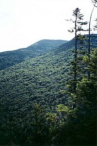
Old Speck Mountain seen from Eyebrow Trail
|
|
| Highest point | |
| Elevation | 4,170 ft (1,270 m) |
| Prominence | 2,730 ft (830 m) |
| Listing | New England 4000 footers #13 New England Fifty Finest |
| Geography | |
| Parent range | Mahoosuc Range |
| Topo map | USGS Old Speck Mountain |
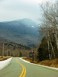
Old Speck Mountain, sometimes called Old Speckle Mountain, is a tall mountain in Maine, USA. It's found in Oxford County. This mountain is the fourth highest in Maine! It's also the tallest peak in the Mahoosuc Range, which is part of the larger White Mountains. Old Speck stands proudly, with Mahoosuc Arm to its southwest. It faces Baldpate Mountain across Grafton Notch to its northeast.
Contents
Where the Water Flows
Old Speck Mountain is part of a large watershed. A watershed is an area of land where all the water drains into a single river or body of water. For Old Speck, this means its water flows into the Androscoggin River.
Rivers and Streams
The Androscoggin River then flows into Merrymeeting Bay. This bay is where the Kennebec River meets the ocean. Finally, the water reaches the Gulf of Maine. Water from the north and east sides of Old Speck goes into the Bear River. This river then joins the Androscoggin. Water from the southeast and southwest sides flows into the Bull Branch of Goose Eye Brook. This brook then joins the Sunday River, which also flows into the Androscoggin. The northwest side of the mountain drains into Silver Stream, then into Chickwolnepy Stream, and finally into the Androscoggin River.
Exploring Old Speck Mountain
The very top of Old Speck Mountain is on the southern edge of Grafton Notch State Park. This park is a beautiful place to visit!
The Appalachian Trail
The famous Appalachian Trail passes near Old Speck Mountain. This trail is a super long path, about 2,170 miles (3,490 km) long! It stretches all the way from Georgia to Maine. The trail runs along the Mahoosuc Range, just 0.3 miles (0.5 km) west of Old Speck's summit. There's a short side trail that hikers can take from the Appalachian Trail to reach the mountain's peak.
Speck Pond
Below the mountain's summit, you'll find Speck Pond. This pond is located at a high elevation, about 3,400 feet (1,036 meters) up! It's a great spot for fishing because it's stocked with brook trout. The Appalachian Trail goes downhill for about 1.1 miles (1.8 km) from near the summit to reach this peaceful pond.

 | Roy Wilkins |
 | John Lewis |
 | Linda Carol Brown |


