Pahuatlán facts for kids
Quick facts for kids
Pahuatlán
|
|
|---|---|
|
Town and Municipality
|
|
| Pahuatlán del Valle | |
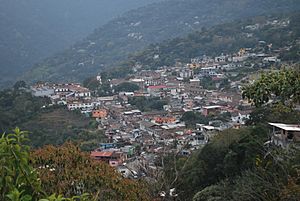
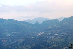
Panoramic of the town of Pahuatlán
|
|
| Country | |
| State | Puebla |
| Founded | 1532 |
| Municipal Status | 19th century |
| Elevation
(of seat)
|
1,600 m (5,200 ft) |
| Population
(2010) Municipality
|
|
| • Municipality | 20,619 |
| Time zone | UTC-6 (Central (US Central)) |
| • Summer (DST) | UTC-5 (Central) |
| Postal code (of seat) |
73100
|
| Demonym | Pahuatense |
Pahuatlán (pronounced pah-wah-TLAHN), officially known as Pahuatlán del Valle, is a town and municipality in central Mexico. It is located in the northwest part of the Puebla state. This area is part of the Sierra Norte region, which has steep mountains and gets a lot of rain from the Gulf of Mexico. Pahuatlán is close to the borders of Hidalgo and Veracruz states.
The town was started by a group of monks called the Augustinians in 1532. They built a small monastery there. The area was home to two main groups of people: the Nahuas and the Otomis. Both groups still live there today. Pahuatlán is famous for its special amate bark paper, which is made by the Otomi people in a community called San Pablito.
Contents
Exploring Pahuatlán Town
The town of Pahuatlán sits on a flat area on the side of Ahila Mountain. It is about 1,600 meters (5,250 feet) above sea level. This makes it part of the Sierra Norte mountains. The town is the main place for shopping and business in the municipality. It has a population of just over 3,000 people.
Traditional Architecture and Art
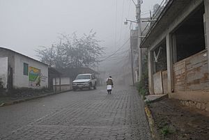
Pahuatlán has kept its traditional, simple buildings. Most houses have two floors with iron balconies and red tile roofs. The streets in the town center are paved with stone. Famous photographers like Angeles Torrejon and Ruben Pax have captured the beauty of this area.
The Heart of Town: Main Plaza
The main plaza is the historic center of Pahuatlán. On Sundays, it turns into a lively market called a tianguis. Here, you can find many handmade items. These include rebozos (shawls), other fabrics, fresh flowers, pottery, and leather goods. Most of these items come from nearby villages.
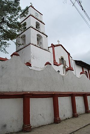
The main government building, the municipal palace, is also around this plaza. The most important church is the Santiago Apóstol parish, built in the 1500s. The town's patron saint is Saint James the Great. His feast day is celebrated on June 25 with church services, parades, fireworks, and traditional dances like the Voladores.
Local Crafts and Culture
The Casa de Cultura (House of Culture) displays paintings and books about the municipality. The main craft store is the Casa del Amate (House of Amate Paper). It sells local amate paper, embroidered items, and paintings. This was once the workshop of painter Rafael Lechuga, who painted scenes of the area and the local paper.
There is also a place called Parque de los Muertos (Park of the Dead). Local stories say that soldiers who supported Emperor Maximilian I were buried there.
Music, Food, and Festivals
The traditional music of Pahuatlán is called huapango. Women often wear a long black skirt with a white embroidered blouse and a rebozo or quezquémetl. Men wear cotton pants and shirts, a palm leaf hat, sandals, and carry a machete.
Local dishes include mole poblano, pipián, tamales, fresh water shrimp, and a type of ant called chicales. For a night snack, people enjoy “molletes.” These are French bread slices with refried beans, longaniza sausage, and cheese, all toasted. Pahuatlán is one of several places that claim to be where the Danza de los Voladores dance began. This amazing dance is mostly performed by the Nahuas in the area.
Pahuatlán is a popular spot for weekend trips, especially for people from Tulancingo. There are hotels and small guesthouses run by families. You can also buy locally grown coffee in the town's stores.
Carnival is a big celebration that lasts for eight days before Ash Wednesday. Men dress in colorful outfits and wooden masks. They dance in the streets with music. These dancers are known as the “Huehues of Pahuatlán.” The town helps support this event with workshops to make costumes and masks.
The biggest festival in Pahuatlán is during Holy Week. This event attracts many visitors. Besides religious events, there is also the annual Festival Cultural de la Sierra. This festival features plays and art shows. Another important celebration in January marks a victory by General Lechuga against the French.
In 2012, Pahuatlán held its first film festival, called the Encuentro Nacional de Festivales de Cine.
Pahuatlán Municipality
The town of Pahuatlán is the main center for the municipality, which has the same name. In 2010, the municipality had 20,619 people living in 34 communities. The total area is about 80 square kilometers (31 square miles). It is located in the far northwest of Puebla state, near the Sierra Otomí-Tepahua mountains in Hidalgo. The municipality borders other municipalities like Tlacuilotepec, Naupan, and Honey. It also shares borders with Hidalgo state to the north, south, and west.
Most communities in the municipality are rural, except for the main town and San Pablito. The local government includes a municipal president, a “síndico” (legal officer), and seven representatives called “regidores.”
Indigenous Communities and Amate Paper
The municipality is in the southern part of a cultural area known as La Huasteca. Almost half of the people living here are indigenous. They belong to either the Nahua or Otomí groups.
After the town of Pahuatlán, the largest community is San Pablito, with about 2,760 people. Its Otomi name is Bite, meaning “below the mountain.” San Pablito is about 12 kilometers (7.5 miles) from the main town, separated by a deep valley with the San Marcos River.
The main activity in San Pablito is making handcrafts. They are especially known for producing “amate” paper. This paper is made from the bark of a type of fig tree that grows in the area. Making this paper goes back to ancient times. Shamans (traditional healers) still use it in their rituals. San Pablito is the main producer of amate paper in Mexico. Women usually make the paper in their homes. It is sold to artists and craftspeople all over the world. Many Nahua painters from the state of Guerrero buy it. When paper is being made, you can hear the rhythmic sound of stones pounding the tree fibers throughout the town.
Environmental Care in Amate Paper Production
Making amate paper can sometimes cause environmental issues. For example, too much bark might be taken from trees. Also, chemicals used to soften the bark and dye the paper can end up in the Cazones River. It is important for producers to be careful and use methods that protect the trees and the river.
Festivals in San Pablito
San Pablito has its own big festival called Fiesta del Pueblo (Town Festival). It starts the week after Holy Week and lasts for fifteen days. During this time, twelve different saints are honored, each on their own day. The most important day is for the Holy Trinity, and the day for the town's patron saint, Saint Paul, is second. San Pablito is also famous for its colorful Day of the Dead celebrations. This lasts from October 31 to November 2, with different days for children, adults, and saints.
Other Communities and Activities
- Cuauneutla: One of the oldest communities, about 13 km (8 miles) from the main town. It has over 700 people and mainly produces coffee. In February, they celebrate the Señor de la Agonía (Lord of Agony).
- Xolotla: About 14 km (8.7 miles) from the main town, with about 2,400 people. They are known for embroidery and other handcrafts.
- Atla: About 10 km (6 miles) away, with about 1,700 people. Their main activity is farming, especially coffee, along with some handcrafts.
- Tlalcruz de Libres: About 12 km (7.5 miles) away, with over 1,000 people. They mainly grow coffee.
- Zoyatla de Guerrero: About 12 km (7.5 miles) away, with under 1,000 people. They also focus on growing coffee.
- Atlantongo: About 18 km (11 miles) away, with about 680 people. They mainly grow chili peppers and make crafts.
Healthcare in Pahuatlán
Pahuatlán has a main hospital located in the valley near the river. It opened in 2000, replacing an older clinic. It has twelve beds and an emergency room. Sometimes, strong storms and shifting ground have caused cracks in the hospital walls.
History of Pahuatlán
The name Pahuatlán comes from the Nahuatl language. It means “place of avocados” or “place of fruit.” Its Otomi name, “Matsooni,” also comes from the word for avocado.
Early History and Spanish Arrival
Before the Spanish arrived, the area was home to Nahua, Otomi, and Totonaca peoples. The Aztec Empire had some control over the area. In 1522, the Spanish took over and set up a system where they managed the land and people. The first Christian missionaries were the Augustinians. They built a small monastery in 1532. This is considered the founding of the town of Pahuatlán. The current parish church, built in 1652, stands where the monastery was. In the 1600s, the area came under the direct rule of the Spanish Crown. By 1750, it was part of the Huauchinango region until 1860.
Important Events
A major historical event happened here during the French Intervention in Mexico. On January 28, 1865, a battle took place between French forces and Mexican troops led by Coronel José Luis Lechuga.
In 1861, the municipality's official name was changed to Pahuatlán del Valle. This was done to honor General Don Leandro Valle.
Modern Challenges and Tourism Efforts
Because Pahuatlán is on a steep hillside, it can have landslides and erosion. In October 2007, a large crack, 800 meters (2,600 feet) long, opened on one side of the town. This caused over eighty families to leave their homes. This event also affected tourism for a while.
The town has applied to become a Pueblo Mágico (Magical Town). This program helps attract tourists. To qualify, the state government invested 50 million pesos to improve the town. This included rebuilding and widening the Atlantongo-Xolotla highway.
Geography and Nature
Mountains and Rivers
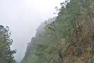
Pahuatlán is in the northwestern part of the Sierra Norte of Puebla mountain range. It is where the Trans-Mexican Volcanic Belt and the Sierra Madre Oriental meet. This area has many mountain peaks in parallel lines, separated by narrow valleys. The land is steep and uneven, with much of the municipality following the San Marcos and Mamiquetla rivers. Major peaks include El Chile, Toxtla, Blanco, Tlazalotepec, De la Cruz, and Batalla de 28 Enero. The elevation in the municipality ranges from 600 to 2,000 meters (2,000 to 6,600 feet) above sea level.
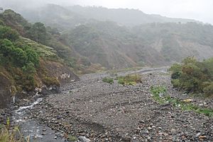
The area has several river basins, all flowing into the Gulf of Mexico. The main rivers are the Mamiquetla, Cuarco, Los Marías, Trinidad, Honey, Alcalman, Pahuatitla, and Chixtla. Several of these rivers join to form the San Marcos River, which is the main tributary of the Cazones River.
Climate and Weather
Pahuatlán has two main climates. The higher parts of the Sierra Norte have a temperate climate, with average temperatures between 12 and 18°C (54 and 64°F). Most of the municipality falls into this category. A smaller part has a semi-hot climate, with average temperatures over 18°C (64°F).
Both climates are humid, meaning they get a lot of moist air from the Gulf of Mexico. Pahuatlán is one of the wettest areas in the Sierra Norte of Puebla. The steep land and wet weather can lead to landslides and cracks in the ground. For example, in 2007, a large crack opened for 800 meters (2,600 feet) from the municipal palace to the Leandro Valle Schools. This caused landslides and forced over eighty families to move.
Natural Life and Caves
Most of the natural forests in the municipality have been cleared. However, some forests remain at the highest elevations. These are part of the Sierra Madre Oriental pine-oak forests ecoregion. Lower areas mostly have shrubs and other low plants. There is a major rainforest along the San Marcos River. Where natural plants still exist, you can find animals like deer, rabbits, and opossums, along with various birds and reptiles.
There are caves in areas like Angeles Tlacuilotepec, El Saltillo, and Cazones. You can also find cave paintings between the Atla and Xolotla communities. There is a small archeological site at Saltillo.
Economy and Community Life
Most people in Pahuatlán municipality live in areas with limited resources. Thirty-one communities are classified as highly marginalized, and two are very highly marginalized. The main ways people earn a living are through farming, especially growing coffee, and making handcrafts. Most of the shopping and business happens in the town of Pahuatlán itself.
Pahuatlán is Mexico's main producer of amate bark paper. This production is mostly in the community of San Pablito. Other handcrafts include hats, necklaces, embroidered clothes, baskets, semi-precious stones, and wool weaving. The Museo de Arte Popular (Museum of Popular Art) has supported a new craft in the area: making beaded bands. Selling these bands helps support the craftspeople of Pahuatlán and raises money for other museum projects.
However, many young people from the area travel to the United States to find work. This means that many communities are left with mostly women. When the economy in the United States slowed down in 2009, it affected Pahuatlán. People sent less money back home, which impacted the local economy.
Even though not many tourists know about the area, efforts are being made to attract more visitors. The main effort is to get the town of Pahuatlán recognized as a “Pueblo Mágico” (Magical Town).
See also
 In Spanish: Municipio de Pahuatlán para niños
 | William L. Dawson |
 | W. E. B. Du Bois |
 | Harry Belafonte |


