Pant, Shropshire facts for kids
Quick facts for kids Pant |
|
|---|---|
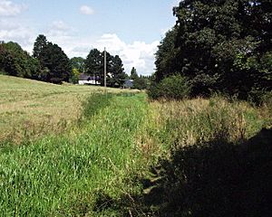
 Course of the Montgomery Canal at Pant, Shropshire |
|
| OS grid reference | SJ275224 |
| Civil parish |
|
| Unitary authority |
|
| Ceremonial county | |
| Region | |
| Country | England |
| Sovereign state | United Kingdom |
| Post town | OSWESTRY |
| Postcode district | SY10 |
| Dialling code | 01691 |
| Police | West Mercia |
| Fire | Shropshire |
| Ambulance | West Midlands |
| EU Parliament | West Midlands |
| UK Parliament |
|
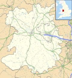
Pant is a small village in Shropshire, England. It lies very close to the border with Wales. The name 'Pant' comes from the Welsh word for 'hollow'. This is because the village is located right below old mines at Llanymynech Rocks Nature Reserve.
In 2011, the population of Pant and the nearby village of Llanymynech together was about 2,000 people. Pant has some interesting features. The Llanymynech Golf Club is unique because it's the only 18-hole golf course in the UK that crosses the border between two countries. There is also Llanymynech Ogof, an old copper mine where many Roman items have been found. The village also has Bryn Offa Church of England Primary School and a large gin wheel. This quiet village was once much busier, with several shops and a post office.
History of Pant
The Llanymynech Rocks Reserve has been used by people since Roman times. Back then, it was a copper mine. More recently, it became a limestone quarry.
When they were very busy, Pant and Llanymynech had a special tramway. This track carried materials from the mines down to different kilns in the villages. Pant had modern kilns near the Montgomery Canal. However, they were used for only a short time. Soon, a more efficient type of kiln, called a hoffman kiln, was built in Llanymynech.
There is a charming story known as "The Pant Heiress." It tells of a rich young lady from Chester who fell in love with a man who worked on the trains passing through Pant. They got married and lived in a house in the village. After her husband passed away, she raised her children alone. She also rented out rooms in her house. She loved to paint, especially in the Cornish town of St. Ives.
People have also found an abandoned gold mine up Llanymynech Rock. Many have collected small pieces of gold there over the years. The mine is hard to find, so it is believed there might still be gold left.
Travel and Transport
Pant was once connected by a railway line that ran from Whitchurch to Welshpool. It was also located on the Montgomery Canal. Both of these are no longer in use today.
The Cambrian Heritage Railways group has brought back to life about 0.75 miles (1.2 km) of the old railway line. This section runs between Pant and Llynclys. It is now a heritage railway where special trains operate. Currently, trains run as far as Penygarreg Lane Halt. The railway often holds steam events on this restored part of the line. There are plans to reopen the entire line from Gobowen and Oswestry to Welshpool. Work is also happening to make the Montgomery Canal usable again through the village.
The busy A483 road runs right through the middle of Pant. This causes some problems for the people living there. For a long time, there has been talk about building a bypass road around Pant and Llanymynech. There were no firm plans until the bypass was officially approved in the 2020 budget.
See also
 In Spanish: Pant (Shropshire) para niños
 | Frances Mary Albrier |
 | Whitney Young |
 | Muhammad Ali |


