
Montgomery Canal facts for kids
Quick facts for kids Montgomery Canal |
|
|---|---|

Montgomery Canal milepost
|
|
| Specifications | |
| Maximum boat length | 70 ft 0 in (21.34 m) |
| Maximum boat beam | 6 ft 10 in (2.08 m) |
| Locks | 27 (originally 26) (Graham Palmer lock was added during restoration) |
| Original number of locks | 26 |
| Maximum height above sea level | 265 ft (81 m) |
| Status | Parts navigable; parts under restoration |
| Navigation authority | Canal and River Trust |
| History | |
| Former names | Montgomeryshire Canal; Llanymynech Branch of the Ellesmere Canal; Montgomery Branch (or Arm) of the Shropshire Union |
| Modern name | Montgomery Canal |
| Original owner | The Company of Proprietors of the Montgomeryshire Canal |
| Principal engineer | John Dadford |
| Other engineer(s) | Thomas Dadford Junior/Thomas Dadford senior/Josias Jessop/John Williams/George W.Buck |
| Date of act | 1794 |
| Date completed | 1821 |
| Date closed | 1936 (legal abandonment: 1944) |
| Date restored | 1987 — (On-going restoration) |
| Geography | |
| Branch(es) | Weston Branch (dis.) |
| Branch of | Llangollen Canal |
The Montgomery Canal (Welsh: Camlas Trefaldwyn), also known as "The Monty", is a canal in eastern Powys and northwest Shropshire. It's being brought back to life, bit by bit! The canal stretches about 33 miles (53 km) from the Llangollen Canal at Frankton Junction to Newtown. It passes through towns like Llanymynech and Welshpool, and even crosses the border between England and Wales.
Long ago, the part of the canal from Llanymynech to Newtown was called the Montgomeryshire Canal. It got its name from the county of Montgomeryshire it flowed through. This canal had two main parts: the Western and Eastern branches, which met at Garthmyl. Near Llanymynech, the Montgomeryshire Canal connected to another waterway, the Llanymynech Branch of the Ellesmere Canal. Later, these different canal sections all became part of the larger Shropshire Union system.
The canal stopped being used after a part of it broke in 1936. It was officially closed in 1944. But in recent times, people have become interested in canals again. So, the old Montgomeryshire Canal branches and the Llanymynech Branch of the Ellesmere Canal are now all called the Montgomery Canal. Fun fact: the canal doesn't actually go to the town of Montgomery!
Today, about 7 miles (11 km) from Frankton Junction to Gronwyn Wharf can be used by boats. This part is connected to the national canal network run by the Canal & River Trust. There are also other short sections near Llanymynech and Welshpool that boats can use, but these are separate from the main network. Work is still happening to fix up more parts of the canal and make them ready for boats.
Contents
History of the Montgomery Canal


The Montgomeryshire Canal was built for a special reason, different from many other canals back then. Most canals made money by carrying goods. But the Montgomeryshire Canal was in a countryside area where there wasn't as much cargo. Its main goal was to move lime, which is a type of rock used to make farm land better for growing crops.
Local landowners helped pay for the canal. They hoped to earn money not from canal fees, but from having better crops on their farms.
Building the Canal: Early Days
The first idea for the Montgomeryshire Canal in 1792 was to connect Llanymynech to Welshpool. It would join the planned Llanymynech Branch of the Ellesmere Canal. By 1793, they decided to extend the canal all the way to Newtown. In 1794, a special law from Parliament allowed the canal to be built. It was called "An act for making a navigable Canal from or near Porthywain Lime Rocks... to or near Newtown..."
The company building the canal could raise £72,000 from shares, and another £20,000 if needed. John Dadford was the main engineer, and his brother Thomas Dadford Junior was his helper.
By February 1796, some parts of the canal were ready. The first boat, named Royal Montgomery, was launched near Welshpool with big celebrations! In July 1797, the connection to the Ellesmere Canal at Llanymynech opened. A month later, the canal reached Garthmyl, giving 16 miles (26 km) of waterway from Llanymynech. But it was still 7 miles (11 km) short of Newtown.
John Dadford left to work in America, and his father, Thomas Dadford senior, took over as engineer. During construction, there were some problems with the Berriew Aqueduct and the Vyrnwy Aqueduct, where one arch fell down. An expert, William Jessop, was called in. He said these were just small issues that happen when building big projects.
Canal Trade and Growth
Even though the canal was meant for farms, trade grew steadily. Quarries near Llanymynech sent limestone down the canal to be turned into fertiliser. As food prices went up, there was a big need for lime to help grow more crops. Once the Chirk and Pontcysyllte aqueducts opened on the Ellesmere Canal, it was easy to bring coal for the lime kilns. Other goods carried included stone for buildings, roofing slates, wood, and tree bark.
The Earl of Powis, a big landowner, was one of the main investors. He and his son owned quarries and mills along the canal. The canal started paying dividends (money back to investors) in 1805. It usually paid good returns until it was no longer independent. The amount of limestone carried went from 14,082 tons in 1806 to 44,592 tons in 1814!
Extending the Canal Westward
For 20 years, Garthmyl was the end of the canal because there wasn't enough money to finish it. But by 1812, Newtown was growing fast, and people wanted the canal extended. In 1813, shareholders voted to continue the canal. Josias Jessop surveyed the route.
The company agreed to ask Parliament for permission. But some shareholders worried they might lose their money. In 1815, a new plan was made: the new section would be built by a separate company, called the Western Branch. The old company would be the Eastern Branch. Profits from the Eastern Branch would help fund the Western Branch.
Under engineer John Williams, the new canal was finished in March 1819. It officially opened on December 7, 1821. This section had six locks going down from Newtown. Water came from the River Severn using a water wheel and a steam engine.
The Western Branch cost £53,390, much more than planned. The company borrowed money and struggled to pay it back. In 1832, George Buck became the engineer and clerk to sort out the money problems. He found many issues. Eventually, a man named William Pugh paid off most of the debts, and the company owed him a lot of money. He got a special law passed to raise the canal tolls. The Western Branch started making enough money to pay interest on its loans, but it seems no dividends were ever paid on its shares. The two branches stayed separate companies.
Shropshire Union Takes Over
The Eastern Branch of the canal did quite well, partly because railways arrived late in the area. The Western Branch, however, struggled because most goods only went in one direction, towards Newtown.
In the 1840s, railways started to become a big threat. In 1845, a proposed railway from Shrewsbury to Newtown wanted to make a deal with the canal company. Meanwhile, the London and Birmingham Railway was talking to the Ellesmere and Chester Canal, which planned to turn some canals into railways.
The Ellesmere and Chester Canal offered to buy the Montgomery Canal. The offer was accepted. In 1847, the Ellesmere and Chester Canal became the Shropshire Union Railways and Canal Company. They took over the Eastern Branch of the Montgomeryshire Canal on January 1, 1847. The Western Branch was bought by the Shropshire Union on February 5, 1850.
The Shropshire Union company later leased its canals to the London and North Western Railway (LNWR). The LNWR agreed to let the Shropshire Union run the canals freely, which they did with energy. The LNWR later built a railway line that competed with the canal. Some former canal shareholders were disappointed that the canal wasn't turned into a railway.
The Canal's Decline
Even though the Shropshire Union managed the canals well, the types of goods they could carry were limited. Slowly, the canals became less profitable. There were talks about closing parts of the canal in the late 1800s. In 1887, they considered closing the whole Montgomery Canal, but it was still making a small profit, so it stayed open.
In May 1917, a part of the Weston Arm (a branch of the canal) broke. It would cost too much to fix, so that part of the canal stayed closed. In 1922, the Shropshire Union was taken over by the London and North Western Railway, which then became part of the London, Midland and Scottish Railway (LMS) in 1923.
Another break in the canal happened in 1936. The LMS tried to close the canal officially but was refused. Finally, in 1944, the LMS got a law passed to close the entire canal from Frankton Junction southwards. After World War II, in 1947, the railways and canals became owned by the government. Control of the Montgomery Canal eventually went to British Waterways in 1963. In 1968, the canal was classified as a "Remainder Waterway," meaning British Waterways only had to do basic maintenance. As a result, the last 2 miles (3.2 km) to Newtown were sold off.
Restoring the Montgomery Canal
Since 1969, the Montgomery Canal has been slowly brought back to life for people to enjoy boating. This has been a big challenge! In some places, the canal was filled in, roads were built over it, bridges were lowered, and pipes were laid in the canal bed. The very end section near Newtown is now dry and no longer owned by the Canal & River Trust.
The "Big Dig" and Early Efforts
In 1969, there were plans to turn the canal bed through Welshpool into a road. People formed the Welshpool By-Pass Action Committee to stop this. They asked for help from the Shropshire Union Canal Society, who organized a "Big Dig" in Welshpool. Over 200 volunteers showed up to clear a section of the canal!
The Shropshire Union Canal Society had already been pushing for the canal's restoration. Before the "Big Dig," they attended council meetings, put up displays, and even took the Welshpool Town Council to Market Drayton to see another canal being restored. Key people involved included Graham Palmer, who later started the Waterway Recovery Group. Volunteers agreed to work on the section from Welshpool Lock northwards.
Even though British Waterways (the canal owners at the time) were against full restoration, they helped locally. They lowered the water level in the Welshpool section so volunteers could work. Welshpool Borough Council wouldn't let volunteers use their trash dump for the removed material, but a local farmer, W Davies, offered his land.
The "Big Dig" was planned for October 18 and 19, 1969. About 100 volunteers were expected, but even more showed up! Over 200 people worked with hand tools and borrowed equipment like cranes, trucks, and diggers. The cleared canal was refilled on Sunday, and the Mayor and Mayoress rode on a boat along the newly cleared section. Because of these efforts, the plan to use the canal route for a bypass was stopped.
Continuing the Restoration Journey
In 1971, a report suggested that the Montgomery Canal should be fully restored. In October 1973, the Prince of Wales announced a plan to restore 7 miles (11 km) of the canal. This project was managed by the Shropshire Union Canal Society and supported by the Variety Club of Great Britain, who wanted to use the canal for children with disabilities. The Prince officially opened Welshpool Town Lock on May 23, 1974.
Despite this progress, in 1976, the Welsh Office approved a plan for a bypass road at Arddleen that would cross the canal at a low level. The Inland Waterways Association and the Shropshire Union Canal Society worked hard to change this plan. By mid-1978, a solution was found, but the extra costs caused delays.
Restoration Beyond Welshpool
In 1979, money was tight. Powis Council needed to fix bridges over the canal and wanted to lower one of them. This would make it harder to restore the canal for boats. The restoration groups fought this in court, but the court allowed the bridge to be lowered. However, the Secretary of State suggested that the canal's route should be protected in future plans.
By 1985, environmental concerns were growing. To make sure boaters and environmentalists could work together, a project was funded to study the plants and animals in the unrestored canal. They also built special "off-line" nature reserves, which are separate areas where rare plants and animals can live. The first one was at Rednal. This idea was a big success and helped future restoration projects.
Montgomeryshire County Council promised £1 million for canal restoration. British Waterways also asked Parliament for permission to restore the whole canal. The restoration also got a generous gift of £200,000 from Humphrey Symonds, specifically for the Montgomery Canal. Frankton Locks were reopened on September 12, 1987, by the Prince of Wales. He announced that volunteers had worked 12,000 hours on the project, saving £200,000 in labor costs!
A law passed in 1987 officially allowed the restoration of the canal from Newtown to Frankton Junction, including its branches. It also formally changed the canal's name to the Montgomery Canal and allowed for nature reserves. Another law in 1988 brought back the right for boats to use the canal. In 2012, British Waterways was replaced by the Canal & River Trust.
Progress Below Frankton
Gallowstree Bridge was opened in 1992. The canal section from Frankton Locks to the River Perry crosses a peat moor. Historically, the canal here relied on the natural water level of the moor to hold water. But modern farming changed this, so a new lining was needed in 1994 to prevent leaks. The peat had also sunk, so a new lock, called Graham Palmer Lock, was built. It was named after the person who helped start the Waterway Recovery Group.
On June 3, 1995, the restored section between Frankton Locks and the aqueduct over the River Perry was opened. On September 21, 1996, the canal was extended to Queen's Head, making 4 miles (6.4 km) of navigable canal connected to the national network.
The 2.5-mile (4 km) section from Maesbury to Redwith received European funding in 2000. There were worries that the canal's status as a Site of Special Scientific Interest (SSSI) in Powys might stop restoration. But after talks, an agreement was reached in 2005. This ensured that rare plants and animals would be protected in off-line nature reserves, allowing boats to use the main canal.
In 2002, work started on Newhouse Lock. They found more structural problems than expected, but more funding was secured. Volunteers did excellent work, completing tasks usually done by professionals. The project cost £250,000, much less than planned, and the volunteer work was valued at £45,000. The lock was finished six months early in 2006 and officially opened on June 25, 2006. This completed the restoration of all locks on the Welsh section of the canal owned by British Waterways.
In 2003, the 3-mile (4.8 km) section from Queen's Head to Gronwen Wharf was reopened, allowing boats through Maesbury Marsh. In October 2007, the 875-yard (800 m) section from Gronwen Wharf to Redwith Bridge was filled with water. An off-line nature reserve was built for rare plants and animals, adding £250,000 to the cost. Restoration then moved to the section towards Pryce's Bridge. This refurbished section opened on July 19, 2014.
Restoration efforts continue towards Crickheath Wharf, where a turning point for boats will be located. With a grant from the National Lottery in 2016, it is planned that the canal will reach Crickheath winding hole by 2020.
The Montgomery Waterway Restoration Trust and the Canal & River Trust are working together on the restoration. As of 2017, Gronwen is the furthest point for larger boats on the northern section, which connects to the Llangollen Canal. There are also short, separate sections of navigable canal in Llanymynech and Welshpool.
Canal Architecture
The lock gear on the Eastern Branch of the Montgomeryshire Canal was unique. Most canal locks have channels in the side walls to fill and empty the lock. But on the Montgomeryshire, the channels were in the base of the canal, and a paddle slid horizontally over them. This could create a big whirlpool when operating the lock! The winding gear was a special geared design, not the usual rack and pinion. This meant the paddles couldn't accidentally drop shut. This paddle gear was designed by George W. Buck.
Many of the lock gates on the Montgomeryshire Canal were replaced with cast iron gates. These gates were curved and had tubular cast iron balance beams. The last pair were taken from Welshpool to the Stoke Bruerne Canal Museum in the early 1970s.
The bridges on the Montgomery Canal continue the numbering from the Llanymynech Branch of the Ellesmere Canal. So, the first bridge on the Montgomery Canal is number 71, because the numbering started at Hurleston Junction on the Llangollen Canal. This means the Llangollen Canal has two separate sets of bridge numbers.
Nature and Wildlife Conservation
After the canal closed, lots of wildlife grew there. The whole Welsh section and parts of the English section (like from Aston Locks to Keeper's Bridge) were named Sites of Special Scientific Interest (SSSIs). This means they are important for nature. Special plants like Floating Water Plantain and Grass-wrack pondweed live there.
To protect this wildlife, nature reserves have been created along the canal. These include Rednal Basin, most of the Weston Branch, and a special reserve near the Aston Locks. Some winding holes (places where boats can turn around) have been given over to nature. For example, one near Crofts Mill Lift Bridge has barriers to keep boats out, and another near Park Mill Bridge has been allowed to become overgrown.
Only a limited number of boats (up to 1,250 per year) are allowed on the navigable section in England. Also, boats must go slower than on most British canals, for example, 2 or 3 miles per hour. This helps protect the wildlife.
Towpath for Walking
The path next to almost all of the canal, called the towpath, is used as a footpath. The section between Pool Quay Lock and Newtown is part of the Severn Way, a long-distance walking route. Shorter parts south of Llanymynech and Pool Quay are also followed by the Offa's Dyke Path.
Canal Route Highlights
Frankton Junction to Carreghofa
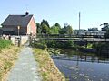
This section was originally part of the Ellesmere Canal. But now, it's officially the start of the Montgomery Canal. The bridges here are numbered starting from 71, continuing from the Llangollen Canal. The canal from Frankton Junction to Gronwen Wharf (just north of Bridge 82) is open for narrowboats.
To go through the locks at Frankton Junction, you need to book ahead. A Canal and River Trust lock-keeper operates them. In 2020, boats could only pass between 9:00 AM and 12:00 PM. Only up to twelve boats can use the locks each day. Boaters must stay on the canal for at least one day and up to 14 days. You can't visit again within six weeks of leaving. The locks include a two-chamber staircase lock and two single locks.
Next to the locks are old canal buildings. You can see the remains of a dry dock where the grain boat Cressy was changed for leisure use in 1929. This boat was later bought by L.T.C. Rolt, who used it to explore old canals and helped start the Inland Waterways Association. A plaque marks this history.
The Weston Branch, which is now filled in, used to split off here. Only a short part remains, used for mooring and as a nature reserve. Nearby is Bridge 71, a red-brick humped-back road bridge from 1785, which is still in its original state and is a grade II listed structure.
The canal goes through a peat bog. Because the bog has been drained, the canal had to be lined to prevent leaks during restoration. A new lock, Graham Palmer Lock, was built here. The Perry Aqueduct, which crosses the River Perry, was replaced during restoration. The old one had three small arches and caused flooding. The new one is a single steel span. Beyond the aqueduct, the canal is very straight because a new, more direct route was built in 1822.
Rednal Basin was once used to transfer goods between the canal and the railway. It's now a nature reserve. At Queen's Head, the canal goes under the A5 road. There are mooring spots and Canal & River Trust buildings here. After Queen's Head are the three Aston Locks. The top lock has a nature reserve next to it.
The canal passes through Maesbury Marsh, a village built along the canal. Canal Central, a building with a post office, shop, tearoom, and bike/canoe hire, was built here in 2006. Mooring is available in parts of Maesbury Marsh. Bridge 81 is a lift bridge that needs a special tool (a windlass) to operate. The Mill Arm has been restored, leading to a boatyard.
The section from Gronwen Wharf to Redwith Bridge (No. 83) reopened in October 2007. However, powered boats can't go past Gronwen Wharf because it's the last turning point. Redwith Bridge was rebuilt to allow narrowboats to pass under it again. In 2014, the section from Redwith Bridge to Pryce's Bridge (No. 84) was completed.
The canal section from Pryce's Bridge through Crickheath and Pant is dry and partly filled in. Restoration is ongoing from Pryce's Bridge to Crickheath Wharf (just north of Bridge 85), which will be the next turning point. Through Pant, the canal ran next to the Oswestry and Newtown Railway. The Cambrian Railways Trust has restored a short part of the railway and built a small station (halt) at Penygarreg Lane next to the canal.
The canal from just after Pant through Llanymynech to Carreghofa has water. However, a new road crossing (Carreghofa Lane) blocks the canal north of Walls Bridge (No. 93). Since 2006, the short section through Llanymynech is navigable. The wharf at Llanymynech has been restored. Another turning point east of Llanymynech Bridge (No. 92) allows boats to turn around. As the canal passes under Llanymynech Bridge, it crosses from Shropshire, England, into Powys, Wales. You can take canal trips on this section on the narrowboat George Watson Buck.
Wern Aqueduct was built after the canal opened to allow a railway branch to pass underneath. A temporary canal diversion was made for its construction, and you can still see where it was.
A feeder from the River Tanat enters the canal above Carreghofa Locks. It was built in 1822.
The Llanymynech Branch of the Ellesmere Canal joins the Eastern Branch of the Montgomeryshire Canal at Carreghofa Locks.
Eastern Branch of the Canal
The canal section from Carreghofa to Arddleen has water, but some bridges have been lowered.
Between the two Carreghofa Locks, there was a side pond. This was needed because the water section between the locks is short.
Near the Vyrnwy Aqueduct, arches were built in the canal's bank to protect it from flooding from the River Vyrnwy. The aqueduct itself has been repaired and strengthened many times. It sometimes leaks into the River Vyrnwy, but the leaks often fix themselves. Unlike other nearby aqueducts, the Vyrnwy Aqueduct is made of stone and uses a special clay lining called puddled clay.
Bridges 102 and 103 carry a major road and have been lowered. To restore navigation, they might need to add an extra lock to lower the water level here.
The section of the canal from Arddleen to Refail (Efail-Fach) Bridge is navigable.
The Guilsfield Arm never actually reached Guilsfield. This branch was about 2.25 miles (3.6 km) long with a wharf at its end. It was flat, with no locks or tunnels, thanks to a deep cutting. Today, a lowered bridge cuts off the arm from the main canal. A short part has become a nature reserve, and the rest is dry.
The water section below Burgedin Bottom Lock is the lowest point of the canal. The Eastern Branch of the Montgomeryshire Canal gets its water from the Ellesmere Canal, the Tanat feeder at Carreghofa, and a feeder from the River Rhiw at Berriew.
The canal through Welshpool was one of the first parts to be restored in 1969. This happened when there was a plan to use the canal's route for a bypass road. Welshpool Town Lock had cast iron gates when the canal closed. These were removed and replaced with standard gates.
Western Branch of the Canal
The canal section from Refail (Efail-Fach) Bridge to Freestone Lock has water and goes southwest. Several bridges have been lowered, including those under the A483 road, which runs alongside the canal. At Brynderwyn, there's a lock with a white cottage, which was once home to the lockkeeper. Brynderwyn Wharf, a former coal wharf, was north of the lock. Some bridges on this section are made from cast iron from the nearby Brymbo factory. Glanhafren Bridge (No. 143) has the date 1889 and fancy cast iron railings. Bridge 147, north of Abermule, dates from 1853.
South of Abermule, the A483 road now cuts across the canal bed. This part of the road is new. To the southwest, Byles Lock and Newhouse Lock continue the climb towards Newtown. At Aberbechan, a three-arched aqueduct carries the canal over Bechan Brook, a small river that flows into the River Severn. Nearby are the remains of an old corn mill. The last bridge on the watered section (No. 153) has "Brymbo 1862" cast into it. Right after this is Freestone Lock, and beyond that, the canal is dry.
Below Bridge 153, water enters the canal from the Penarth Weir on the River Severn. This weir is a unique two-level structure built in 1813-1814. There's a modern salmon ladder on its western side. Between the river and the canal are old sewage treatment beds, now a wildlife haven managed by the Montgomeryshire Wildlife Trust. The canal section from Freestone Lock to Newtown is mostly filled in, and the site of the basin in Newtown, along with the last 0.5 miles (0.8 km) of the route, is now a housing estate. A public footpath follows the canal's old route, passing the sites of Dolfor Lock and Rock Lock.
The Newtown Pumphouse used to lift water from the River Severn to the canal. It first used a water wheel and bucket pumps, later helped by a steam engine. Eventually, a diesel pump was used, but pumping stopped in the 1940s. The building, which once had a tall chimney, still exists but is privately owned.
Points of Interest
| Point | Coordinates (Links to map resources) |
OS Grid Ref | Notes |
|---|---|---|---|
| Frankton Junction | 52°52′49″N 2°56′13″W / 52.8804°N 2.9369°W | Llangollen Canal/Montgomery Canal junction | |
| Gronwen Wharf and Bridge No. 82 | 52°48′55″N 3°02′01″W / 52.8152°N 3.0337°W | Gronwen winding hole, wharf and bridge | |
| Redwith lift bridge No. 82A | 52°48′46″N 3°02′18″W / 52.8127°N 3.0383°W | New 2009 | |
| Redwith Bridge No. 83 | 52°48′36″N 3°02′19″W / 52.8101°N 3.0385°W | ||
| Pryces Bridge No. 84 | 52°48′30″N 3°02′36″W / 52.8084°N 3.0434°W | Southern limit in water | |
| Crickheath Wharf | 52°48′21″N 3°03′01″W / 52.8059°N 3.0503°W | Wharf under restoration | |
| Carreghofa Locks | 52°46′27″N 3°06′24″W / 52.7743°N 3.1068°W | Ellesmere Canal/Eastern Branch of the Montgomeryshire junction | |
| Guilsfield Arm | 52°43′28″N 3°06′31″W / 52.7244°N 3.1085°W | ||
| Garthmyl | 52°35′18″N 3°11′40″W / 52.5883°N 3.1944°W | Eastern/Western Branch of the Montgomeryshire junction |
Images for kids
-
Restoration near Redwith Bridge, July 2007
-
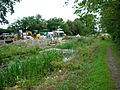
Restoration near Crickheath Wharf, August 2007
-
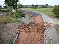
Puddle clay lining and temporary end stop at Redwith Bridge, October 2007
-
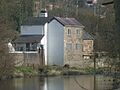
The Newtown pumping station seen from across the River Severn. The intake pipe can still be seen.
-
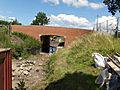
The culvert that was once bridge 129 marked the end of the navigable section in 2009.


