Parrearra, Queensland facts for kids
Quick facts for kids ParrearraSunshine Coast, Queensland |
|||||||||||||||
|---|---|---|---|---|---|---|---|---|---|---|---|---|---|---|---|

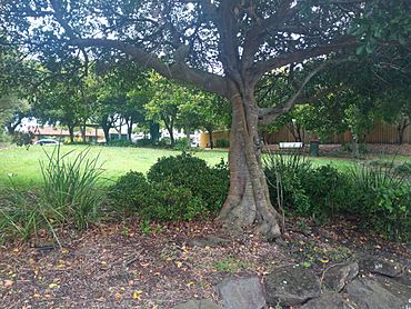
Park in Sunbird Close, 2021
|
|||||||||||||||
| Population | 4,661 (2021 census) | ||||||||||||||
| • Density | 1,860/km2 (4,800/sq mi) | ||||||||||||||
| Established | 1967 | ||||||||||||||
| Postcode(s) | 4575 | ||||||||||||||
| Area | 2.5 km2 (1.0 sq mi) | ||||||||||||||
| Time zone | AEST (UTC+10:00) | ||||||||||||||
| Location | |||||||||||||||
| LGA(s) | Sunshine Coast Region | ||||||||||||||
| County | Canning | ||||||||||||||
| Parish | Mooloolah | ||||||||||||||
| State electorate(s) | Kawana | ||||||||||||||
| Federal Division(s) | Fisher | ||||||||||||||
|
|||||||||||||||
Parrearra is a suburb located in the Sunshine Coast Region of Queensland, Australia. In 2021, about 4,661 people lived here. It's part of the wider Kawana Waters area and is often called Kawana Island because it's surrounded by water.
Contents
Exploring Parrearra's Location
Parrearra is quite unique because it's almost like an island! It's surrounded by water on three sides. To the west, you'll find the Mooloolah River. The Parrearra Canal is to the north-east, and the Wyuna Canal is to the south-east and south.
These canals, along with the river, make Parrearra feel like an island. Together, the canals are sometimes called Parrearra Lake. Their main job is to help prevent floods in the Kawana Waters area. But they are also used for fun activities like boating.
Getting Around Parrearra
You can get to Parrearra mainly by using Kawana Way. This road comes into the suburb from the east, crossing the Mooloolah River. It then leaves the suburb to the south over a bridge that crosses the Wyuna Canal.
Another road, Kawana Island Boulevard, connects to Kawana Way. It also leaves the suburb to the east, crossing a bridge over the Wyuna Canal. The Nicklin Way runs along the northern edge of Parrearra, but you can't get into the suburb directly from it. Parrearra is mostly a place where people live.
The Story Behind Parrearra's Name
The name Parrearra was first suggested in 1967. It was chosen by Alfred Grant, who was developing the Kawana Waters area. The name comes from an old Aboriginal word meaning "length of river."
On September 1, 1967, the Queensland Place Names Board officially named Parrearra as a town. Later, in 1989, it was changed and defined as a suburb.
Who Lives in Parrearra?
In 2016, the population of Parrearra was 4,468 people. By 2021, the number of people living in Parrearra had grown to 4,661.
Schools Near Parrearra
There are no schools located directly within Parrearra. Students living here usually go to nearby schools. The closest primary schools are Brightwater State School and Buddina State School. For high school, students typically attend Kawana Waters State College.
 | Madam C. J. Walker |
 | Janet Emerson Bashen |
 | Annie Turnbo Malone |
 | Maggie L. Walker |


