Peel River (Canada) facts for kids
Quick facts for kids Peel River |
|
|---|---|

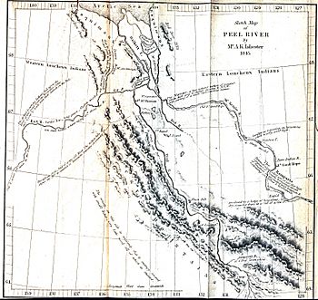
Peel River, 1845
|
|
| Native name | Teetł'it Gwinjik |
| Country | Canada |
| Territories | |
| Physical characteristics | |
| Main source | Ogilvie Mountains |
| River mouth | Mackenzie River Mackenzie Delta 67°0′0″N 134°59′3″W / 67.00000°N 134.98417°W |
| Basin features | |
| Basin size | 73,600 km2 (28,400 sq mi) |
The Peel River (called Teetł'it Gwinjik in the Gwich’in language) is an important river in Canada. It flows through the Yukon and Northwest Territories. This river is a major branch of the much larger Mackenzie River.
Contents
About the Peel River
The Peel River starts in the Ogilvie Mountains in the central part of the Yukon. It forms where two other rivers, the Ogilvie River and the Blackstone River, join together.
Where Does It Flow?
The Peel River flows into the Mackenzie River in a wide area called the Mackenzie Delta. A delta is a landform that looks like a triangle. It is created when a river splits into many smaller channels before flowing into a larger body of water.
Sometimes, a small channel from the Peel River can connect to channels from the Mackenzie River. This means you can follow a continuous water path for a very long distance. It makes the Peel River seem even longer!
Rivers That Join the Peel
Many smaller rivers flow into the Peel River, making it bigger. These are called tributaries. The main tributaries of the Peel River are:
- Ogilvie River
- Blackstone River
- Hart River
- Wind River (Yukon)
- Bonnet Plume River
- Snake River (Yukon)
Crossing the River
The Dempster Highway crosses the Peel River near a community called Fort McPherson. Depending on the time of year, people cross the river in different ways:
- During summer, a ferry boat carries vehicles and people across the water.
- In winter, when the river freezes solid, an ice bridge is built. This allows cars and trucks to drive right over the frozen river.
Fort McPherson is the only community located directly along the banks of the Peel River.
The Peel Watershed
The area of land that drains into the Peel River is called the Peel Watershed. This area is mostly wilderness. People are currently making plans for how this land should be used in the future. This is called land use planning. It helps decide what parts of the land should be protected and what parts can be used for other activities.
Changes in the River's Water
Scientists are studying the Peel River. One expert, Steven Kokelj, studies permafrost. Permafrost is ground that stays frozen all year round. In the Peel River region, the permafrost is starting to melt.
When permafrost melts, it can release tiny bits of chemicals called ions into the water. These ions include elements like calcium and sulphur. Scientists are watching these changes to understand how melting permafrost affects the river's water quality.
See also
 In Spanish: Río Peel (Canadá) para niños
 | Charles R. Drew |
 | Benjamin Banneker |
 | Jane C. Wright |
 | Roger Arliner Young |

