Pharaoh Peaks facts for kids
Quick facts for kids Pharaoh Peaks |
|
|---|---|

Pharaoh Peaks
|
|
| Highest point | |
| Elevation | 2,713 m (8,901 ft) |
| Prominence | 410 m (1,350 ft) |
| Listing | Mountains of Alberta |
| Geography | |
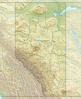
| Location | Banff National Park Alberta, Canada |
| Parent range | Ball Range, Canadian Rockies |
| Topo map | NTS 82O/04 |
| Geology | |
| Age of rock | Cambrian |
| Type of rock | Sedimentary rock |
| Climbing | |
| Easiest route | Scramble |
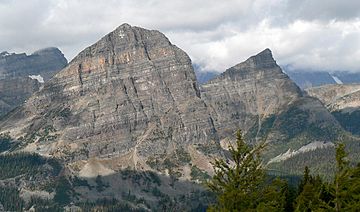
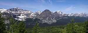
Pharaoh Peaks is a mountain in Banff National Park in Alberta, Canada. It stands about 2,713 meters (8,901 feet) tall and has three main tops. This mountain is part of the Ball Range in the amazing Canadian Rockies.
The mountain got its name, Pharaoh, because of other places nearby with Egyptian names. These include Egypt Lake, Pharaoh Lake, Mummy Lake, and Scarab Lake. Arthur O. Wheeler of the Interprovincial Boundary Survey gave these names in 1922. He thought the area was very beautiful. The name Pharaoh Peaks became official in 1956.
How Pharaoh Peaks Was Formed
Like other mountains in Banff Park, Pharaoh Peaks is made of sedimentary rock. This rock formed from layers of sand, mud, and tiny shells that settled at the bottom of ancient seas. Over millions of years, these layers hardened into rock.
This process happened from the Precambrian to the Jurassic periods. Later, during a time called the Laramide orogeny, these rock layers were pushed up. They were also moved east and slid over younger rocks, creating the mountains we see today.
Weather at Pharaoh Peaks
Pharaoh Peaks has a subarctic climate. This means it has very cold, snowy winters. Summers are usually mild. Temperatures can drop below -20°C (-4°F). With wind, it can feel even colder, sometimes below -30°C (-22°F).
If you want to climb the mountain, the best time is from June through September. During these months, the weather is usually more favorable. Rain and melting snow from the mountain flow into smaller streams. These streams then join the larger Bow River.


