Pinaleño Mountains facts for kids
Quick facts for kids Pinaleño Mountains |
|
|---|---|
 |
|
| Highest point | |
| Peak | Mount Graham |
| Elevation | 10,720 ft (3,270 m) |
| Geography | |
| Country | United States |
| State | Arizona |
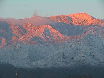
The Pinaleño Mountains are a tall mountain range in southeastern Arizona, United States. They are located near the town of Safford. In the Yavapai language, they are called Walkame, meaning "pine mountains." The Western Apache language name is Dził Nnilchí' Diyiléé, which means "pine-burdened mountain."
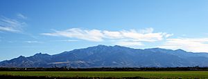
These mountains rise over 7,000 feet (2,100 m) from the desert floor. This is more than any other mountain range in Arizona! The Pinaleños are surrounded by the Sonoran Desert and Chihuahuan Desert. Higher up, you'll find forests that are like those in colder, northern areas. Experts say these mountains have "the highest diversity of habitats of any mountain range in North America." This means many different kinds of plants and animals live here.
The highest point is Mount Graham, which is 10,720 feet (3,267 m) tall. The Western Apache call it Dził Nchaa Sí'an, or "Big Seated Mountain." Many local people call the whole mountain range "Mount Graham." When they do, the actual peak is called "High Peak." The Pinaleño Mountains cover about 300 square miles (780 km2). They are part of the Coronado National Forest.
The Pinaleño Mountains were important to Native American groups. The Pinal Band of the San Carlos Apache and the Hwaalkamvepaya/Walkamepa Band of the Yavapai people lived here. They used the mountains as a main source of pine nuts, which were a very important food for them.
The Pinaleños are a type of mountain range called a sky island. Imagine a mountain as an island in the middle of a desert "sea." These mountains are isolated by hot, dry desert valleys. This isolation means that plants and animals on these mountains can't easily travel to other mountains. Over time, this can lead to unique subspecies developing. This idea is similar to what Charles Darwin learned from animals on the Galápagos Islands. For example, the Mount Graham red squirrel is a special type of red squirrel found only here.
The towns closest to the Pinaleño Mountains are Safford and Willcox, Arizona.
Contents
Plants and Animals of the Pinaleños
The Pinaleño Mountains are home to a wide variety of plants and animals. This makes them very special.
Trees and Other Plants
You can find many different trees here, such as Douglas fir, Engelmann spruce, quaking aspen, and Ponderosa pine. You'll also see silverleaf oaks, box elder, and bigtooth maple.
Animals and Wildlife
Common animals in the Pinaleños include mule deer, Coue's white-tail deer, hawks, and black bears.
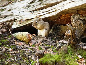
The Mount Graham red squirrel is a very important animal here. People once thought it was extinct, but it was "rediscovered" in the 1970s. Since 1987, it has been officially listed as an endangered species. This means it is at risk of disappearing forever.
Ancient Trees
Unlike many other mountains in Arizona, the Pinaleños do not have lava deposits. Mountains with lava tend to have fewer trees. The Pinaleños, however, have many trees, including some that are very old. Researchers have found living Douglas fir trees that started growing in 1257 and 1270 AD! That's before Christopher Columbus arrived in the Americas. These trees survived because the rocky cliffs protected them from fires. Scientists also found dead firs that were as old as 1102 AD.
Heliograph Station
Heliograph Peak in the Pinaleños was once home to a special communication station in the 1800s.
During General Nelson A. Miles' fight against the Apaches led by Geronimo in the mid-1880s, a U.S. Signal Corps officer set up a clever signal system. Soldiers on mountain peaks across Arizona and New Mexico used mirrors, called heliographs, to flash messages over long distances. Heliograph Peak was one of these important stations because it is one of the highest mountains in the area.
After Geronimo was captured in 1886, the heliograph system was no longer needed.
Civilian Conservation Corps
The Civilian Conservation Corps (CCC) was a program in the 1930s that helped people find work during the Great Depression. Many CCC workers came to the Pinaleño Mountains. They built many things that people still enjoy today.
For example, they built improvements at campgrounds, hiking trails, and roads. These projects made it easier for visitors to explore and enjoy Mount Graham.
One of their projects was building a 99-foot (30 m) steel lookout tower on Heliograph Peak. This tower was used to watch for fires in the Pinaleños and nearby mountain ranges. The tower is still there today. However, most fire watching is now done from the ground or by airplanes.
2004 Fire
In the summer of 2004, a large wildfire called the Nuttall-Gibson complex burned over 30,000 acres (120 km2) in the Pinaleño Mountains. Heavy monsoon rains helped firefighters put out the blaze. The firefighting effort cost over $8.5 million and involved more than 800 firefighters.
Firefighters were able to protect the Mount Graham International Observatory and the cabins. Only two structures were damaged: a historic fire lookout and an equipment storage shack.
Arizona's Governor Janet Napolitano visited the area during the fire. She said, "This is a big, major fire, and it concerns us all." She noted that the fire looked much better after firefighters worked hard to contain it.
Fragile Ecosystem
Because the Pinaleño Mountains are a "sky island," their ecosystem is very special and sensitive. The U.S. Forest Service says that before about 1870, the Pinaleños had healthy forests. These forests were used to natural, low-intensity wildfires.
However, after European settlement, these natural processes were changed. Overgrazing by animals and efforts to stop all fires led to problems. Also, large trees were harvested. Now, the forests have too many small trees and dead wood. This makes them more likely to have very big, damaging fires.
Threats from Climate Change
Since the Pinaleños are a fragile ecosystem, even small changes in climate can have a big impact. Larger climate changes, like global warming, could threaten the mountains' ecology. Some people believe the 2004 fires were partly caused by global warming.
The Forest Service says that climate change and drought are making the Pinaleños more likely to have insect outbreaks and huge, destructive fires. They believe that managing the forests carefully, using methods like controlled burns, is needed to help restore the natural balance.
Mount Graham Observatory
Mount Graham International Observatory (MGIO) sits on top of Mount Graham, the highest peak in the Pinaleños. It is run by the University of Arizona. This observatory has some of the most advanced telescopes and astronomical instruments in the world.
World's Most Advanced Telescope
The Large Binocular Telescope (LBT) at Mount Graham is one of the most powerful telescopes. It can see much deeper into space and with ten times more clarity than the Hubble Space Telescope. With this amazing telescope, astronomers can study planets in distant solar systems. They can also look back in time to see objects from the very beginning of the universe, about 14 billion years ago. The LBT is already partly working.
Swift Trail
The Swift Trail (Arizona Route 366) is a modern highway that makes the Pinaleño Mountains easy to visit. The road is 36 miles (58 km) long. About 23 miles are paved, and 13 miles are graded dirt. As you drive up this winding mountain road, you can experience different climate zones. It's like driving from Mexico to Canada in just one afternoon!
The road was named after T. T. Swift, who was the first supervisor of the Coronado National Forest. The route has been improved many times over the years, including major work in the 1930s and 1990s.
Peaks of the Pinaleños
- Mount Graham 10,720 ft (3,270 m)
- Hawk Peak 10,627 ft (3,239 m)
- Plain View Peak 10,370 ft (3,160 m)
- Heliograph Peak 10,022 ft (3,055 m)
- Merrill Peak 9,288 ft (2,831 m)
- Ladybug Peak 8,780 ft (2,680 m)
- Greasewood Mountain 7,094 ft (2,162 m)
 | Toni Morrison |
 | Barack Obama |
 | Martin Luther King Jr. |
 | Ralph Bunche |


