
Pine Island, Minnesota facts for kids
Quick facts for kids
Pine Island
|
|
|---|---|

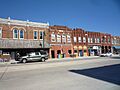
City Hall and downtown Pine Island
|
|

|
|
| Country | United States |
| State | Minnesota |
| Counties | Goodhue, Olmsted |
| Area | |
| • Total | 6.02 sq mi (15.60 km2) |
| • Land | 5.99 sq mi (15.52 km2) |
| • Water | 0.03 sq mi (0.08 km2) |
| Elevation | 994 ft (303 m) |
| Population
(2020)
|
|
| • Total | 3,769 |
| • Density | 629.11/sq mi (242.89/km2) |
| Time zone | UTC-6 (Central (CST)) |
| • Summer (DST) | UTC-5 (CDT) |
| ZIP code |
55963
|
| Area code(s) | 507 |
| FIPS code | 27-51136 |
| GNIS feature ID | 2396208 |
| Website | pineislandmn.com |
Pine Island is a city located in the state of Minnesota, United States. It is mainly in Goodhue County, but a small part also reaches into Olmsted County. This makes a portion of the city part of the Rochester metropolitan area.
In 2020, about 3,769 people lived in Pine Island. The city has a strong farming background. However, it is slowly changing into a bedroom community. Many people who live here travel to nearby Rochester for work. Pine Island is also special because it has Minnesota's very first diverging diamond interchange, which is a unique type of road intersection.
Contents
History of Pine Island
Pine Island was first planned out in 1856. This is when the city's layout was officially created. A post office has been open and serving the community since 1856 as well.
Where is Pine Island?

Pine Island is located along the Middle Fork of the Zumbro River. The United States Census Bureau says the city covers about 5.61 square miles (14.53 square kilometers). Most of this area, about 5.59 square miles (14.48 square kilometers), is land. Only a small part, about 0.02 square miles (0.05 square kilometers), is water.
U.S. Highway 52 is a major road that runs through the community. It helps people travel in and out of Pine Island.
Pine Island's Climate
| Climate data for Pine Island, Minnesota | |||||||||||||
|---|---|---|---|---|---|---|---|---|---|---|---|---|---|
| Month | Jan | Feb | Mar | Apr | May | Jun | Jul | Aug | Sep | Oct | Nov | Dec | Year |
| Record high °F (°C) | 58 (14) |
64 (18) |
83 (28) |
93 (34) |
107 (42) |
106 (41) |
109 (43) |
101 (38) |
101 (38) |
94 (34) |
78 (26) |
79 (26) |
109 (43) |
| Mean daily maximum °F (°C) | 24 (−4) |
29 (−2) |
43 (6) |
61 (16) |
69 (21) |
79 (26) |
85 (29) |
81 (27) |
73 (23) |
63 (17) |
42 (6) |
29 (−2) |
57 (14) |
| Mean daily minimum °F (°C) | 3 (−16) |
7 (−14) |
20 (−7) |
45 (7) |
44 (7) |
55 (13) |
62 (17) |
56 (13) |
49 (9) |
35 (2) |
22 (−6) |
8 (−13) |
34 (1) |
| Record low °F (°C) | −43 (−42) |
−35 (−37) |
— | — | — | — | — | — | — | — | — | — | −43 (−42) |
| Average precipitation inches (mm) | 0.90 (23) |
0.88 (22) |
1.92 (49) |
3.35 (85) |
3.75 (95) |
4.67 (119) |
4.25 (108) |
4.88 (124) |
3.80 (97) |
2.46 (62) |
2.02 (51) |
1.13 (29) |
34.01 (864) |
| Source: The Weather Channel | |||||||||||||
People of Pine Island
| Historical population | |||
|---|---|---|---|
| Census | Pop. | %± | |
| 1880 | 656 | — | |
| 1890 | 548 | −16.5% | |
| 1900 | 832 | 51.8% | |
| 1910 | 834 | 0.2% | |
| 1920 | 934 | 12.0% | |
| 1930 | 961 | 2.9% | |
| 1940 | 1,040 | 8.2% | |
| 1950 | 1,298 | 24.8% | |
| 1960 | 1,308 | 0.8% | |
| 1970 | 1,640 | 25.4% | |
| 1980 | 1,977 | 20.5% | |
| 1990 | 2,125 | 7.5% | |
| 2000 | 2,337 | 10.0% | |
| 2010 | 3,263 | 39.6% | |
| 2020 | 3,769 | 15.5% | |
| U.S. Decennial Census | |||
In 2000, the average income for a household in Pine Island was $47,500. For families, the average income was $59,792. The average income per person in the city was $20,370. About 5.6% of all people in Pine Island lived below the poverty line. This included 6.2% of those under 18 and 14.6% of those aged 65 or older.
Population in 2010
According to the census from 2010, Pine Island had 3,263 people living there. There were 1,292 households and 873 families. The city had about 583.7 people per square mile (225.4 people per square kilometer). There were 1,399 homes in total.
Most of the people in Pine Island were White (96.6%). Other groups included African American (0.9%), Native American (0.1%), and Asian (0.8%). About 1.7% of the population was Hispanic or Latino.
About 36.1% of households had children under 18 living with them. More than half (53.3%) were married couples. The average household had 2.47 people, and the average family had 3.02 people. The median age in the city was 35.2 years. About 27.4% of residents were under 18 years old.
Notable People from Pine Island
- Ralph Wilford Samuelson was the inventor of waterskiing. He moved to Pine Island from Lake City, Minnesota to raise turkeys. He lived in Pine Island until he passed away.
Images for kids
-
Downtown Pine Island and the post office

See also
 In Spanish: Pine Island (Minnesota) para niños
