Pomfret, Connecticut facts for kids
Quick facts for kids
Pomfret, Connecticut
|
||
|---|---|---|
| Town of Pomfret | ||
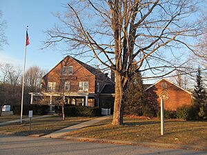
Pomfret Town Office
|
||
|
||
| Motto(s):
Picturesque Pomfret
|
||
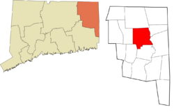
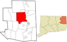 Windham County and Connecticut Windham County and Connecticut |
||
| Country | ||
| U.S. state | ||
| County | Windham | |
| Region | Northeastern CT | |
| Incorporated | 1713 | |
| Government | ||
| • Type | Selectman-Town Meeting | |
| Area | ||
| • Total | 40.6 sq mi (105.2 km2) | |
| • Land | 40.3 sq mi (104.4 km2) | |
| • Water | 0.3 sq mi (0.7 km2) | |
| Elevation | 430 ft (131 m) | |
| Population
(2020)
|
||
| • Total | 4,266 | |
| • Density | 106/sq mi (40.9/km2) | |
| Time zone | UTC−5 (Eastern) | |
| • Summer (DST) | UTC−4 (Eastern) | |
| ZIP code |
06259, 06258
|
|
| Area code(s) | 860/959 | |
| FIPS code | 09-61030 | |
| GNIS feature ID | 0213490 | |
| Major highways | ||
| Website | https://www.pomfretct.gov/ | |
Pomfret is a small town in Windham County, Connecticut, USA. In 2020, about 4,266 people lived there. It's part of the Northeastern Connecticut Planning Region. The town became official in 1713. It was named after a place called Pontefract in England. The land for Pomfret was bought from Native Americans in 1686. This deal was known as the "Mashamoquet Purchase."
Contents
Exploring Pomfret's Geography
Pomfret covers about 40.6 square miles (105.2 square kilometers). Most of this area is land. Only a small part, about 0.3 square miles (0.7 square kilometers), is water.
Pomfret shares its borders with several other towns. To the north is Woodstock. To the east are Putnam and Killingly. Eastford is to the west. Finally, Brooklyn and Hampton are to the south.
Villages and Neighborhoods
Pomfret includes several smaller areas. These are like different neighborhoods or sections of the town:
- Abington
- Elliotts
- Pomfret
- Pomfret Center
- Pomfret Landing
Key Roads and Natural Spots
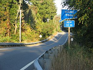
The main roads in Pomfret are U.S. Route 44, which runs east to west, and Route 169, which runs north to south. Route 101 also goes east to west.
Pomfret is home to two state parks. These are Mashamoquet State Park and Wolf Den State Park. They are located near where US 44 and CT 101 meet. Wolf Den State Park is famous for a story about General Israel Putnam. He supposedly killed the last wolf in Connecticut there. You can find a small cave, which is the wolf den, and a large rock called the Indian Chair.
The Air Line Trail is a path that used to be a railroad. It connects Pomfret with Putnam, a town to its east. This trail is about seven miles (11 km) long. A big part of it goes through the Bafflin Sanctuary. This is a nature preserve owned by the Audubon Society and covers about 700 acres (2.8 square kilometers).
Pomfret does not have one main town center. This is because the town grew a lot to the south after it was first created. The town office is on US Route 44. The Pomfret School, a school that prepares students for college, was founded in 1894. It is located across from where the Congregational Church used to be. About a mile north is Christ Episcopal Church. This church has beautiful windows designed by Louis Comfort Tiffany. The Rectory School, started in 1920, is also nearby.
The historic Pomfret Town House is on Town House Road. It was built in 1841. Its location was chosen by a committee because citizens couldn't agree.
Pomfret's Population and People
| Historical population | |||
|---|---|---|---|
| Census | Pop. | %± | |
| 1820 | 2,042 | — | |
| 1850 | 1,805 | — | |
| 1860 | 1,673 | −7.3% | |
| 1870 | 1,488 | −11.1% | |
| 1880 | 1,470 | −1.2% | |
| 1890 | 1,471 | 0.1% | |
| 1900 | 1,831 | 24.5% | |
| 1910 | 1,857 | 1.4% | |
| 1920 | 1,454 | −21.7% | |
| 1930 | 1,617 | 11.2% | |
| 1940 | 1,710 | 5.8% | |
| 1950 | 2,018 | 18.0% | |
| 1960 | 2,136 | 5.8% | |
| 1970 | 2,529 | 18.4% | |
| 1980 | 2,775 | 9.7% | |
| 1990 | 3,102 | 11.8% | |
| 2000 | 3,798 | 22.4% | |
| 2010 | 4,247 | 11.8% | |
| 2020 | 4,266 | 0.4% | |
| U.S. Decennial Census | |||
In 2010, Pomfret had 4,247 people living in 1,582 households. About 31.5% of households had children under 18. Most people in Pomfret were White (95.7%). Other groups included Asian (1.6%) and African American (0.6%). About 1.9% of the population was Hispanic or Latino.
The average age in Pomfret was 42 years old. About 24.8% of the population was under 18.
Economy and Businesses in Pomfret
One of the major companies in Pomfret is Loos & Co..
Education in Pomfret
Students in Pomfret attend the Pomfret Community School for Kindergarten through 8th grade. After that, students go to Woodstock Academy for high school. Woodstock Academy became Pomfret's official high school in 1987.
Pomfret also has two private schools: the Pomfret School and the Rectory School.
Historic Places to Visit
A large part of Pomfret, about 380 acres (1.5 square kilometers), is listed as a historic district on the U.S. National Register of Historic Places. This area is called the Pomfret Street Historic District. It includes properties along Route 169. It was added to the National Register in 1998.
Other important historic places in Pomfret include:
- Brayton Grist Mill – This mill is on US 44.
- Gwyn Careg – Also on US 44.
- Israel Putnam Wolf Den – Located off Wolf Den Road.
- Pomfret Town House – Found on Town House Road.
Famous People from Pomfret
Many interesting people have lived in or are connected to Pomfret:
- Jim Calhoun (born 1942), a famous former basketball coach for the University of Connecticut.
- Effingham Capron (1791–1859), an important leader against slavery.
- Rivers Cuomo (born 1970), a member of the rock band Weezer.
- Ernest Flagg (1857–1947), an architect who designed buildings for the Pomfret School.
- Bertram Goodhue (1869–1924), another architect known for his Gothic-style buildings.
- Israel Putnam (1718–1790), a major general who served with George Washington.
- Renée Zellweger (born 1969), an Academy Award-winning actress.
See also
In Spanish: Pomfret (Connecticut) para niños
 | Ernest Everett Just |
 | Mary Jackson |
 | Emmett Chappelle |
 | Marie Maynard Daly |


