Prato (Leventina) facts for kids
Quick facts for kids
Prato (Leventina)
|
||
|---|---|---|
|
||
| Country | Switzerland | |
| Canton | Ticino | |
| District | Leventina | |
| Area | ||
| • Total | 16.82 km2 (6.49 sq mi) | |
| Elevation | 1,043 m (3,422 ft) | |
| Population
(Dec 2020 )
|
||
| • Total | 388 | |
| • Density | 23.07/km2 (59.75/sq mi) | |
| Postal code |
6773
|
|
| Localities | Fiesso, Mascengo, Morasco, Rodi | |
| Surrounded by | Dalpe, Lavizzara, Osco, Quinto | |
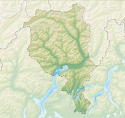
Prato (Leventina) is a small town, also called a municipality, in the Leventina district of Switzerland. It is located in the canton of Ticino.
Contents
History of Prato (Leventina)
Prato (Leventina) was first written about in 1211. Back then, it was called de Prato. For a while, people in German-speaking areas knew it as Pratt, but that name isn't used anymore. Between 1902 and 1939, it was known as Prato-Fiesso.
This village might have grown up around a Sust. A Sust was like a special warehouse and office building found in the Alps. It was important for people traveling along the Gotthard road. Prato (Leventina) was the center of a Vicinanza, which was a local community. This community included the areas of Prato, Fiesso, and until 1866, Dalpe.
The people of Prato (Leventina) played a big role in organizing the mule traders. These traders used mules to carry goods over the mountain passes. The village stayed important until 1820, when the first main road was built over the pass.
In 1561, a building called the Dazio Grande was built in Rodi. This building was used as a customs house and a Sust until 1834. Today, the same building is a cultural center, rebuilt in 1999.
The local church, called the parish church of San Giorgio, was first mentioned in 1210. It has a Romanesque tower and beautiful decorations from the 1600s. The church was updated in the 1950s.
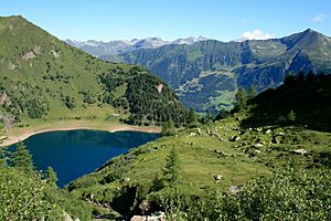
For a long time, the main way people made a living here was by raising animals. But in the last 100 years, Prato (Leventina) has become a popular place for tourists. People visit in both summer and winter. In the small village of Rodi, there's the Tremorgio power plant, built between 1918 and 1926. There's also a cable car, built in 1928, that takes people from the valley up to Lago Tremorgio.
In 2005, most jobs in the town were in industry, like manufacturing. About a quarter of the jobs were in service industries, like tourism. In 2000, more than half of the people working in Prato (Leventina) traveled to other towns for their jobs.
Geography of Prato (Leventina)
Prato (Leventina) covers an area of about 16.85 square kilometers (about 6.5 square miles).
Here's how the land is used:
- About 6.3% of the land is used for farming.
- Nearly half (46.9%) is covered by forests.
- About 2.9% has buildings or roads.
- A small part (3.1%) is rivers or lakes.
- About 29.1% is unproductive land, meaning it's not used for farming or building.
Looking closer at the land:
- In the built-up areas, 0.9% is for homes and buildings, and 1.1% is for roads.
- In the forested areas, 34.2% is dense forest. Another 10.4% has small trees and bushes, and 2.3% has orchards or small groups of trees.
- Of the farming land, 5.3% is used for growing crops.
- Of the water, 2.4% is in lakes and 0.8% is in rivers.
- In the unproductive areas, 15.0% has plants that aren't useful for farming, and 14.2% is too rocky for plants to grow.
The town is in the Leventina district. It sits in a valley at an elevation of about 1046 meters (3,432 feet), near the Monte Piottino gorge. Prato (Leventina) includes the main village of Prato and smaller villages called hamlets: Fiesso, Mascengo, Rodi, and Morasco.
Coat of Arms
The blazon (description) of Prato (Leventina)'s municipal coat of arms is: Azure two dogs Argent rampant reguardant gorged Or holding together a fleur de lis of the last and a chief Argent, overall a chief Gules a cross Argent. This means it shows two silver dogs on a blue background, holding a golden lily, with a red top section that has a white cross.
Population and Demographics
Prato (Leventina) has a population of 428 people (as of December 2004). In 2008, about 26.2% of the people living here were foreign nationals. Over ten years (1997–2007), the population grew by 6.8%.
Most people in Prato (Leventina) speak Italian (85.1%). The second most common language is Serbo-Croatian (6.8%), and the third is Macedonian (3.0%). In 2000, eight people spoke German, one person spoke French, and 338 people spoke Italian. The remaining 50 people spoke other languages.
In 2008, about 51.4% of the population was male and 48.6% was female. There were 163 Swiss men and 69 non-Swiss men. There were 175 Swiss women and 44 non-Swiss women.
The age groups in Prato (Leventina) in 2009 were:
- Children (0-9 years old): 46 people (10.2%)
- Teenagers (10-19 years old): 38 people (8.4%)
- Young adults (20-29 years old): 71 people (15.7%)
- Adults (30-39 years old): 49 people (10.9%)
- Adults (40-49 years old): 61 people (13.5%)
- Adults (50-59 years old): 65 people (14.4%)
- Seniors (60-69 years old): 55 people (12.2%)
- Seniors (70-79 years old): 38 people (8.4%)
- Seniors (over 80 years old): 28 people (6.2%)
In 2000, there were 166 households in the town, with about 2.4 people living in each home. Most buildings (77.6%) were single-family homes.
The historical population of Prato (Leventina) is shown below:
| year | population |
|---|---|
| 1602 | 224 |
| 1639 | 191 |
| 1745 | 308 |
| 1850 | 424 |
| 1900 | 327 |
| 1950 | 306 |
| 2000 | 397 |
Important Heritage Sites
The Dazio Vecchio building in Prato (Leventina) is listed as an important heritage site of national significance in Switzerland. This means it's a very important historical place.
Economy and Jobs
In 2007, Prato (Leventina) had a low unemployment rate of 2.42%.
Here's how people were employed in 2005:
- 10 people worked in the primary economic sector, which includes farming and forestry.
- 100 people worked in the secondary sector, which includes manufacturing and construction.
- 41 people worked in the tertiary sector, which includes services like tourism and shops.
In 2000, 16 workers came into Prato (Leventina) for their jobs, while 114 workers left the town to work elsewhere. This means more people leave the town for work than come in. About 6.4% of working people used public transportation to get to work, and 58.9% used a private car. In 2009, Prato (Leventina) had 3 hotels with a total of 23 rooms and 54 beds, showing its role in tourism.
Religion
Based on the 2000 census:
- 308 people (77.6%) were Roman Catholic.
- 11 people (2.8%) belonged to the Swiss Reformed Church.
- 62 people (15.62%) belonged to other churches.
- 16 people (4.03%) did not answer the question about their religion.
Education
In Prato (Leventina), about 59.6% of adults aged 25-64 have finished either non-mandatory high school or gone on to higher education, like university.
In 2009, there were 68 students in Prato (Leventina).
- The Ticino education system offers up to three years of optional kindergarten. In Prato (Leventina), 12 children were in kindergarten.
- Primary school lasts for five years. 20 students attended regular primary schools, and two students attended a special primary school.
- In middle school, students either go to a two-year program or a four-year program to prepare for higher education. There were 18 students in the two-year middle school program.
- For high school, students can prepare for a trade or for university. Five students were full-time vocational students, and 8 were part-time.
In 2000, 13 students from Prato (Leventina) went to schools outside the town.
Notable People
- Michela Figini: She won an Olympic gold medal in 1984 and was a world champion in 1985 for downhill skiing. She was born in 1966.
See also
 In Spanish: Prato (Tesino) para niños
 | Victor J. Glover |
 | Yvonne Cagle |
 | Jeanette Epps |
 | Bernard A. Harris Jr. |


