Pryor Creek, Oklahoma facts for kids
Quick facts for kids
Pryor Creek, Oklahoma
|
|
|---|---|
| Nickname(s):
A Town For All Seasons
|
|

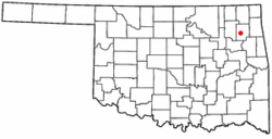
Location of Pryor Creek and Mayes County
|
|
| Country | United States |
| State | Oklahoma |
| County | Mayes |
| Area | |
| • Total | 10.03 sq mi (25.98 km2) |
| • Land | 9.99 sq mi (25.88 km2) |
| • Water | 0.04 sq mi (0.10 km2) 0.31% |
| Elevation | 627 ft (191 m) |
| Population
(2020)
|
|
| • Total | 9,444 |
| • Density | 944.97/sq mi (364.87/km2) |
| Time zone | UTC-6 (CST) |
| • Summer (DST) | UTC-5 (CDT) |
| ZIP code |
74361, 74362
|
| Area code | 918/539 |
| FIPS code | 40-60950 |
| GNIS feature ID | 2411500 |
Pryor Creek (often called Pryor) is a city in Mayes County, Oklahoma, in the United States. It is the main city of Mayes County. In 2020, about 9,444 people lived there.
The city was first called Coo-Y-Yah. This is a Cherokee word meaning "place of the huckleberries". In 1887, it was renamed Pryor Creek after a nearby stream and railroad station. The name was shortened to Pryor by the U.S. Postal Service to avoid confusion with another town, Pond Creek. Today, both names are commonly used.
Contents
History of Pryor Creek
In the early 1800s, different Native American tribes, like the Cherokee and Osage, were given land in what was called Indian Territory. This area later became Oklahoma.
Captain Nathaniel Hale Pryor was an important person who settled in this region. He was married to an Osage woman and worked with the Osage people. He set up a trading post on the Grand River. This was around the same time the Union Mission was started nearby in 1820.
Pryor Creek was located along important travel routes. The Texas Road was a path used for moving cattle. Later, the Jefferson Highway followed a similar route. Today, U.S. Route 69 runs roughly along these old trails.
In 1870, the Missouri-Kansas-Texas Railroad began building tracks through the Cherokee Nation. By June 1871, the railroad reached the area where Pryor Creek is now.
A post office was opened, and the town was named Coo-y-yah. On April 23, 1887, the name changed to Pryor Creek. However, the "Creek" part was dropped by the post office in 1909. Even so, the city government's official name is still Pryor Creek.
The 1942 Tornado
On April 27, 1942, a very strong tornado hit Pryor. It moved through the main street and caused a lot of damage to buildings and homes. This storm was a major event for the town. Many people were injured, and the city had to rebuild. The tornado caused about $3 million in damage.
After the storm, the governor sent state troopers to help people and keep order. This tornado was one of the strongest in Oklahoma's history. It showed how important it was for the community to work together to recover.
In 1951, the city decided on a new way to govern itself. They chose a mayor-council government system. This system allows citizens to elect a mayor and council members. It also created boards to manage city services like parks, libraries, and utilities such as gas, water, and electricity.
Geography and Location
Pryor is in northeast Oklahoma. It is located where U.S. Route 69 and Oklahoma State Highway 20 meet. A stream called Pryor Creek flows near the west and south sides of the city.
The city covers about 6.5 square miles (16.9 square kilometers). Most of this area is land, with a small part being water.
Population and People
| Historical population | |||
|---|---|---|---|
| Census | Pop. | %± | |
| 1900 | 495 | — | |
| 1910 | 1,798 | 263.2% | |
| 1920 | 1,767 | −1.7% | |
| 1930 | 1,828 | 3.5% | |
| 1940 | 2,501 | 36.8% | |
| 1950 | 4,486 | 79.4% | |
| 1960 | 6,476 | 44.4% | |
| 1970 | 7,057 | 9.0% | |
| 1980 | 8,483 | 20.2% | |
| 1990 | 8,327 | −1.8% | |
| 2000 | 8,659 | 4.0% | |
| 2010 | 9,539 | 10.2% | |
| 2020 | 9,444 | −1.0% | |
| U.S. Decennial Census | |||
In 2010, Pryor Creek had 9,539 people. Most residents were white, but a significant number were Native American. There were also smaller groups of African American, Asian, and other races. About 4.9% of the population identified as Hispanic or Latino.
In 2000, there were 8,659 people living in the city. About 30% of households had children under 18. The average age of people in Pryor was 36 years old.
Education in Pryor Creek
Pryor Creek has a good school system. It includes an early childhood center, three primary schools, a junior high school, and a senior high school. There is also a performing arts auditorium and a basketball arena.
Higher Education and Training
Northeast Tech has one of its campuses in Pryor. This school offers vocational and technical training. About 400 students attend the Pryor campus.
Rogers State University also has a branch campus in Pryor. This is the only university serving the Pryor and Mayes County area. Over 350 students attend classes here each semester.
Pryor Creek is also home to Pryor Beauty College.
The Thunderbird Youth Academy is located in Pryor. This program helps high school dropouts get their lives back on track. It is funded by the government and run by the Oklahoma National Guard. The program is free for Oklahoma residents aged 16 to 18.
Economy and Industry
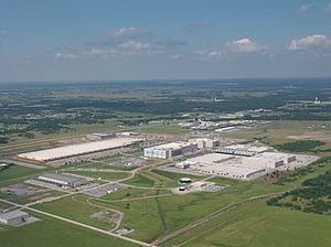
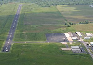
The MidAmerica Industrial Park is a large business area located about 4 miles (6.4 km) south of Pryor. More than 80 companies operate here. These include big names like Google, DuPont, and Nordam. The park even has its own airport, the MidAmerica Industrial Park Airport, with a 5,000-foot runway.
Google's Presence
In 2007, Google announced plans to build a large Internet data center at the Mid-America Industrial Park. This facility cost $600 million and employs around 400 people. It is one of Google's largest data centers in the world.
In 2018, Google announced a $600 million expansion to their data center in Pryor. This new building made Pryor Google's second-largest data center. Their total investment in the Pryor community has reached $2.5 billion.
New Industries
On June 17, 2021, the electric vehicle company Canoo announced it would build its first factory in the MidAmerica Industrial Park. This factory will be on a 400-acre site.
Manufacturing is a very important part of Pryor's economy. It employs about 40% of the city's workers. Pryor is the seventh largest manufacturing center in Oklahoma. Key industries include machinery, metals, electronics, and transportation equipment.
Places to Visit and Events
Pryor is known for hosting Rocklahoma. This is an annual music festival held about 4 miles (6.4 km) north of town.
The Coo-Y-Yah Museum is located in the old Katy Railroad Depot. It is run by the Mayes County Historical Society. The museum has exhibits about Native American history and pioneer life.
Pryor was also a filming location for Season 3 of the FX comedy series Reservation Dogs. This show was created by filmmaker Sterlin Harjo.
Parks and Recreation
Pryor offers many places for fun and fitness. The Pryor Creek Recreation Center is a modern fitness facility. It has a 21,000-square-foot building with an indoor pool and a fully equipped gym.
The city has five parks. Whitaker Park is 24 acres and includes an outdoor pool, a fishing pond, and sports fields. Centennial Park has a walking trail and a fitness course. Earl Ward Park is home to the Pryor Creek Golf Club, an 18-hole golf course.
Pryor is also close to several lakes, making it a great spot for outdoor activities. These include Lake Hudson to the east, Lake Oologah to the northwest, and Fort Gibson Lake to the south.
Notable People from Pryor Creek
- Joseph J. Clark (1893-1971), an Admiral in the U.S. Navy during World War II, was born in Pryor.
- Preston Bynum (1939-2018), an Arkansas politician and businessman.
- "Indian" Bob Johnson, a professional baseball player.
- Roy Johnson, another professional baseball player.
- Chad Kimsey, a professional baseball player.
- J. H. Langley, an Associate Justice of the Oklahoma Supreme Court.
- Cliff Mapes, a professional baseball player.
- Mayes McLain, a professional football player and pro-wrestler.
- Christi Passmore, a racing driver.
- Clyde Van Sickle, a professional football player.
- Hank Wyse, a professional baseball player.
See also
 In Spanish: Pryor Creek (Oklahoma) para niños


