
Ramiriquí facts for kids
Quick facts for kids
Ramiriquí
|
||
|---|---|---|
|
Municipality and town
|
||

Church of Ramiriquí
|
||
|
||

Location of the municipality and town of Ramiriquí in the Boyacá department of Colombia
|
||
| Country | ||
| Department | Boyacá Department | |
| Province | Márquez Province | |
| Founded | 21 December 1541 | |
| Founded by | Pedro Durán | |
| Area | ||
| • Municipality and town | 146.5 km2 (56.6 sq mi) | |
| • Urban | 7.25 km2 (2.80 sq mi) | |
| Elevation | 2,325 m (7,628 ft) | |
| Population
(2015)
|
||
| • Municipality and town | 10,015 | |
| • Density | 68.362/km2 (177.06/sq mi) | |
| • Urban | 5,023 | |
| Time zone | UTC-5 (Colombia Standard Time) | |
| Website | Official website: http://www.ramiriqui-boyaca.gov.co/ | |
.svg)
Ramiriquí is a town and a municipality in Colombia. It is located in the Boyacá Department. This area is part of the Márquez Province.
Ramiriquí is surrounded by other towns. To the north, it borders Tunja, which is the capital of the department. To the south, you'll find Chinavita and Zetaquirá. To the east, it borders Rondón and Ciénaga. Finally, to the west, it borders Chivatá, Tibaná, and Jenesano.
Contents
What Does Ramiriquí Mean?
The name Ramiriquí comes from the last cacique (a local chief) of the area, named Ramirique.
In the Chibcha language of the Muisca people, Ramirraquí means "white earth." Another idea for the name's meaning is Ca-mi-quiquí. This means "our strength over the grasslands."
A Look Back in Time: Ramiriquí's History
Before the Spanish arrived, the area of Ramiriquí was home to the Muisca. This was before the Spanish conquistadors came to the Altiplano Cundiboyacense in the 1530s.
The northern part of the Muisca Confederation was once ruled from Ramiriquí. Later, a legendary and powerful cacique named Goranchacha moved the capital. He moved it to nearby Hunza, which is known today as Tunja. The first ruler of Hunza was Hunzahúa, and the city was named after him.
The second-to-last Muisca ruler, Quemuenchatocha, passed away in Ramiriquí. This happened after he was defeated by the Spanish conquistador Gonzalo Jiménez de Quesada.
The modern town of Ramiriquí was officially started on December 21, 1541. It was founded by a Spanish friar named Pedro Durán.
Ancient rock carvings, called petroglyphs, have been found within the borders of Ramiriquí. These carvings tell us about the people who lived there long ago.
What Ramiriquí Produces
The main ways people make a living in Ramiriquí are through agriculture, fishing, and making crafts.
Farmers in Ramiriquí grow many different crops. These include uchuva (also known as goldenberries), tree tomatoes, cucumbers, beans, blackberries, and maize (corn). Fishing is also an important activity for some people. Others create beautiful handmade crafts to sell.
Famous People from Ramiriquí
Ramiriquí is the birthplace of several notable people:
- Jose Ignacio de Marquez: He was the first civilian (non-military) president of Colombia.
- José Patrocinio Jiménez: A well-known former professional cyclist.
- Mauricio Soler: Another former international cyclist who achieved fame in the sport.
Climate in Ramiriquí
Ramiriquí has a mild and pleasant climate. It is located in the mountains, which helps keep temperatures from getting too hot. The weather is generally cool and comfortable throughout the year. There are periods of rain, especially in certain months, which helps the plants and crops grow.
| Climate data for Ramiriquí (Villa Luisa), elevation 2,200 m (7,200 ft), (1981–2010) | |||||||||||||
|---|---|---|---|---|---|---|---|---|---|---|---|---|---|
| Month | Jan | Feb | Mar | Apr | May | Jun | Jul | Aug | Sep | Oct | Nov | Dec | Year |
| Mean daily maximum °C (°F) | 23.2 (73.8) |
23.6 (74.5) |
23.3 (73.9) |
22.5 (72.5) |
21.7 (71.1) |
20.8 (69.4) |
20.3 (68.5) |
19.8 (67.6) |
21.2 (70.2) |
21.9 (71.4) |
22.3 (72.1) |
22.7 (72.9) |
21.9 (71.4) |
| Daily mean °C (°F) | 16.7 (62.1) |
17.0 (62.6) |
17.3 (63.1) |
17.1 (62.8) |
16.8 (62.2) |
16.1 (61.0) |
15.6 (60.1) |
15.6 (60.1) |
16.0 (60.8) |
16.5 (61.7) |
16.7 (62.1) |
16.7 (62.1) |
16.5 (61.7) |
| Mean daily minimum °C (°F) | 10.6 (51.1) |
11.1 (52.0) |
12.0 (53.6) |
12.6 (54.7) |
12.7 (54.9) |
12.2 (54.0) |
11.9 (53.4) |
11.7 (53.1) |
11.3 (52.3) |
11.7 (53.1) |
12.1 (53.8) |
11.5 (52.7) |
11.8 (53.2) |
| Average precipitation mm (inches) | 19.5 (0.77) |
33.6 (1.32) |
55.9 (2.20) |
95.1 (3.74) |
129.0 (5.08) |
110.0 (4.33) |
115.4 (4.54) |
95.8 (3.77) |
77.5 (3.05) |
112.0 (4.41) |
92.7 (3.65) |
40.1 (1.58) |
976.4 (38.44) |
| Average precipitation days (≥ 1.0 mm) | 6 | 9 | 13 | 19 | 23 | 24 | 26 | 24 | 19 | 20 | 17 | 10 | 204 |
| Average relative humidity (%) | 78 | 76 | 77 | 80 | 82 | 84 | 85 | 85 | 82 | 81 | 82 | 80 | 81 |
| Source: Instituto de Hidrologia Meteorologia y Estudios Ambientales | |||||||||||||
Images for kids
-
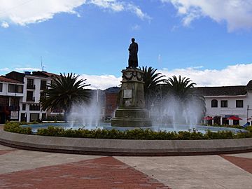
Central square
-
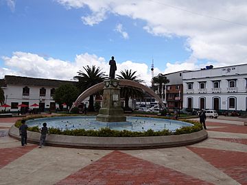
Central square
-
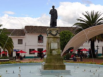
Central square
-
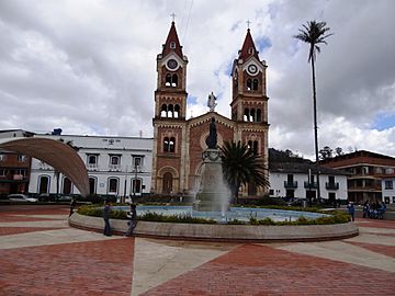
Central square and church
-
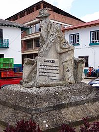
Farmer monument


See also
 In Spanish: Ramiriquí para niños
