Rangitoto Range facts for kids
Quick facts for kids Rangitoto Range |
|
|---|---|

Ranginui repeater station and access track
|
|
| Highest point | |
| Elevation | 978 m (3,209 ft) |
| Geography | |
| Location | Waikato, New Zealand |
| Parent range | Rangitoto |
| Topo map | Bennydale BF34 [1] |
The Rangitoto Range is a mountain range found in the Pureora Forest Park. This park is located on the North Island of New Zealand.
The highest points in the range are Ranginui, which is 978 meters (3,209 feet) tall. Other important peaks include Mt Baldy (855 meters) and Rangitoto (873 meters). Several important rivers, like the Waipa, Puniu, and Mokau River, start their journey in this range. The Rangitoto Range also marks the eastern edge of a region known as the King Country. Water from the eastern side of the range flows into the Waikato River.
Protecting the Environment
The forests in the Rangitoto Range were some of the last native forests in New Zealand that were planned to be cut down for wood. However, many people protested and worked to protect these special areas.
Because of these efforts, some parts of the native forests, including totara and rewarewa trees, were saved. Areas that had been cut down are now being replanted and cared for to help them grow back.
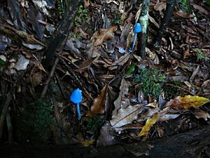
This range is home to many rare and endangered animals. These include the North Island kōkako, a special native bird, and the kaka, a type of parrot. You might also find the falcon, North Island brown kiwi, and the blue duck here. Other unique creatures living in the range are bats and the rare Hochstetter's frog.
How the Range Was Formed
The Rangitoto Range is mostly made of a type of rock called greywacke. This rock formed a very long time ago, between the Late Jurassic and Early Cretaceous periods. Greywacke is a kind of sandstone that often has small pieces of siltstone and conglomerate mixed in. It also has many white lines of quartz running through it.
Over time, much of this greywacke was covered by layers of volcanic rock called ignimbrite. The main ignimbrite layer, known as the Ongatiti Formation, can be up to 150 meters (492 feet) thick. This ignimbrite is a type of rock that forms from hot ash and rock fragments that explode from a volcano.
The ignimbrite often creates rounded, flat-topped hills. The edges of these hills can look like eroding banks, with large blocks of ignimbrite scattered around. This happens when the softer greywacke underneath wears away, leaving the harder ignimbrite behind.
 | Victor J. Glover |
 | Yvonne Cagle |
 | Jeanette Epps |
 | Bernard A. Harris Jr. |


