
Readfield, Maine facts for kids
Quick facts for kids
Readfield, Maine
|
|
|---|---|

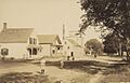
Readfield Depot c. 1909
|
|

Location in Kennebec County and the state of Maine.
|
|
| Country | United States |
| State | Maine |
| County | Kennebec |
| Incorporated | 1791 |
| Villages | Readfield Kents Hill Readfield Depot |
| Area | |
| • Total | 30.95 sq mi (80.16 km2) |
| • Land | 29.16 sq mi (75.52 km2) |
| • Water | 1.79 sq mi (4.64 km2) |
| Elevation | 226 ft (69 m) |
| Population
(2020)
|
|
| • Total | 2,597 |
| • Density | 89/sq mi (34.4/km2) |
| Time zone | UTC-5 (Eastern (EST)) |
| • Summer (DST) | UTC-4 (EDT) |
| ZIP code |
04355
|
| Area code(s) | 207 |
| FIPS code | 23-62190 |
| GNIS feature ID | 0582693 |
| Website | Town website |
Readfield is a town located in Kennebec County, Maine, in the United States. In 2020, about 2,597 people lived there.
Readfield is known for a few things. It is home to the Kents Hill School, which is a special school that helps students get ready for college. It also has Maranacook Community Schools, which are public schools for the area.
The town is a popular spot for outdoor fun. It has nine different lakes and ponds, including the large Maranacook Lake. Readfield is part of the beautiful Winthrop Lakes Region. Long ago, Readfield was called Pond Town because of all its water bodies.
Contents
Exploring Readfield's Geography
Readfield covers an area of about 30.95 square miles (80.16 square kilometers). Most of this area is land, about 29.16 square miles (75.52 square kilometers). The rest is water, which is about 1.79 square miles (4.64 square kilometers).
The town has several important water features. It includes the northern part of Maranacook Lake. It also has the southern part of Torsey Pond, a corner of Echo Lake, and the northeast shore of Lovejoy Pond. Small streams like Beaver Brook and Tingley Brook also flow through Readfield.
Main roads that go through Readfield include State Routes 17, 41, and 135. Readfield shares its borders with several other towns. These include Manchester to the east and Winthrop to the south. To the southwest is Wayne, and to the west is Fayette. Finally, Mount Vernon and Belgrade are to the north.
Readfield's Population Over Time
The number of people living in Readfield has changed a lot over the years. Here is a look at the population counts from different years:
| Historical population | |||
|---|---|---|---|
| Census | Pop. | %± | |
| 1800 | 938 | — | |
| 1810 | 1,396 | 48.8% | |
| 1820 | 1,511 | 8.2% | |
| 1830 | 1,884 | 24.7% | |
| 1840 | 2,037 | 8.1% | |
| 1850 | 1,985 | −2.6% | |
| 1860 | 1,510 | −23.9% | |
| 1870 | 1,456 | −3.6% | |
| 1880 | 1,243 | −14.6% | |
| 1890 | 1,176 | −5.4% | |
| 1900 | 994 | −15.5% | |
| 1910 | 996 | 0.2% | |
| 1920 | 911 | −8.5% | |
| 1930 | 881 | −3.3% | |
| 1940 | 986 | 11.9% | |
| 1950 | 1,022 | 3.7% | |
| 1960 | 1,029 | 0.7% | |
| 1970 | 1,258 | 22.3% | |
| 1980 | 1,943 | 54.5% | |
| 1990 | 2,033 | 4.6% | |
| 2000 | 2,360 | 16.1% | |
| 2010 | 2,598 | 10.1% | |
| 2020 | 2,597 | 0.0% | |
| U.S. Decennial Census | |||
In 1960, there were 1,029 people in Readfield. By 1980, the population had grown to 1,943. This was a big increase! By 2000, the number of residents reached 2,360. The population in 2020 was 2,597 people.
Many people in Readfield work in professional jobs or in management. Others work in sales, administration, or service jobs. Some people also work in skilled trades.
Schools in Readfield
Readfield has both public and private schools for students.
Public Schools
- Maranacook Area Schools
- Maranacook Community Middle School
- Maranacook Community High School
- Readfield Elementary
Private School
- Kents Hill School
Places to Visit
- Readfield Historical Society & Museum: This museum has old items, papers, and photos that tell the story of Readfield. It is a great place to learn about the town's past.
Famous People from Readfield
Some notable people have connections to Readfield:
- Christian Duguay: A funny actor who has appeared in comedies.
- Doug Friedman: A professional ice hockey player.
- John Hubbard: A doctor who became the 22nd governor of Maine.
- Jonathan G. Hunton: The 9th governor of Maine.
- Anson P. Morrill: A US congressman and the 24th governor of Maine.
- Mildred Brown Schrumpf: A food expert and writer from Maine.
- Timothy Simons: A comic actor.
- Naythen Wilson: A unique musician and composer.
Images for kids
-
Readfield Depot around 1909
-

Location of Readfield in Kennebec County, Maine
See also
 In Spanish: Readfield (Maine) para niños
