Red Pike (Wasdale) facts for kids
Quick facts for kids Red Pike |
|
|---|---|
 |
|
| Highest point | |
| Elevation | 826 m (2,710 ft) |
| Prominence | c. 62 m |
| Listing | Wainwright, Nuttall, Hewitt |
| Geography | |
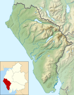
| Location | Cumbria, England |
| Parent range | Lake District, Western Fells |
| OS grid | NY165105 |
| Topo map | OS Landranger 89, Explorer OL4, OL6 |
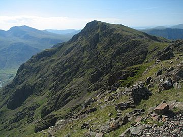
Red Pike is a mountain, also called a fell, located in the beautiful Lake District in England. It stands tall at 826 meters (about 2,709 feet) high. This impressive fell is found just north of Wast Water, a famous lake.
Many hikers enjoy climbing Red Pike as part of a longer adventure called the Mosedale Horseshoe. This popular walk also includes another big mountain, Pillar.
It's easy to get Red Pike mixed up with another mountain nearby, Red Pike (Buttermere). That's because the other Red Pike is only about three miles away! To avoid confusion, people often call this one Wasdale Red Pike. This name comes from the nearby valley, Wasdale.
Contents
Exploring the Western Fells
The Western Fells are a group of mountains shaped like a triangle in the Lake District. They are bordered by the River Cocker to the northeast and the Wasdale valley to the southeast. As you go west, the hills get smaller and lead towards the coast.
At the very center of these high mountains are Great Gable and its smaller peaks. Two main ridges spread out from here, like arms around the long, wild Ennerdale valley. Red Pike is part of the southern arm of these Western Fells.
The Red Pike Ridge
The main line of mountains, called the watershed, goes west from Great Gable. This line separates the streams that flow into Ennerdale from those that flow into Wasdale. Along this path, you'll find big mountains like Kirk Fell, Pillar, Scoat Fell, Haycock, and Caw Fell.
Scoat Fell has a long ridge that stretches south, ending at Yewbarrow. Red Pike sits along this ridge. The Red Pike ridge is a wide area of high land between Nether Beck (a stream) to the west and Mosedale (a valley) to the east.
The side of Red Pike facing Mosedale is very steep and has many rocky cliffs. The western slopes, however, go down slowly over a couple of miles. The ridge starts at a low point, or col, southeast of Scoat Fell. From this low point, it's a short climb to the top of Red Pike. Most of the ridge then slopes down southeast towards a place called Dore Head.
Lakes and Streams
Red Pike has a nearly continuous wall of cliffs above Mosedale, especially above an area called Black Comb. Bull Crags and Black Crags protect the southern part of the mountain. To the west, a long shoulder of land gently slopes down between Nether Beck and Over Beck. These two streams get closer as they flow towards Wastwater.
In the middle of this high area is Low Tarn. This is a large, shallow lake in a flat basin. Water from Low Tarn flows into Over Beck. This whole area is quiet and doesn't have many paths among its grassy hills and small cliffs.
Scoat Tarn, at the top of Nether Beck, is different. It's a corrie tarn, which means it formed in a bowl-shaped hollow carved by a glacier. It's held in place by grassy mounds of rock and dirt called moraines. Scoat Tarn is quite deep, about 65 feet (20 meters).
Red Pike also has a smaller southern peak. This peak is about 2,627 feet (801 meters) high.
Mountain Makeup: Geology
Red Pike is mostly made of a type of rock called andesite lava. This rock is part of something called the Birker Fell Formation. You can also find layers of lapilli-tuff (rock made from small volcanic fragments) and intrusions of rhyolite (another type of volcanic rock) within the mountain.
Reaching the Summit
The main top of Red Pike has a cairn, which is a pile of stones. This cairn sits right on the edge of the Mosedale Crags. To the west, the slope is gentle and covered with short grass.
The southern peak also has a large cairn. About a hundred yards further, you'll find "The Chair." This is a special armchair-shaped wind shelter built into a rock. It's just off the path and offers amazing views to the south. The Chair is so easy to spot when climbing from Dore Head that it once gave its name to the whole mountain!
Mountains like Scoat Fell and Pillar block the view to the north. However, you can get great views of the Scafells (England's highest mountains) and the Wasdale Screes (steep slopes of loose rock).
Climbing Red Pike
There are several ways to climb Red Pike. One way starts from Overbeck Bridge on the Wastwater road. From there, you can find a path up to Low Tarn and then reach the summit by following the long western slopes.
Another option is to follow Over Beck stream all the way to its source at Dore Head. From Dore Head, you can then climb up the south ridge to the top. Dore Head can also be reached from Mosedale if you start from Wasdale Head, but this involves a long climb up loose rock (scree). Instead, you could climb Black Comb on easier slopes and then go back to the summit.
Red Pike is often the starting point for the Mosedale Horseshoe walk. This ridge walk also includes Scoat Fell and Pillar. If you're feeling strong, you might even add Yewbarrow and Kirk Fell to your adventure!
 | Frances Mary Albrier |
 | Whitney Young |
 | Muhammad Ali |


