Yewbarrow facts for kids
Quick facts for kids Yewbarrow |
|
|---|---|

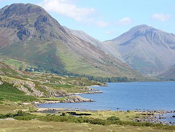
Yewbarrow (left) from Wast Water
|
|
| Highest point | |
| Elevation | 628 m (2,060 ft) |
| Prominence | c.142 m (466 ft) |
| Listing | Hewitt, Wainwright, Nuttall |
| Geography | |
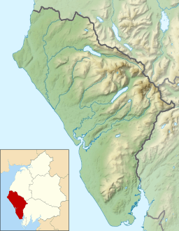
| Location | Cumbria, England |
| Parent range | Lake District, Western Fells |
| OS grid | NY173084 |
| Topo map | OS Landrangers 89, 90, Explorer OL6 |
Yewbarrow is a mountain, also called a fell, in the English Lake District. It stands just north of Wast Water, a beautiful lake. This mountain is 628 meters (2,060 feet) high. Its shape looks a bit like an upside-down boat or an ancient burial mound, which is called a "barrow." Yewbarrow is often seen on the left side in classic pictures of Great Gable and Wast Water.
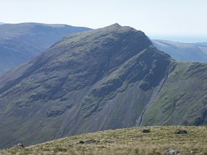
There's a second, slightly lower top called Stirrup Crag. It's 616 meters (2,021 feet) high and about half a mile north of the main summit. Some lists of mountains, like the Hewitt and Nuttall lists, count this "Yewbarrow North Top" as its own separate peak.
The name "Yewbarrow" comes from two things. "Yew" is a type of tree that used to grow a lot on the mountain. "Barrow" refers to its mound-like shape.
Contents
Exploring Yewbarrow's Location
The Western Fells are a group of mountains in the Lake District. They form a triangle, with the River Cocker to the northeast and Wasdale to the southeast. To the west, these hills get smaller as they reach the coast. At the center of these tall mountains are Great Gable and its nearby peaks. Two main ridges spread out from Great Gable, like arms around the long, wild valley of Ennerdale. Yewbarrow is part of the southern arm of these mountains.
The main line of peaks goes west from Great Gable. This line separates the streams that flow into Ennerdale from those that flow into Wasdale. Along this path, you'll find mountains like Kirk Fell, Pillar, Scoat Fell, Haycock, and Caw Fell. Scoat Fell has a long ridge that stretches south and ends at Yewbarrow. Another mountain, Red Pike, is also found along this ridge.
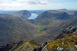
The southern end of Yewbarrow rises steeply from the shore of Wast Water. The top of the mountain runs north for about two miles. Just past the second peak, the ridge turns sharply west at a dip called Dore Head (475 meters / 1,560 feet). From there, it continues towards Red Pike. The valley of Wasdale Head is to the east of Yewbarrow, and the quiet valley of Over Beck is to the west. The top of the ridge has steep cliffs, especially above Over Beck and at both ends. Stirrup Crag is below the north summit, and sometimes the top is even called by that name. Dropping Crag and Bell Rib protect the southern end of the ridge.
What Yewbarrow is Made Of
The very top of Yewbarrow is made of rock types like tuff, lapilli-tuff, and breccia. These are all types of rock formed from volcanic ash and fragments. The eastern slopes show rhyolitic rocks. The steep cliffs on the western side are made of plagioclase-phyric andesite lava. These are all igneous rocks, meaning they formed from cooled magma or lava.
Climbing Yewbarrow: Your Adventure Awaits

Even though Yewbarrow is smaller than other famous mountains around Wasdale Head—like Scafell Pike, Scafell, Great Gable, Kirk Fell, and Pillar—climbing it can be a bit of an adventure! The two main paths involve some "scrambling," which means using your hands to climb over rocks.
There are two main ways to climb Yewbarrow from Wasdale Head:
- One way is through Overbeck Bridge and a rock opening called the Great Door. This spot offers amazing views of Wast Water. You can actually avoid most of the scrambling here by taking a path to the left of the main rocky gully.
- The other way is via Dore Head and Stirrup Crag. There's a marked path here that avoids scrambling, leading up the west side from below Stirrup Crag to the small dip between Yewbarrow's two tops.
You can also climb Yewbarrow as part of a longer hike called the Mosedale Horseshoe. This challenging route can start or end at Yewbarrow and also includes other peaks like Red Pike, Scoat Fell, Steeple, and Pillar.
Reaching the Top of Yewbarrow
When you reach the summit, you'll find a cairn (a pile of stones) on a grassy patch. This might be a nice surprise after the rocky climb! Yewbarrow is a fantastic place to see the other tall mountains in this part of the Lake District. Because of its special location, it's one of the best spots to get clear, unbroken views of the Scafells, Great Gable, Kirk Fell, and Pillar.
 | Charles R. Drew |
 | Benjamin Banneker |
 | Jane C. Wright |
 | Roger Arliner Young |


