Reverie, Tennessee facts for kids
Quick facts for kids
Reverie, Tennessee
|
|
|---|---|

|
|
| Country | United States |
| State | Tennessee |
| Counties | Tipton County |
| Elevation | 239.44 ft (73 m) |
| Population
(2000) of the Reverie voting precinct
|
|
| • Total | 11 |
| Time zone | UTC-6 (CST) |
| • Summer (DST) | UTC-5 (CDT) |
| ZIP codes |
Reverie TN, AR 72395
Wilson, AR 72395 |
Reverie is a very small community in Tipton County, Tennessee, United States. It is an unincorporated community, which means it's not an official town or city with its own local government. In 2001, only 11 people lived there.
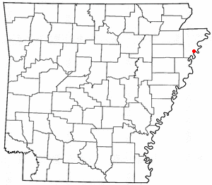
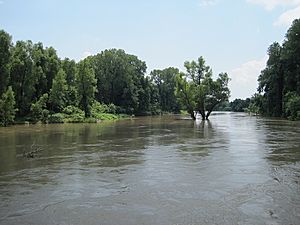
Something amazing happened in Reverie in 1876. The Mississippi River suddenly changed its path! It moved away from its old channel, which used to be the border between Tennessee and Arkansas. This big change meant that Reverie, which was once on the Tennessee side, ended up on the Arkansas side of the river.
This river change, called the Centennial Cut-off, caused a big legal question. The Supreme Court had to decide in 1918 if the state border should move with the river.
Reverie is also known for some cool discoveries. In 1900, a mastodon skeleton was found nearby. Later, ancient artifacts from an Native American village were discovered. These artifacts show that people lived there between 1400 and 1650 AD.
Contents
Who Lives in Reverie?
According to the United States Census, in 2000, the total population of the Reverie voting area was 11 people. All of these residents were non-Hispanic white individuals.
How Do Kids Go to School?
Even though Reverie is officially in Tennessee, the state of Tennessee pays for the children living there to attend schools in Arkansas. This is because of how the river changed the area.
What Is the Economy Like?
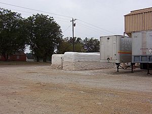
The main way people make money around Reverie is through farming, especially growing cotton.
After slavery ended, many families in the area worked as sharecroppers. This meant they farmed land owned by someone else. In return, they gave the landowner a part of their crop, usually cotton.
Over time, new machines like the cotton picker made it so fewer people were needed to work in the fields. This led to a big drop in the number of people living in the area. By 2007, there were no industries or big businesses in Reverie.
What Is Reverie's History?
Reverie was founded in the 1800s and was one of the first settlements in Tipton County. A U.S. Post office opened there in 1883, but it is no longer in operation today.
Prehistoric Mastodon Skeleton Discovery
Mastodons were huge, extinct animals that looked a lot like modern elephants. They lived in North America for millions of years, disappearing about 10,000 years ago.
In 1900, an archaeologist named James K. Hampson found the bones of a mastodon. The skeleton was discovered on what was called Island No. 35 of the Mississippi River, about 3 miles (4.8 km) east of Reverie. Sadly, the site where the bones were found was reported as destroyed in 1957.
Ancient Village from 1400-1650 AD
About 4 miles (6.4 km) northeast of Reverie is the Nodena site. In the early 1900s, artifacts were found here from an ancient Native American village. This village was about 15 acres (6.1 hectares) big and was active between 1400 and 1650 AD.
You can see some of these amazing artifacts on display at the Hampson Museum State Park in Wilson, Arkansas. The Nodena site is very important; it was named a National Historic Landmark in 1964 and added to the National Register of Historic Places in 1966.
Where Is Reverie Located?
Location and Landscape

Reverie is located at a specific point: 35.53806 degrees North and -89.99 degrees West. These coordinates mark where the old post office used to be. The land here is about 239.44 feet (73 meters) above sea level.
The area around Reverie is mostly flat Mississippi River flood plains. You'll see lots of farm fields and only a few trees.
How the Mississippi River Changed Reverie
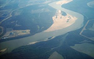
When the border between Tennessee and Arkansas was first set in 1795, it followed the middle of the Mississippi River. Back then, the river flowed northwest of Reverie. But after the big river change in 1876, the Mississippi River moved to the southeast of Reverie. This cut Reverie off from the rest of Tipton County.
Today, Reverie is surrounded by the modern Mississippi River on one side and the old river channels on the other sides. Even though the old channels don't always have water, Reverie is on what is like an island, called Island No. 35 of the Mississippi River, because water surrounds it.
Traveling to the County Seat

The county seat, Covington, Tennessee, is only about 18 miles (29 km) away in a straight line. However, because of the river and roads, driving to Covington from Reverie in 2007 meant a much longer trip. You had to go through Memphis, Tennessee, making the drive over 83 miles long!
Postal Information
The postal address and ZIP code for Reverie used to be Reverie TN, AR 72395. This ZIP code is also used for Wilson, Arkansas. The United States Postal Service now suggests using Wilson, AR 72395 for mail to Reverie.
 | Dorothy Vaughan |
 | Charles Henry Turner |
 | Hildrus Poindexter |
 | Henry Cecil McBay |


