Rice Fork facts for kids
Quick facts for kids
Rice Fork
|
|
|---|---|
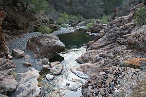
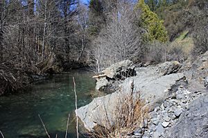
Rice Fork at Crabtree Hot Springs
|
|
| Country | United States |
| State | California |
| County | Lake County |
| Elevation | 2,257 ft (688 m) |
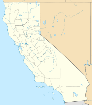
The Rice Fork is a stream in Lake County, California. It flows for about 22.7 miles (36.5 kilometers) and is a branch of the Eel River.
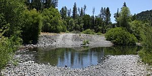
This stream starts high up on the northwest side of Goat Mountain, near the border of Colusa and Lake County. It begins at an elevation of over 6,000 feet (1,829 meters). The Rice Fork quickly flows down the steep side of the mountain. Then, it turns north and winds through a narrow, deep canyon for about 18 miles (29 kilometers). It crosses two forest roads and many smaller streams join it along the way.
The Rice Fork ends its journey at the southern end of Lake Pillsbury. Its elevation there is around 1,800 feet (549 meters), which changes depending on the lake's water level. Before the Scott Dam was built in the 1920s (which created Lake Pillsbury), the Rice Fork flowed directly into the Eel River. It is one of the longest streams in Lake County.
Many smaller streams flow into the Rice Fork. These include Salt Creek, French Creek, Parramore Creek, Bevans Creek, Bear Creek, Packsaddle Creek, Willow Creek, Deer Creek, Rice Creek, and Soda Creek.
Contents
History of Rice Fork
In the 1860s, there was a very dry year in the Sacramento Valley. A man named Rice and his friends brought their horses and mules to Rice Valley. They used this area for its good pastures. Rice Valley became their main base. Mr. Rice was active in that area for only a few years. However, Rice Valley, Rice Creek, and the Rice Fork all got their names from him.
A long time ago, an Indian trail went from the hot springs down the Rice Fork canyon. It led to where the river met Gravelly Valley. From there, it crossed the river and went up Squaw Valley Creek. The trail then went over a ridge to an Indian village at Bloody Rock. Today, part of this old trail is covered by Lake Pillsbury.
Understanding the Rice Fork Watershed
A watershed is an area of land where all the water drains into a single river, lake, or ocean. The Rice Fork watershed is surrounded by tall mountains.
To the east, Snow Mountain-West stands tall at 7,038 feet (2,145 meters). Its huge west ridge goes down to Lake Pillsbury. This ridge separates the Rice Fork watershed from the Eel River watershed. Snow Mountain's southern ridge connects to Goat Mountain, which is 6,121 feet (1,866 meters) high. This connection separates the Rice Fork waters from the South Fork Stony Creek.
To the west of Snow Mountain-West, other mountains like Pine Mountain (4,057 feet or 1,237 meters), Horse Mountain (4,688 feet or 1,429 meters), and Elk Mountain (4,191 feet or 1,277 meters) form the western edge of the Rice Fork watershed. French Ridge, Little Horse Mountain (3,420 feet or 1,042 meters), and the west ridge of Goat Mountain mark the southern boundary. All the water from this area flows into Lake Pillsbury, then into the Eel River, and finally reaches the Pacific Ocean.
The Rice Fork contributes a lot of water to Lake Pillsbury. It drains about 33 percent of the total area that feeds the lake. This means it likely provides a similar amount of water flowing into the lake. Most of the mud and dirt (called sediment) in Lake Pillsbury settles in the upper parts of the Eel River and Rice Fork arms of the lake.
Hale Ridge Research Natural Area
The Rice Fork forms the southern edge of the Hale Ridge Research Natural Area (RNA). This special area covers about 975 acres (395 hectares). The Rice Fork also runs alongside the western boundary of the RNA for about one mile.
The RNA is a protected area for the northern spotted owl, which is a federally protected bird. It's also a winter home for black-tailed deer. The U.S. Forest Service created this area in 1987. They wanted to protect the knobcone pine forest, which is common in the North Coast Ranges. Inside the RNA, you'll find thick stands of knobcone pine trees and mixed conifer forests. These forests are mostly made up of Douglas-fir trees. They also provide a place for the northern goshawk to spread out.
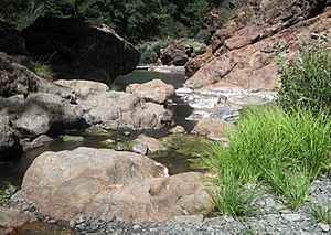
The rocks under the RNA are mostly greywacke sandstones and shales. Greywacke looks like muddy, brownish-gray sandstone. It can be soft and crumbly in some places, but solid rocks and boulders are found in the Rice Fork stream bed.
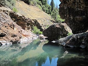
Some people visit Crabtree Hot Springs, which is right next to the RNA. The Rice Fork is also used a little for outdoor activities. However, very few people go into the RNA itself. There is a small risk of wildfires starting from human activity at the hot springs.
Tributaries of Rice Fork
Many smaller streams, called tributaries, flow into the Rice Fork. Here are some of the main ones:
- Salt Creek is one of the larger tributaries. It starts at Fir Root Spring, about 4,400 feet (1,341 meters) high on Goat Mountain. It flows southwest down a steep canyon for about 3.4 miles (5.5 kilometers). It goes over a 25-foot (7.6-meter) waterfall and crosses a forest road before joining the Rice Fork. This happens about 11.9 miles (19.2 kilometers) upstream from Lake Pillsbury, and about a quarter-mile upstream from Crabtree Hot Springs.
- French Creek begins about 3,800 feet (1,158 meters) high near the top of French Ridge. It flows north down a steep canyon for about 3.9 miles (6.3 kilometers). Another stream, Rock Creek, joins it. French Creek then enters the Rice Fork about 10.9 miles (17.5 kilometers) upstream from Lake Pillsbury. This is about a mile downstream from Crabtree Hot Springs.
* Rock Creek (a branch of French Creek) starts about 3,600 feet (1,097 meters) high on Elk Mountain. It flows northeast for about 3.6 miles (5.8 kilometers) down a steep canyon. It joins French Creek about 0.4 miles (0.6 kilometers) before French Creek meets the Rice Fork.
- Soda Creek starts about 3,800 feet (1,158 meters) high on Elk Mountain. It flows east down a steep canyon and joins the Rice Fork a short distance upstream from Parramore Creek.
- Parramore Creek also starts about 3,800 feet (1,158 meters) high on Elk Mountain. It flows east for about 4.6 miles (7.4 kilometers) down a steep canyon. It crosses a forest road at a place called Three Crossings. It joins the Rice Fork about 8.1 miles (13.0 kilometers) upstream from Lake Pillsbury.
- Bear Creek flows from a spring about 6,500 feet (1,981 meters) high on Snow Mountain-West. It quickly drops down a steep canyon and flows southwest for about 9.1 miles (14.6 kilometers). Another stream joins it, and it passes under a concrete bridge and crosses a forest road. Bear Creek joins the Rice Fork about 7.2 miles (11.6 kilometers) upstream from Lake Pillsbury.
* Blue Slides Creek (a branch of Bear Creek) starts about 4,400 feet (1,341 meters) high on Goat Mountain. It flows west for about 4.2 miles (6.8 kilometers) down a steep canyon. It runs alongside Forest Road M-10 before joining Bear Creek just after the bridge.
- Bevans Creek starts about 3,200 feet (975 meters) high on Horse Mountain. It flows northeast for about 3.5 miles (5.6 kilometers) down a steep canyon. It joins the Rice Fork about 5.5 miles (8.9 kilometers) upstream from Lake Pillsbury.
- Rice Creek begins about 6,100 feet (1,859 meters) high on Snow Mountain-West. It quickly flows down the steep west side of the mountain, going southwest for about 8.1 miles (13.0 kilometers) through a steep canyon. It crosses a forest road and passes through Rice Valley. It joins the Rice Fork about 4.3 miles (6.9 kilometers) upstream from Lake Pillsbury.
- Deer Creek starts about 5,400 feet (1,646 meters) high on Snow Mountain-West. It flows west for about 6.5 miles (10.5 kilometers) down a steep canyon, crossing a forest road. It joins the Rice Fork about 1.6 miles (2.6 kilometers) upstream from Lake Pillsbury.
- Willow Creek begins about 3,400 feet (1,036 meters) high on Horse Mountain. It flows northeast for about 5 miles (8.0 kilometers) down a steep canyon. It joins the Rice Fork about 1.2 miles (1.9 kilometers) upstream from Lake Pillsbury.
- Packsaddle Creek starts about 3,600 feet (1,097 meters) high on Pine Mountain. It flows northeast for about 3.1 miles (5.0 kilometers) down a steep canyon. It joins the Rice Fork near Swallow Rock, at the very southern tip of Lake Pillsbury.
Places to Visit: Crossings, Campgrounds, and Trails
There are several places where roads cross the Rice Fork and its tributaries, and some spots for camping and hiking.
River and Creek Crossings
- Forest Road 17N04 (Twin Valley Road) crosses both the Rice Fork and Salt Creek where they meet.
- Forest Road M-10 (also known as county road 301-C) crosses the Rice Fork a short distance downstream from where Bear Creek joins it.
- Forest Road M-10 (county road 301-C) has a bridge over Bear Creek where it meets Blue Slides Creek.
- Forest Road M-3 (18N04) crosses Rice Creek about 2 miles (3.2 kilometers) north of its meeting point with Forest Road M-10.
- Forest Road M-3 (18N04) crosses Deer Creek about 5 miles (8.0 kilometers) north of its meeting point with Forest Road M-10.
- Forest Road 17N16 (Long Ridge Road) crosses Bear Creek where it meets Forest Road M-10.
Campgrounds and Trailheads
- Bear Creek Campground (USFS) – This campground is free and open all year. You can stay for a maximum of 14 days. It has 16 picnic tables, grills, and 2 toilets. It's located at an elevation of 2,000 feet (610 meters). The campground is next to Bear Creek, near where it meets Blue Slides Creek, on Forest Road M-10. It's about 9 miles (14.5 kilometers) northeast from where this road meets Elk Mountain Road. This is the only public campground in the Rice Fork Eel River watershed.
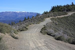
- Summit Springs Trailhead is located about 5,200 feet (1,585 meters) high on the south ridge of Snow Mountain-West. A hiking trail follows the ridge line to the top of Snow Mountain West Peak (7,038 feet or 2,145 meters) and East Peak (7,056 feet or 2,151 meters). Forest Road M-10 crosses the south ridge at about 4,300 feet (1,311 meters). A smaller forest road continues up the ridge to the trailhead.
Images for kids
 | Victor J. Glover |
 | Yvonne Cagle |
 | Jeanette Epps |
 | Bernard A. Harris Jr. |


