
Richfield, New York facts for kids
Quick facts for kids
Richfield, New York
|
|
|---|---|

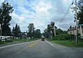
US 20 westbound in the Richfield hamlet of Brighton Corners
|
|

Otsego County map with the Town of Richfield in Red
|
|
| Country | United States |
| State | New York |
| County | Otsego |
| Area | |
| • Total | 32.46 sq mi (84.06 km2) |
| • Land | 30.86 sq mi (79.92 km2) |
| • Water | 1.60 sq mi (4.14 km2) |
| Elevation | 1,470 ft (448 m) |
| Population
(2010)
|
|
| • Total | 2,388 |
| • Estimate
(2016)
|
2,277 |
| • Density | 73.79/sq mi (28.49/km2) |
| Time zone | UTC-5 (Eastern (EST)) |
| • Summer (DST) | UTC-4 (EDT) |
| ZIP code |
13439
|
| Area code(s) | 315 |
| FIPS code | 36-61467 |
| GNIS feature ID | 0979417 |
Richfield is a small town located in Otsego County, New York, in the United States. It's found at the northern edge of the county. In 2010, about 2,388 people lived here.
Contents
Discover the History of Richfield
Richfield has a long and interesting past. The area known as Richfield Springs was once called "Big Medicine Waters" by the local Native American tribes. This name came from the special springs found there.
How Richfield Was Formed
The town of Richfield was officially created on April 10, 1792. It was formed from a larger area called the Town of Otsego. Later, in 1799, two other towns, Exeter and Plainfield, were separated from Richfield.
Early Settlers and Life in Richfield
Before the American Revolution, some people tried to settle here, but they had to leave during the war. After the war, new settlers arrived in 1787. These included John Kimball, Richard and William Pray, John Beardsley, Joseph Coats, and Seth Allen.
More families came in 1789 and 1790, settling near what is now Richfield Springs and Schuyler Lake. The first baby born in the town was Jos. Beardsley, and the first marriage was between Ebenezer Russell and Mrs. Moore. The first school was taught by James S. Palmer in Richfield Springs.
Richfield's Early Economy
In the early days, Richfield was known for its farming. Farmers in the town produced a lot of cheese. In fact, around 1860, Richfield made about 500,000 pounds of cheese every year! This was more than double what any other town in the county produced.
The Famous Richfield Springs
The village of Richfield Springs is famous for its natural springs. These springs were believed to have special healing powers, especially for skin problems. Many people would visit the springs hoping to feel better. Scientists even studied the water to find out what was in it!
What Was in the Spring Water?
A scientist named Professor Reid analyzed the water from the Richfield Springs. He found that a gallon of the water contained:
- Bicarbonate of magnesia
- Bicarbonate of lime
- Chloride of sodium and magnesia
- Sulphate of magnesia
- Hydrosulfate of magnesia and lime
- Sulphate of lime
It also had a gas called sulfurated hydrogen.
Exploring Richfield's Geography
Richfield covers an area of about 32.4 square miles (84.06 square kilometers). Most of this is land, with about 1.5 square miles (4.14 square kilometers) being water.
Lakes and Creeks
The northern border of Richfield touches Herkimer County. A large part of Canadarago Lake is located in the eastern side of the town. Several small streams flow into this lake:
- Hyder Creek flows in from the west.
- Ocquionis Creek and Mink Creek flow into the lake from the north, passing through Richfield Springs.
Major Roads in Richfield
You can find important roads in Richfield that help people travel through the area:
- New York State Route 28 (NY 28) runs north and south, passing by the western side of Canadarago Lake.
- NY 28 crosses US Route 20 in the village of Richfield Springs.
- NY 167 also starts in Richfield Springs, connecting with US Route 20.
People and Population in Richfield
| Historical population | |||
|---|---|---|---|
| Census | Pop. | %± | |
| 1820 | 1,772 | — | |
| 1830 | 1,752 | −1.1% | |
| 1840 | 1,680 | −4.1% | |
| 1850 | 1,502 | −10.6% | |
| 1860 | 1,648 | 9.7% | |
| 1870 | 1,831 | 11.1% | |
| 1880 | 2,515 | 37.4% | |
| 1890 | 2,699 | 7.3% | |
| 1900 | 2,526 | −6.4% | |
| 1910 | 2,212 | −12.4% | |
| 1920 | 2,133 | −3.6% | |
| 1930 | 2,099 | −1.6% | |
| 1940 | 1,970 | −6.1% | |
| 1950 | 2,339 | 18.7% | |
| 1960 | 2,662 | 13.8% | |
| 1970 | 2,602 | −2.3% | |
| 1980 | 2,608 | 0.2% | |
| 1990 | 2,711 | 3.9% | |
| 2000 | 2,423 | −10.6% | |
| 2010 | 2,388 | −1.4% | |
| 2016 (est.) | 2,277 | −4.6% | |
| U.S. Decennial Census | |||
In 2000, there were 2,423 people living in Richfield. These people lived in 968 households, and 641 of those were families. The population density was about 78 people per square mile (28 people per square kilometer).
Who Lives in Richfield?
Most people in Richfield are White (97.48%). There are also smaller percentages of African American, Native American, Asian, and Pacific Islander residents. About 0.37% of the population identified as Hispanic or Latino.
Families and Age Groups
About 26.9% of households in Richfield had children under 18 living with them. More than half of the households (53.6%) were married couples living together.
The population's age was spread out:
- 23.1% were under 18 years old.
- 7.0% were between 18 and 24.
- 23.9% were between 25 and 44.
- 25.1% were between 45 and 64.
- 20.9% were 65 years or older.
The average age in Richfield was 42 years old.
Communities and Places in Richfield
The Town of Richfield has several smaller communities and interesting locations:
- Brighton (or "Brighton Corners") – A small community in the northern part of the town, located along US-20.
- Canadarago Hill – A raised area found in the Village of Richfield, also known as The Round Top.
- Dogtown – A community near the southern border of Richfield, located on County Route 24.
- Federal Corners – A spot east of Richfield Springs where Butternut Road and Cemetery Road meet.
- Gunset Hill – A hill located west of Richfield Springs.
- Hawk Hill – Another hill, found near Dogtown.
- Nine Hill – A hill southwest of Richfield Springs.
- Pray Hill – A hill located west of Brighton.
- Monticello – A community southwest of Richfield Springs, at the intersection of County Road 24 and County Route 25.
- Richfield Hill – A raised area in the northwestern part of the town, extending into the town of Columbia.
- Richfield Springs – This is the main village in the northeastern part of the town, where US-20 and NY-28 meet. It's north of Canadarago Lake.
- Round Top – A raised area on the western town line, partly in Herkimer County.
- Sunset Hill – A hill located north of the village of Richfield.
Images for kids
-
US 20 westbound in the Richfield hamlet of Brighton Corners
See also
 In Spanish: Richfield (Nueva York) para niños
