Ripley, Queensland facts for kids
Quick facts for kids RipleyIpswich, Queensland |
|||||||||||||||
|---|---|---|---|---|---|---|---|---|---|---|---|---|---|---|---|

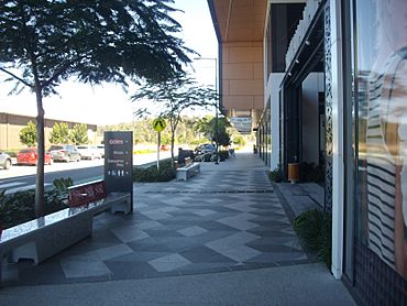
Ripley Town Centre
|
|||||||||||||||
| Population | 4,288 (2021 census) | ||||||||||||||
| • Density | 335.0/km2 (868/sq mi) | ||||||||||||||
| Postcode(s) | 4306 | ||||||||||||||
| Area | 12.8 km2 (4.9 sq mi) | ||||||||||||||
| Time zone | AEST (UTC+10:00) | ||||||||||||||
| Location |
|
||||||||||||||
| LGA(s) | City of Ipswich | ||||||||||||||
| State electorate(s) | Ipswich | ||||||||||||||
| Federal Division(s) | Blair | ||||||||||||||
|
|||||||||||||||
Ripley is a growing suburb located in the City of Ipswich, Queensland, Australia. It's a place where many families live and new developments are happening. In 2021, about 4,288 people called Ripley home.
Contents
Where is Ripley?
Ripley is a suburb in Queensland, Australia. Its eastern edge follows a waterway called Bundamba Creek. The Centenary Highway also runs through the south-east part of the suburb. Ripley is named after the Ripley Valley, where it is located.
A Look at Ripley's Past
Ripley has a long history. It is part of the traditional lands of the Yugarabul Indigenous Australian people.
Early Settlement and Farming
The area started as a farming community in the mid-1800s. People settled here to work the land.
Schools in Ripley's History
A school called Bundamba Upper State School opened on 2 February 1874. It was later renamed Ripley State School in 1909. However, it closed in 1930 because not enough students were attending. This old school was located in the nearby area of South Ripley.
Cityhope Church
Cityhope Church was built in 1998. Its church community first started in Ipswich in the mid-1960s.
Ripley's Modern Development
In 2007, a big plan was announced for Ripley. It was going to become a modern, master-planned urban development. This means the whole area was carefully designed before building started.
How Many People Live in Ripley?
The number of people living in Ripley has grown a lot.
- In 2016, the population was 1,405 people.
- By 2021, the population had grown to 4,288 people.
The Future of Ripley: A Growing Community
The Ripley area is part of a large project to help Brisbane and its surrounding areas grow. This project is called the western growth corridor. The development, known as Ecco Ripley, is being built to make space for more people. Many people are moving to the area from other parts of Australia and from overseas.
What to Expect in the Future
When the Ripley area is fully developed, it is expected to be home to about 120,000 people. There could be as many as 50,000 homes. The development will also create many job opportunities, with an estimated 200,000 positions.
Location for Growth
The Ripley development is close to other growing suburbs. These include South Ripley, Swanbank, Deebing Heights, and White Rock. These areas have suitable land for new homes, businesses, and industrial buildings. This project is planned to be one of the largest communities ever built in Australia.
Getting Around Ripley
Ripley has public transport options to help people travel.
Bus Services
Bus route 531 connects Ripley to other areas. It runs between Springfield Central and Yamanto.
Future Train Connections
There are plans for new train lines in the future. The Springfield railway line might be extended to Ipswich. New train stations are also planned between Ipswich and Springfield.
Education in Ripley
Ripley has schools to support its growing number of families.
Local Schools
A new government primary school, Ripley Central State School, opened in January 2023. It is located on Binnies Road. Before it was built, the school went through a planning and approval process with the Ipswich City Council. Other schools, Ripley Valley State School and Ripley Valley State Secondary College, are located in the nearby suburb of South Ripley.
Community Places
Cityhope Church
Cityhope Church is a community gathering place. It is located at 7 Rex Hills Drive (27°39′27″S 152°46′51″E / 27.6576°S 152.7808°E). This church is part of the Australian Christian Churches group.
 | James B. Knighten |
 | Azellia White |
 | Willa Brown |


