
River Bain facts for kids
Quick facts for kids River Bain |
|
|---|---|

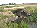
Tilting Gate Weir near Thornton
|
|
| Other name(s) | The Bain |
| Country | England |
| Region | Lincolnshire |
| Physical characteristics | |
| Main source | Ludford, Lincolnshire Wolds, England 130 m (430 ft) |
| River mouth | River Witham Dogdyke, Tattershall 53°5′0.1″N 0°11′45.8″W / 53.083361°N 0.196056°W |
| Basin features | |
| Tributaries |
|

The River Bain is a river in Lincolnshire, England. It is a smaller river that flows into a larger one, called the River Witham.
The Bain starts its journey in the Lincolnshire Wolds at a village called Ludford. This village is on a long walking path known as The Viking Way. As the river flows, it passes through or near several villages. These include Burgh on Bain, Biscathorpe, Donington on Bain, Goulceby, Asterby, and Hemingby. Eventually, it reaches the town of Horncastle. Here, another river, the River Waring, joins the Bain. The River Waring starts about 5 kilometers (3 miles) northeast of Horncastle.
After leaving Horncastle, the River Bain continues its path. It flows through the villages of Kirkby on Bain, Coningsby, and Tattershall. Finally, it meets the River Witham at a place called Dogdyke.
Contents
The Horncastle Canal: A River's New Purpose
For a while, the River Bain was changed to help transport goods. In the late 1700s and early 1800s, a group of people, led by Sir Joseph Banks, worked to turn part of the Bain into a canal. A canal is like a man-made river that helps boats travel easily.
Building the Canal
It took a lot of talking and planning to make this happen. The Horncastle Canal finally opened in 1802. This canal became a very important way to move goods around. It was used a lot before trains became common.
The Canal Today
Today, the Horncastle Canal is no longer used for large boats. But it's still a busy place! Many people enjoy fishing there. Canoeists love to paddle along its waters. And naturalists (people who study nature) visit to observe the plants and animals.
Amazing River Animals
The River Bain is home to many different kinds of fish and other creatures.
Fish Species
You can find lots of fish in the river, including:
- Chub
- Bream
- Roach
- Rudd
- Brown trout
- Pike
- Eel
There are also smaller fish species like:
- Miller's thumb
- Gudgeon
- Stone loach
Crayfish in the Bain
The river is also home to a special type of crayfish called Austropotamobius pallipes. This is a native species, meaning it's originally from this area. However, there are also other crayfish called American signal crayfish (Pasifastacus leniusculus). These were brought to the area from somewhere else. The American signal crayfish compete with the native crayfish for food, which can be a problem for the native ones.
The River's Valley and Floods
The valley where the River Bain flows was shaped a long, long time ago.
How the Valley Formed
It was formed by a huge glacier during the most recent ice age. Even though the valley is not very big, you can clearly see how it was carved out by the ice.
When the River Overflows
The River Bain can sometimes flood. This means the water rises and spills over its banks. Floods have happened many times throughout history, usually about once every 30 to 50 years. The most recent big flood was in 2007. During that time, the river overflowed all along its path. The town of Horncastle was especially affected by the high water.
Towns and Villages Along the Bain
Many communities are located in the River Bain valley. These include:
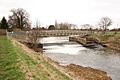
- Tattershall
- Coningsby
- Kirkby on Bain
- Haltham
- Roughton
- Horncastle
- Hemingby
- Goulceby with Asterby
- Donington on Bain
- Burgh on Bain
- Ludford

Images for kids
-
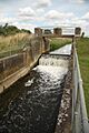
Tattershall Sluice
-
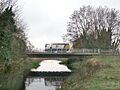
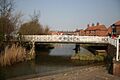
Road bridge over the River Bain in Coningsby
-
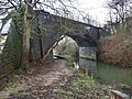
Mason's Lane Bridge
-
Old railway bridge at Coningsby
-
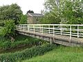
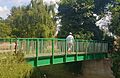
Footbridge in Kirkby on Bain
-
Haltham Lock
-
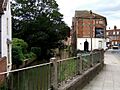
Bridge Street in Horncastle
-
Bridge at Tesco in Horncastle
-
Market Bridge


