
Viking Way facts for kids
Quick facts for kids Viking Way |
|
|---|---|
 |
|
| Length | 147 mi (237 km) |
| Location | Lincolnshire, England |
| Trailheads | Barton-on-Humber Lincolnshire 53°41′51″N 0°26′40″W / 53.6974°N 0.4444°W and Oakham, Rutland 52°40′08″N 0°43′30″W / 52.6688°N 0.7250°W |
| Use | Hiking |
| Elevation change | 161 m (528 ft) |
| Highest point | Sewstern Leicestershire, 52°46′53″N 0°41′09″W / 52.7814°N 0.6859°W, 164 m (538 ft) |
| Lowest point | Bardney Lincolnshire, 53°11′54″N 0°18′56″W / 53.19846°N 0.31546°W, 3 m (9.8 ft) |
| Difficulty | Easy |
| Season | All year |
| Sights | Humber Bridge South Ferriby Bardney Abbey Lincoln Cathedral Rutland Water |
The Viking Way is a long distance trail in England. It stretches for about 147 miles (237 km). The trail connects the Humber Bridge in North Lincolnshire to Oakham in Rutland. It's a great way to explore the English countryside!
Contents
Discovering the Viking Way's Past
The Viking Way officially opened on Sunday, September 5, 1976. The opening ceremony took place in Tealby. A local official from Lincolnshire County Council opened the trail. The original plan was for the chairman, John Hedley-Lewis, to open it. Sadly, he was ill and passed away later that year.
John Hedley-Lewis was the president of the local Ramblers' Association. To remember him, a special memorial stile was built on the route. You can find it at Stenwith, near Woolsthorpe-by-Belvoir.
Connecting Trails and European Paths
The Countryside Commission saw how important the Viking Way was. It was a high-quality, long-distance walk. It connected to other major trails in Eastern England.
These trails include:
- The Yorkshire Wolds Way at the northern end.
- The Hereward Way and Macmillan Way from Oakham.
- The Jurassic Way from Stamford.
- The southern end of the Peddars Way from Thetford.
Most of the Viking Way is also part of a bigger European path. It's called the E2 European long distance path.
Viking History Along the Way
Many old settlements were built on dry land in the Lincolnshire Wolds. The Viking Way passes by these ancient sites. There is proof that the Vikings had a big influence in this area. This was around the 9th century.
For example, many place names end in "by." This is a common ending in Scandinavia. Also, old documents and coins show Scandinavian names. Much of the Viking Way is a "Byway Open to All Traffic." This means it's a public path that vehicles can also use.
Exploring the Viking Way Route
The Viking Way takes you through different parts of England. Each section has its own unique sights.
North Lincolnshire Section
The walk begins by going under the huge Humber Bridge. Then, it follows the edge of the Ancholme Valley. It crosses over the M180 at the A15 roundabout. This area was once part of Humberside until 1996.
Lincolnshire Section

The trail continues through the Lincolnshire Wolds. This area is known as an Area of Outstanding Natural Beauty (AONB). You will pass through towns like Caistor and Horncastle. It crosses major roads like the A46 and the A158.
The path then follows the River Bain into Woodhall Spa. This part of the trail used to be a railway line. It is now called the Spa Trail. The route heads northwest through Stixwould, Southrey, and Bardney. It then goes through Stainfield before reaching Fiskerton. From Fiskerton, it follows the south side of the River Witham towards Lincoln.
Through Lincoln City
The trail used to follow the river directly into Lincoln. However, around 2002, the path was changed. It now takes a small detour near Washingborough to cross the river.
From there, it crosses the Lincoln – Grimsby railway line. It enters Lincoln on Crofton Road. It then goes around the south side of Lincoln County Hospital. The path follows Lindum Terrace and crosses the A15. It passes Pottergate and enters the grounds of Lincoln Cathedral. You will walk past the south side of the cathedral on Minster Yard.
The trail then goes down the famous Steep Hill. It follows the main shopping High Street of Lincoln. It crosses the River Witham and a railway at a level crossing. It continues along Tentercroft Street and Sincil Bank. This leads towards the football ground. The path goes along Scorer Street towards South Park. It then meets the old route on Canwick Road (B1188).
The trail runs along the southern edge of the South Common. This common also marks the boundary between Lincoln and North Kesteven. It crosses the A15 at this boundary.
South Lincolnshire and Beyond

The Viking Way runs next to the A607 to the west of Bracebridge Heath. It goes through villages like Waddington, Harmston, Coleby, Boothby Graffoe, Navenby, and Wellingore. These villages are along the Lincoln Cliff. The trail then follows the old Ermine Street and crosses the A607.
Near High Dyke Farm, just north of the A17, it reaches the boundary of South Kesteven. This is west of RAF Cranwell. At Byard's Leap, it crosses the A17. It then follows the B6403 towards Ancaster.
The path heads west and enters South Kesteven. It meets the A607 again at Carlton Scroop. Then, it crosses the River Witham and passes through Marston and Long Bennington. The trail was extended to Long Bennington in 1997. This allowed walkers to cross the A1 on a road bridge. Before this, people had to cross the busy road directly.
The trail no longer goes through Allington. It crosses the A52 near Sedgebrook and a railway line. It then follows what used to be called Sewstern Lane. It meets the Lincolnshire – Leicestershire boundary near Harston. The path follows this boundary and crosses the A607.
Leicestershire Section
The trail passes Saltby Airfield, which used to be RAF Saltby. It also goes through Buckminster. Then, it enters Sewstern, briefly going into Leicestershire and the area of Melton.
Rutland Section
The Viking Way then rejoins the Lincolnshire boundary. This is near where the River Witham starts. It then enters Rutland and passes through Thistleton. The path goes very close to the former RAF Cottesmore. It continues through Greetham and Exton.
It meets the A606 and the Hereward Way at Whitwell. Then, it passes through two watersports centers on Rutland Water at Whitwell and Barnsdale. From here, it follows the A606 from Barnsdale Hill into Oakham. When the trail first opened, it followed main roads from Exton to Oakham. The facilities at Whitwell and Barnsdale had not been built yet.
Images for kids
-

The Viking Way Marker
-

The start of the walk at the old Coastguard Station
-
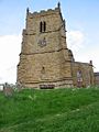
The Ramblers Church, Walesby, located on the trail, has a long association with walkers.
-

Navenby from The Viking Way


