
River Ure facts for kids
Quick facts for kids River Ure |
|
|---|---|
.jpg)
|
|
.png)
Location of the Ure within North Yorkshire
|
|
| Country | England |
| State | North Yorkshire |
| Physical characteristics | |
| Main source | Ure Head 640 m (2,100 ft) 54°21′59.967″N 2°18′0.033″W / 54.36665750°N 2.30000917°W |
| River mouth | River Ouse Cuddy Shaw Reach (near Linton-on-Ouse), North Yorkshire, England 10 m (33 ft) 54°2′4″N 1°16′30″W / 54.03444°N 1.27500°W |
| Length | 119 km (74 mi) |
The River Ure is a river in North Yorkshire, England. It flows for about 74 miles (119 km) before it changes its name to the River Ouse. The River Ure is the main river in Wensleydale. This valley is special because it's named after a village (Wensley) instead of its river. The valley used to be called Yoredale, after the river.
The Ure is one of many rivers that flow from the Yorkshire Dales into the River Ouse. Some rivers that join the Ure are the River Swale and the River Skell.
Contents
River Ure: Its Name and History
The earliest known name for the river was Earp around the year 1025. Later, it was called Jor and then Yore. This is why places like Jervaulx Abbey got their names. In more recent times, people started using the name "Ure."
The name "Ure" likely means "the strong or swift river." This idea comes from the old Roman name for Aldborough, which was Isurium. This suggests the river's name might be linked to an ancient word meaning "strong."
River Ure: Its Journey
The River Ure starts at a place called Ure Head on Abbotside Common. It flows west, then turns south. When it reaches the A684 road, it turns east and flows through Wensleydale past Wensley.
From Wensley, it flows southeast to Jervaulx Abbey, then south to Mickley. It then turns east again and flows south towards Ripon. After Ripon, it flows east again to Boroughbridge.
East of Boroughbridge, the River Swale joins the Ure. About 6 miles (10 km) downstream from this meeting point, near Linton-on-Ouse, the River Ure changes its name to the River Ouse.
River Ure: Water Levels
The river's water levels are watched at different points. This helps people know how high or low the water is. Here are some average levels:
| Monitoring station | Station elevation | Low water level | High water level | Record high level |
|---|---|---|---|---|
| Bainbridge | 208 m (682 ft) | 0.06 m (0.20 ft) | 2.5 m (8.2 ft) | 3.66 m (12.0 ft) |
| Kilgram | 94 m (308 ft) | 0.27 m (0.89 ft) | 1.5 m (4.9 ft) | 5.64 m (18.5 ft) |
| Masham | 76 m (249 ft) | 0.14 m (0.46 ft) | 2.3 m (7.5 ft) | 3.53 m (11.6 ft) |
| Ripon Ure Bank | 24 m (79 ft) | 0.03 m (0.098 ft) | 0.89 m (2.9 ft) | 3.73 m (12.2 ft) |
| Westwick Lock | 22 m (72 ft) | 0.11 m (0.36 ft) | 2.5 m (8.2 ft) | 3.35 m (11.0 ft) |
| Boroughbridge | 15 m (49 ft) | 9.62 m (31.6 ft) | 13 m (43 ft) | 15.59 m (51.1 ft) |
- Low and high water levels are average figures.
River Ure: The Land It Flows Through
The area around the River Ure changes as it flows.
Upper Wensleydale
This part of the valley is high and open. The river here is shallow and flows quickly. Many small streams join the river from nearby woodlands and sheep farms.
Mid Wensleydale
Here, the valley sides have stepped limestone cliffs. The valley floor is made of old glacial material. The river becomes wider and flows more gently, winding in curves. Several waterfalls can be found in this area.
Lower Wensleydale
This section is even wider. The river continues to wind gently until it drops sharply at Aysgarth, creating famous waterfalls. The valley sides become more covered with trees. As the river moves past Middleham, it flows in wider curves towards the southeast.
River Ure: A Look Back in Time
People have lived in the Ure valley since ancient times. You can see old tools and earthworks from the Bronze and Iron Ages in museums. The Romans even built a fort at Bainbridge. The names of villages in the valley show that different groups, like the Angles and Norse, settled there long ago.
During the Middle Ages, much of the upper valley was used for sheep farming. It belonged to places like Middleham Castle and Jervaulx Abbey.
In 1751, a main road called the Richmond to Lancaster Turnpike was built. It followed an old Roman road. Later, in 1795, it was moved to go through Hawes.
More recently, Aysgarth Falls has been used as a filming location. It appeared in the movie Robin Hood: Prince of Thieves (1990) and the film Wuthering Heights (1992).
River Ure: What People Do There
Today, the main ways people make a living in the Ure valley are:
- Farming: Growing crops and raising animals.
- Lead Mining: Although less common now, it was important in the past.
- Dairying: Making dairy products, like the famous Wensleydale cheese from Hawes.
- Quarrying: Digging for stone.
- Tourism: Many visitors come to see the beautiful countryside.
There are also breweries in Masham, like Black Sheep and Theakston. Many walking paths, including the Pennine Way, go through the area, inviting people to explore.
River Ure: How Boats Use It
The River Ure can be used by boats as far upstream as its meeting point with the Ripon Canal. This is about 13.6 miles (22 km) from the mouth of the river. There are special gates called locks at Milby and Westwick that help boats move up and down the river.
Boats have been able to travel on parts of the Ure since the late 1700s. Over time, different companies owned the navigation rights. For a while, the river wasn't kept clear, making it harder for boats to travel. Today, the Canal & River Trust is in charge of keeping the river open for navigation.
River Ure: Plants and Animals
The different areas around the River Ure are home to many types of plants and animals.
Plants of the River Ure
You can find various plants like cranesbill, bistort, pignut, and buttercup. Other beautiful flowers include wood anemones, violets, primroses, purple orchids, cowslips, and herb paris. Some tough plants, like spring sandwort, even grow where lead mining used to happen.
Animals of the River Ure
The valley has many badgers, roe deer, red foxes, and rabbits. You can also spot different birds, such as golden plovers, curlews, and oystercatchers.
The river itself is full of fish! Some types you might find are Brown Trout, Grayling, Barbel, Chub, Roach, and Perch.
Gallery
-
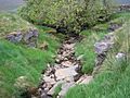
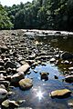
The River Ure near its source
-
River Ure west of Hawes
-
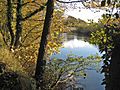
The River Ure near Worton Bridge
-
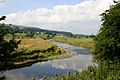
River Ure near Aysgarth with Batt Island in view
-
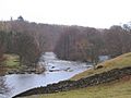
The River Ure at Hackfall Gorge near Mickley
-
River Ure near West Tanfield
-
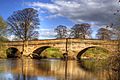
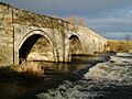
Bridge over River Ure near Ripon
-
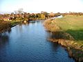
River Ure, Roecliffe
-
B6265 Hewick Bridge over River Ure
-
River Ure taken from Arrows Bridge


Lists
Tributaries of the River UreThese are streams and rivers that flow into the River Ure, starting from its source:
|
Settlements Along the River UreThese are towns and villages found along the River Ure, starting from its source:
|
Bridges and Crossings Over the River UreThese are the places where roads or paths cross the River Ure, starting from its source:
|
See also
 In Spanish: Río Ure para niños
