Rosedale, Queensland facts for kids
Quick facts for kids RosedaleQueensland |
|||||||||||||||
|---|---|---|---|---|---|---|---|---|---|---|---|---|---|---|---|
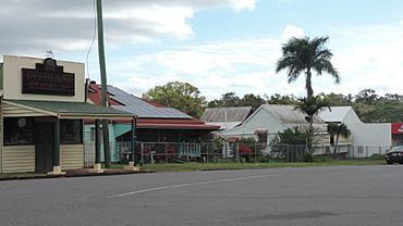
Rosedale, 2016
|
|||||||||||||||
| Population | 452 (2021 census) | ||||||||||||||
| • Density | 1.2063/km2 (3.124/sq mi) | ||||||||||||||
| Postcode(s) | 4674 | ||||||||||||||
| Area | 374.7 km2 (144.7 sq mi) | ||||||||||||||
| Time zone | AEST (UTC+10:00) | ||||||||||||||
| Location |
|
||||||||||||||
| LGA(s) |
|
||||||||||||||
| State electorate(s) |
|
||||||||||||||
| Federal Division(s) | Flynn | ||||||||||||||
|
|||||||||||||||
Rosedale is a small country town and area in central Queensland, Australia. It is special because it is split between two different local government areas: the Gladstone Region and the Bundaberg Region. In 2021, about 452 people lived in Rosedale.
Contents
Where is Rosedale?
Rosedale is located about 423 kilometers (263 miles) north of Brisbane. Brisbane is the capital city of Queensland. The town is also about 58 kilometers (36 miles) northwest of Bundaberg. Bundaberg is a larger regional city. The town is connected by the North Coast railway line.
Most of Rosedale is in the Gladstone Region. However, a small southern part near Lake Monduran is in the Bundaberg Region. Even though the town is in the Gladstone Region, it is actually closer to Bundaberg. Some people in Rosedale have shown interest in joining the Bundaberg Region instead.
In the eastern part of Rosedale, you can find the Littabella Conservation Park. This park also extends into the nearby area of Watalgan. There is also the Littabella National Park which reaches into Waterloo and Monduran. In the southeast, you will find the Monduran State Forest.
Rosedale's History
In July 1853, John Little and his family arrived in the area. They had traveled a long way from New South Wales with many sheep. They chose a spot overlooking a large creek, which is now called Baffle Creek. John Little's wife, Catherine, suggested the name "Rosedale" for their new home. In 1854, they built a house and pens for their animals.
The Little family lived on Rosedale Station until about 1979. Over time, more people started to settle in Rosedale. They took up smaller pieces of land.
Rosedale School and Memorial
Rosedale Provisional School first opened its doors on July 6, 1896. On January 1, 1909, it became Rosedale State School. In 1964, a secondary department was added. This meant older students could also attend.
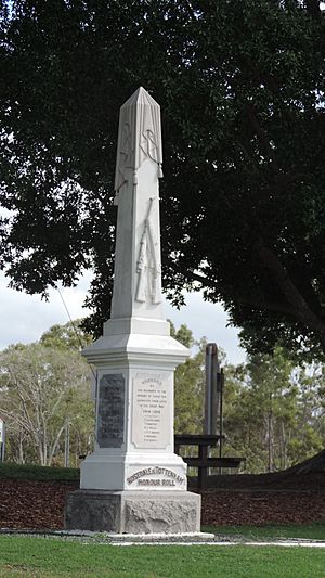
On December 13, 1920, a special war memorial was unveiled in Rosedale. It honors those who fought and died in World War I. Later, it was updated to also remember those from World War II. The memorial is located in James Street, next to the Memorial Hall.
In 2004, a train called a tilt train went off its tracks near Rosedale. About 120 passengers were injured in this accident.
Education in Rosedale
Rosedale State School is a government school for all ages, from Prep (the first year of school) to Year 12. It is located at 21 James Street. In 2018, the school had 243 students. It also has a special education program for students who need extra support. Students come to Rosedale State School from Rosedale and nearby areas like Lowmead, Agnes Water, 1770, Winfield, and Yandaran.
Local Facilities
Rosedale has several important facilities for the community. The Rosedale Police Station is located at 14 McPherson Street. The Rosedale SES Facility is at 2 Callaghan Street. The SES helps people during emergencies like floods or storms.
There are also two cemeteries in the area. The Rosedale cemetery is north of the town in Ferry Road. The Rosedale Baffle Creek Cemetery, also known as Flinders Cemetery, is in Barnetts Road.
What to Find in Rosedale
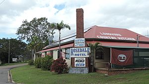
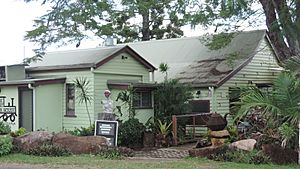
In Rosedale, you can find a local pub, a tea house, and a general store. These places are where people can meet and buy things.
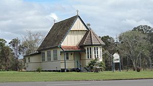
St John's Community Church is a privately owned church located in James Street. The Rosedale branch of the Queensland Country Women's Association (CWA) meets at 13 McPherson Street. The CWA is a group that supports women and communities in rural areas.
 | Ernest Everett Just |
 | Mary Jackson |
 | Emmett Chappelle |
 | Marie Maynard Daly |


