Roundtop Hill (Maryland) facts for kids
Quick facts for kids Roundtop Hill |
|
|---|---|
| Highest point | |
| Elevation | 1,358 feet (410 m) |
| Prominence | 650 feet (200 m) |
| Geography | |
| Location | Washington County, Maryland, U.S. |
| Parent range | Allegheny Mountains, part of the Ridge-and-Valley Appalachians |
| Topo map | USGS Hancock (PA and MD) Quadrangle |
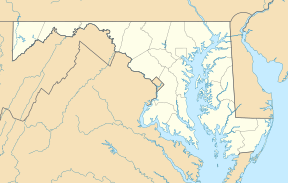
Roundtop Hill is a mountain in Washington County, Maryland. It is located southwest of the town of Hancock. The top of the mountain is about 1,358 feet (414 meters) high.
Geography of Roundtop Hill
Roundtop Hill is different from other mountains nearby. It is not part of a long chain of mountains called a ridge system. This mountain is only about 2 miles (3.2 kilometers) long.
It sits less than 1 mile (1.6 kilometers) from Tonoloway Ridge. This is about 3.5 miles (5.6 kilometers) southwest of Hancock. Roundtop Hill causes a big curve in the Potomac River. The river flows around its eastern side.
A large part of the eastern side of the hill is within the Chesapeake and Ohio Canal National Historical Park. The old canal bed and its walking path run along the narrow land at the bottom of the hill.
Geology: How Roundtop Hill Was Formed
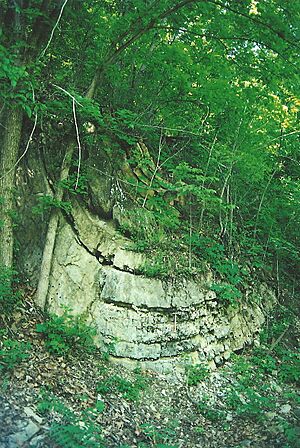
Roundtop Hill is a great place to see amazing rock formations. You can see layers of rock from the Silurian period. These layers are part of the Wills Creek Formation and the older Bloomsburg Formation. They are visible along the old railroad path.
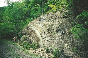
You can see examples of how rocks have been bent and folded over time. This bending is called folding. You can also see how rocks have split into thin sheets, which is called cleavage. There are also faults, which are cracks where rocks have moved past each other.
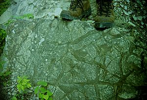
About 500 feet (152 meters) of these rock layers are visible. They show how bedded rocks have changed shape over millions of years. You can even spot ancient mudcracks, which are marks left by dried mud from long ago.
 | Lonnie Johnson |
 | Granville Woods |
 | Lewis Howard Latimer |
 | James West |


