Sandy Creek (Ohio) facts for kids
Quick facts for kids Sandy Creek |
|
|---|---|

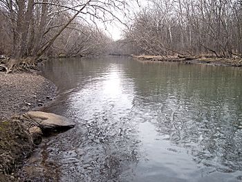
Sandy Creek near its mouth, downstream of Bolivar Dam in 2006
|
|
|
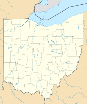
Location of the mouth of Sandy Creek
|
|
| Country | United States |
| State | Ohio |
| Physical characteristics | |
| Main source | Hanover Township, Columbiana County 1,299 ft (396 m) 40°46′19″N 80°54′09″W / 40.77194°N 80.90250°W |
| River mouth | Tuscarawas River Bethlehem Township, Stark County 887 ft (270 m) 40°39′28″N 81°26′14″W / 40.65778°N 81.43722°W |
| Length | 41.3 mi (66.5 km) |
| Basin features | |
| Basin size | 504 sq mi (1,310 km2) |
| Tributaries |
|
Sandy Creek is a river in northeastern Ohio, United States. It is about 41 miles (66 kilometers) long. This creek flows into the Tuscarawas River. From there, its water travels through the Muskingum and Ohio Rivers. Eventually, it becomes part of the huge Mississippi River system. The area of land that drains into Sandy Creek is called its watershed. This watershed covers about 503 square miles (1,303 square kilometers).
Contents
Where Sandy Creek Flows
Sandy Creek starts in Hanover Township. This is in western Columbiana County. The creek begins about two miles (3 km) northeast of Hanoverton.
Journey Through Ohio
The creek generally flows towards the west and southwest. It passes through several counties in Ohio. These include northwestern Carroll County and southeastern Stark County. It also goes through northeastern Tuscarawas County.
Along its path, Sandy Creek flows past several towns. These towns include Kensington, Minerva, and Malvern. It also goes by Waynesburg and Magnolia.
Joining Other Waters
Sandy Creek eventually joins the Tuscarawas River. This meeting point is in Bethlehem Township. It is about one mile (2 km) northeast of Bolivar.
As it flows, Sandy Creek collects water from smaller streams. At Minerva, it is joined by the Still Fork. Near Waynesburg, a short stream called Little Sandy Creek flows into it. In Sandyville, the creek collects Nimishillen Creek. Nimishillen Creek is important because it drains water from the city of Canton.
Bolivar Dam
Near where Sandy Creek meets the Tuscarawas River, there is a special dam. It is called the Bolivar Dam. This dam was built by the U.S. Army Corps of Engineers. It is a "dry dam," which means it only holds back water during floods. This helps protect nearby areas from too much water.
How Much Water Flows?
Scientists measure how much water flows in rivers. This is called the flow rate. The United States Geological Survey has a measuring station in Waynesburg. They have been tracking Sandy Creek's flow since 1939.
Average and Extreme Flows
Between 1939 and 2005, the average flow of Sandy Creek was about 278 cubic feet per second (8 cubic meters per second). That's like filling 278 boxes, each one foot on every side, with water every second!
The highest flow ever recorded was on January 22, 1959. On that day, 15,000 cubic feet per second (425 cubic meters per second) of water rushed by. This shows how much water can flow during a big storm. The lowest flow recorded was 6.9 cubic feet per second (0 cubic meters per second). This happened when the creek had very little water.
Other Names for Sandy Creek
Over time, rivers can sometimes have different names. The Geographic Names Information System keeps track of these names. Sandy Creek has also been known by a few other names in the past.
- Big Sandy Creek
- Big Sandy River
- Elks Eye Creek
- Lamanshicolas Creek
- Lamenshikola Creek
 | William Lucy |
 | Charles Hayes |
 | Cleveland Robinson |


