Santa Maria, Bulacan facts for kids
Quick facts for kids
Santa Maria
Santa Maria de Pandi
|
|||
|---|---|---|---|
| Municipality of Santa Maria | |||
|
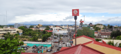
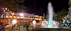
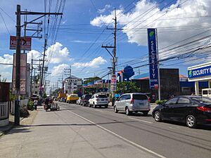
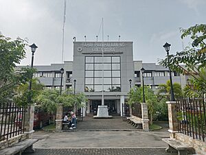
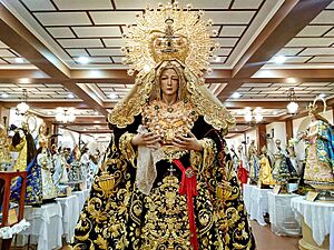
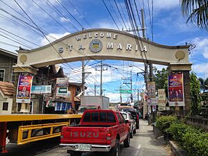
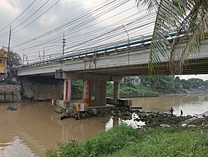
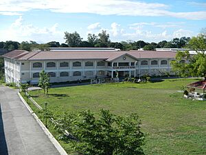
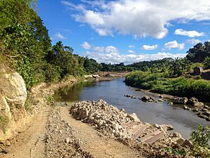
(From top, left to right): Población skyline • Paso Bridge • Immaculate Conception Church • Philippine Arena • Municipal Hall at night
|
|||
|
|||
| Nickname(s):
Chicharon Capital of the Philippines
|
|||
| Motto(s):
ONE Santa Maria, Lahat Kasama
(English: ONE Santa Maria, All Together) |
|||
| Anthem: Bayan Kong Mahal (English: My Beloved Town) |
|||
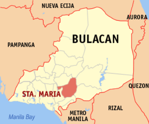
Map of Bulacan with Santa Maria highlighted
|
|||
|
OpenStreetMap
|
|||
| Country | Philippines | ||
| Region | Central Luzon | ||
| Province | Bulacan | ||
| District | [[{{#property:P7938}} | — Lua error in Module:Wd at line 1804: attempt to index field 'wikibase' (a nil value).]] | ||
| Founded | 13th century CE (part of the Kingdom of Tondo) |
||
| Incorporated | . | ||
| • Barrio | circa 1647 | ||
| • Hacienda | July 4, 1699 | ||
| • Pueblo | November 26, 1793 | ||
| Founded by | Fray Francisco Javier OFM | ||
| Barangays | 24 (see Barangays) | ||
| Government | |||
| • Type | Sangguniang Bayan | ||
| Area | |||
| • Total | 90.92 km2 (35.10 sq mi) | ||
| Elevation | 20 m (70 ft) | ||
| Highest elevation | 62 m (203 ft) | ||
| Lowest elevation | -1 m (−3.3 ft) | ||
| Population
(2020 census)
|
|||
| • Total | 289,820 | ||
| • Rank | 5 out of 1,489 Municipalities | ||
| • Density | 3,187.64/km2 (8,255.9/sq mi) | ||
| • Households | 70,619 | ||
| Demonym(s) | Santa Maríans | ||
| Economy | |||
| • Income class | 1st municipal income class | ||
| • Poverty incidence |
|
||
| • Revenue | ₱ 1,206 million (2022) | ||
| • Assets | ₱ 2,136 million (2022) | ||
| • Expenditure | ₱ 961.5 million (2022) | ||
| • Liabilities | ₱ 192.9 million (2022) | ||
| Service provider | |||
| • Electricity | Manila Electric Company (Meralco) | ||
| Time zone | UTC+8 (PST) | ||
| ZIP code |
3022
|
||
| PSGC |
[https://psa.gov.ph/classification/psgc/?q=psgc/barangays/{{#pro000®code={{&provcode=
|
||
| IDD : area code | +63 (0)44 | ||
| Native languages | Tagalog | ||
| Catholic diocese | Diocese of Malolos | ||
| Patron saint | Our Lady of The Immaculate Conception | ||
Santa Maria is a busy municipality in the province of Bulacan, Philippines. It is officially known as the Municipality of Santa Maria. As of the 2020 census, about 289,820 people live there. This makes it one of the most populated municipalities in Central Luzon.
Santa Maria is located along the Santa Maria River. It has been a lively community for nearly 400 years. It started as a small village (called a barrio) of Bocaue in the early 1600s. It became its own independent town on November 26, 1793. This was thanks to a Spanish friar named Francisco Dominguez Javier.
The town was once called Santa Maria de Pandi. It was named after the Immaculate Conception. The main part of the town, called the Poblacion, is its historic center. It is surrounded by four rivers and has kept its original size of 2.88 square kilometers since the Spanish Colonial Era.
Santa Maria is the most populated municipality in Central Luzon. It is also the 7th most populated municipality in the entire Philippines. In Bulacan, it is the second most populated local government unit, after San Jose del Monte City.
The downtown area of Santa Maria is very active. It includes three busy barangays: Poblacion, Bagbaguin, and Sta. Clara. This area is a major business hub in Bulacan. It handles more than half of all the town's economic activities. Santa Maria is also a leading financial center in Bulacan. In 2021, its total bank deposits reached PHP 31.27 billion. This was almost 75% of all bank deposits in Eastern Bulacan. Santa Maria is also the richest municipality in Bulacan. In 2022, it had assets of PHP 1.87 billion and revenues of PHP 1.206 billion. The town has a good standard of living, with only 4% of its people living in poverty. This is one of the lowest rates in the country.
Santa Maria is the hometown of José Corazón de Jesús, a famous Filipino poet. He was known as "Huseng Batute". Another famous person from Santa Maria is Francisco Santiago, a composer. He wrote many popular Filipino songs. The town has also produced important political leaders. These include three governors of Bulacan and three representatives to the Philippine Congress.
Contents
What's in a Name?
Santa Maria gets its name from the Immaculate Conception, also known as La Purisima Concepcion. The older name, Santa Maria de Pandi, included "Pandi." This word comes from the Kapampangan word pande, which means "blacksmith." It is similar to the Tagalog word panday.
A Look Back in Time
Early Days (Before 1521)
Before the Spaniards arrived in the Philippines, Santa Maria was a wild area. It had thick rainforests and many wild animals. Aetas and Dumagats were among the first people to live there.
Spanish Rule (1521–1898)
Santa Maria began as a barrio (village) of Bocaue around 1647. It is believed that the Dominicans also started a large estate called Hacienda de Lolomboy around this time. This estate stretched across a wide area.
Santa Maria became an independent town on November 26, 1793. This was done by the Franciscan friar Francisco Dominguez Javier. He started building the town's church, which was finished in the early 1800s. The church helped spread Christianity in the area. More people moved to the town. The first village leader, Andres dela Cruz, was appointed. This led to the permanent establishment of Poblacion, which became the center of the Spanish government. People used to rent their land from the friars. They paid their rent at a large convent in what is now Sta. Clara. Santa Maria was then called "Santa Maria de Pandi." Later, people could buy their land from the friars.
American Era and Japanese Occupation (1898–1946)
When the Americans took over, the title "captain" was changed to "presidente." Maximo Evidente was the first to hold this position from 1899 to 1900. Agustin Morales built the town's first main water system. Fortunato F. Halili, who later became Governor of Bulacan, also served as presidente. During World War II, Dr. Teofilo Santiago became mayor. He encouraged people to plant cassava and helped start the poultry industry. This made Santa Maria known as "The Egg Basket of the Philippines."
Modern Times (1947–Present)
After World War II, Conrado Ignacio was the first elected mayor (1947–1955). Many other leaders followed him. In 1986, after the People Power Revolution, Dr. Alfredo Perez was appointed as the temporary leader. Later, Ricardo Nicolas, Jr. took over.
In the 1988 elections, Eriberto Ramos was elected mayor. He served until 1992. Then, Reylina G. Nicolas became mayor. During her time, Santa Maria received many awards. The municipality grew from a second-class to a first-class municipality in terms of income. In 2001, Reylina Nicolas became a representative for Bulacan. Bartolome R. Ramos then became mayor.
In 2004, Jesus Mateo became mayor. He helped establish the Santa Maria extension campus in 2005. In 2007, Bartolome R. Ramos was elected mayor again. He served until 2016. Russel G. Pleyto was mayor from 2016 to 2022. Currently, Bartolome R. Ramos is the mayor, having taken office again on June 30, 2022.
Exploring Santa Maria's Location
Santa Maria is about 30 kilometers northeast of Manila. It is 21 kilometers away from Malolos City. The town is in the eastern part of Bulacan. It shares borders with Angat and Pandi to the north. Part of San Jose del Monte City is to the south. Norzagaray and other parts of San Jose del Monte are to the east. Marilao and Bocaue are to the west.
Santa Maria covers about 90.92 square kilometers. The town is mostly flat, but it has some hills in the northern part. The Santa Maria River is the main body of water.
Most areas in Santa Maria have a low risk of flooding. However, some parts near the Santa Maria River and its smaller streams can flood.
Natural Resources
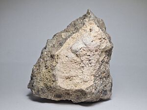
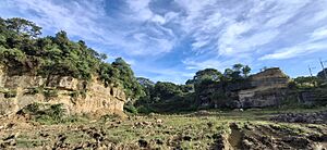
Santa Maria has many natural resources. It is known for its large amounts of gravel, sand, and volcanic tuff. Volcanic tuff is also called adobe or lastillas. Quarrying, which is digging up these materials, is an important way for local people to earn a living. These resources are used in construction and for decorative items.
Weather and Climate
Santa Maria's weather is similar to Manila's. It has two main seasons: a dry season and a wet season. The dry months are from November to April, with little rainfall. The wet season is from June to September, with much more rain. The temperature usually stays between 19°C (66°F) and 35°C (95°F).
| Climate data for Santa Maria, Bulacan | |||||||||||||
|---|---|---|---|---|---|---|---|---|---|---|---|---|---|
| Month | Jan | Feb | Mar | Apr | May | Jun | Jul | Aug | Sep | Oct | Nov | Dec | Year |
| Mean daily maximum °C (°F) | 29 (84) |
30 (86) |
32 (90) |
34 (93) |
33 (91) |
31 (88) |
30 (86) |
29 (84) |
29 (84) |
30 (86) |
30 (86) |
29 (84) |
31 (87) |
| Mean daily minimum °C (°F) | 20 (68) |
20 (68) |
21 (70) |
23 (73) |
24 (75) |
25 (77) |
24 (75) |
24 (75) |
24 (75) |
23 (73) |
22 (72) |
21 (70) |
23 (73) |
| Average precipitation mm (inches) | 7 (0.3) |
7 (0.3) |
9 (0.4) |
21 (0.8) |
101 (4.0) |
152 (6.0) |
188 (7.4) |
170 (6.7) |
159 (6.3) |
115 (4.5) |
47 (1.9) |
29 (1.1) |
1,005 (39.7) |
| Average rainy days | 3.3 | 3.5 | 11.1 | 8.1 | 18.9 | 23.5 | 26.4 | 25.5 | 24.5 | 19.6 | 10.4 | 6.4 | 181.2 |
| Source: Meteoblue | |||||||||||||
Barangays: Santa Maria's Communities
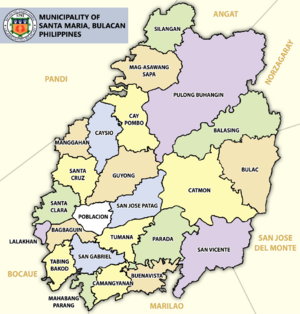
Santa Maria is divided into 24 smaller areas called barangays. Each barangay has its own smaller sections called puroks and sometimes sitios.
| Barangays | District | Population (2020) |
Area (km2) |
Density (/km2) |
|---|---|---|---|---|
| Bagbaguin | Downtown | 7,839 | 7.6358 | 1,026.61 |
| Balasing | North | 9,732 | 6.3713 | 1,527.47 |
| Buenavista | South | 2,821 | 2.4647 | 1,144.56 |
| Bulac | East | 10,015 | 5.2009 | 1,925.63 |
| Camangyanan | South | 5,019 | 2.4761 | 2,026.98 |
| Catmon | East | 15,938 | 8.2860 | 1,923.49 |
| Cay Pombo | North | 32,674 | 4.1626 | 7,849.42 |
| Caysio | West | 14,979 | 3.1198 | 4,801.27 |
| Guyong | West | 16,909 | 3.6191 | 4,672.16 |
| Lalakhan | West | 2,319 | 0.3354 | 6,914.13 |
| Mag-asawang Sapa | North | 10,381 | 1.1327 | 9,164.83 |
| Mahabang Parang | South | 5,140 | 1.0466 | 4,911.14 |
| Manggahan | West | 2,779 | 1.6386 | 1,695.96 |
| Parada | East | 9,419 | 4.0669 | 2,316.01 |
| Población | Downtown | 12,871 | 2.8032 | 4,591.54 |
| Pulong Buhangin | North | 41,218 | 14.3817 | 2,866.00 |
| San Gabriel | South | 9,630 | 3.6787 | 2,617.77 |
| San Jose Patag | West | 13,985 | 2.5218 | 5,545.64 |
| San Vicente | East | 24,451 | 7.2537 | 3,370.83 |
| Sta. Clara | Downtown | 12,419 | 2.1470 | 5,784.35 |
| Sta. Cruz | West | 11,364 | 2.2705 | 5,005.06 |
| Silangan | North | 2,102 | 0.9387 | 2,239.27 |
| Tabing Bakod | South | 5,410 | 1.2530 | 4,317.64 |
| Tumana | South | 10,406 | 2.1202 | 4,908.03 |
People of Santa Maria
In 2020, Santa Maria had 289,820 people. This makes it the largest municipality in Central Luzon by population. Barangay Pulong Buhangin is the most populated barangay in Santa Maria. It has 41,218 residents.
Religion
Most people in Santa Maria are Christians. About 91% are Roman Catholics. Santa Maria has eight parishes and one quasi-parish. Many villages also have their own chapels. Other religious groups like Members Church of God International and Iglesia ni Cristo also have a strong presence.
Santa Maria's Economy
| Source: Philippine Statistics Authority |
|
Santa Maria's population is growing fast. This leads to more businesses and trade. The main industries in Santa Maria include farming, food processing, and making small crafts. Banking, fireworks, rubber, and textiles are also important.
The public market in Poblacion and a private market in Pulong Buhangin are key places for buying and selling goods. In 2003, the Santa María Industrial Park was made a Special Economic Zone. This helps businesses grow.
Santa Maria has many businesses. There are 28 fireworks makers, 5 textile factories, 87 clothing factories, and 9 rubber industries. In 2022, Santa Maria ranked 5th for economic strength and 9th for infrastructure in the Cities and Municipalities Competitive Index.
Farming and Food
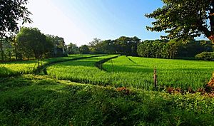
Rice, fruits, corn, vegetables, hogs, cattle, poultry, and freshwater fish are the main farm products. There are about 36 food processing businesses in Santa María. The town also has over 150 poultry and pig farms. This has led to many feed mills and trading centers. There are 20 rice mills in Santa María.
Local Crafts
There are 10 furniture-making businesses in the town.
Shopping and Services
Santa Maria has a public market and several private markets. There is also a mall with a supermarket, department store, cinemas, and restaurants. Convenience stores are also available.
How Santa Maria is Governed
Like other municipalities in the Philippines, Santa Maria has a mayor and vice mayor. They are elected for three-year terms. The mayor leads the town's departments and carries out local laws. The vice mayor leads a council of 10 members. This council creates the town's policies. Santa Maria is part of the 6th District of Bulacan.
Current Leaders
| Position | Name | Party | |
|---|---|---|---|
| Mayor | Bartolome R. Ramos | Lakas | |
| Vice Mayor | Roberto B. Perez | PFP | |
| Councilors | Angelito C. Jacinto | Lakas | |
| Froilan C. Caguiat | PFP | ||
| Mark Angelo R. Clemente | Lakas | ||
| Eresto S. Dela Cruz | Lakas | ||
| Neil B. Mateo | Lakas | ||
| Carl G. Castillo | Lakas | ||
| Esperanza G. Ramos | Lakas | ||
| Rico Jude P. Sto. Domingo | Lakas | ||
| Ex Officio Municipal Council Members | |||
| ABC President | Nonpartisan | ||
| SK Federation President | Nonpartisan | ||
Fun Things to Do
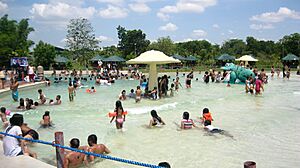
Santa Maria has ten resorts. They are in barangays like Pulong Buhangin and Catmon. These resorts are popular for people from Metro Manila and nearby towns. They offer swimming pools, meeting rooms, hotels, and cottages. In 2005, over 138,000 tourists visited these resorts. Sitio Lucia Resort was the most popular.
Historical Spots
- La Purísima Concepción Parish Church
- Huseng Batute Marker
- Francisco Santiago Marker
Festivals and Celebrations
The town fiesta of Santa Maria celebrates its patroness, the Purisima Concepcion. It is a month-long event in February. The main feast day is on the Thursday after February 2. This celebration shows the town's strong devotion to the Virgin Mary. During February, there are also musical shows, sports events, and concerts. A special root crop called "Tuge" is sold during this time.
Sports and Recreation
The Philippine Arena is a huge indoor stadium in Ciudad de Victoria. It is located in Santa Maria and Bocaue, Bulacan. It can hold up to 55,000 people. It was a major part of the Iglesia ni Cristo's 100th anniversary in 2014.
Popular sports in Santa Maria include basketball, softball, bowling, badminton, tennis, and chess. Basketball courts are found in schools and barangays. There is also a tennis court and a gymnasium named after Ricardo D. Nicolas, Jr.
Getting Around and Services
Bridges
Santa Maria has ten bridges. They cross rivers and other waterways. All bridges are made of strong concrete and are in good condition.
Communication
Communication services in Santa Maria include telegraph, postal system, and telephone companies like PLDT and Digitel. Major cellular companies like Smart Communications, Globe Telecom, and Dito Telecommunity also provide service.
Water and Electricity
The Santa Maria Water District provides water supply. The Manila Electric Company (Meralco) provides electricity to the entire municipality.
Essential Services
Health
Santa Maria has one government hospital and seven private hospitals. There are also veterinary clinics for farm animals and pets. These clinics offer various services, including surgeries and vaccinations.
Safety and Security
Santa Maria is a generally peaceful town. It is served by 51 policemen and 15 firemen. Local volunteers, called barangay tanods, also help keep the peace. Crime rates are low.
Learning in Santa Maria
Santa Maria is part of the Department of Education's Division of Bulacan. There are 32 public elementary schools and 5 public high schools. Many private schools are also in the municipality. For higher education, the Polytechnic University of the Philippines has a campus in Santa Maria.
Famous People from Santa Maria
- José Corazón de Jesús (1896–1932), Huseng Batute – A famous Filipino poet.
- Francisco Santiago (1889–1947), known as the "Father of Kundiman" – A well-known composer.
- Krystal Reyes (born 1996) – A child actress.
- Angel Locsin (born 1985) – An actress, model, and host.
- Alfred Vargas (born 1981) – An actor.
- Maine Mendoza (born 1995), also known as "Yaya Dub" – A popular TV host.
Sister Cities
Santa Maria has a special connection with:
See also
 In Spanish: Santa María (Bulacán) para niños
- Fortunato F. Halili Avenue
- Legislative districts of Bulacan


