Scheduled monuments in Taunton Deane facts for kids
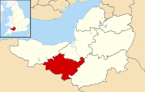
Taunton Deane was a local government area in Somerset, England. It was like a district with its own council, based in Taunton. On April 1, 2019, it joined with West Somerset to create a new, larger area called Somerset West and Taunton.
This district was first formed on April 1, 1974. It brought together the old areas of Taunton, Wellington Urban District, Taunton Rural District, and Wellington Rural District. In 1975, Taunton Deane was given "borough status." This special status allowed Taunton to keep its traditional mayor, which was a big deal because many other districts didn't have mayors anymore. The name "Taunton Deane" comes from an older local area called the Taunton Deane Hundred.
Contents
What are Scheduled Monuments?
A scheduled monument is a really important old place or object in the UK. It gets special legal protection because it's listed by the government. Think of it like a VIP list for ancient sites! English Heritage helps find these sites. The law that protects them is the Ancient Monuments and Archaeological Areas Act 1979.
The word "monument" doesn't just mean a statue. It can be any archaeological site, even if you can't see it above ground. These sites must have been built by people. They can be anything from very old prehistoric standing stones and burial places, to Roman ruins, and Medieval buildings like castles and monasteries. Even more recent places, like old industrial sites or buildings from the World Wars, can be scheduled monuments.
Ancient Wonders of Taunton Deane
Taunton Deane has 33 scheduled monuments. Many of these are from the Neolithic (New Stone Age), Bronze Age, and Iron Age. These include ancient burial mounds called bowl barrows and cairns (piles of stones). There are also hill forts, which were old fortified settlements, like Norton Camp.
Castle Neroche was an Iron Age hill fort that was later used as a Norman motte-and-bailey castle. This means it had a raised mound (motte) with a wooden or stone tower, and a walled courtyard (bailey).
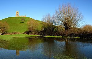
Burrow Mump also shows signs of Roman use, but it's mostly known as a Norman motte-and-bailey castle. Later, a church was built there. In 1946, a man named Major Alexander Gould Barrett gave Burrow Mump to the National Trust. It became a special memorial for the 11,281 brave men from Somerset who lost their lives in World War I and World War II.
Medieval and More Recent Sites
The Middle Ages are shown through several old churchyard crosses. Part of Taunton Castle is also a scheduled monument. This castle has Anglo-Saxon beginnings and was made bigger during the Medieval and Tudor times.
More recent protected sites include Poundisford Park, Buckland Priory, Bradford Bridge, and even a duck decoy from the 17th century. A duck decoy was a special pond used to catch ducks. Some sites, like Balt Moor Wall, are so old that their exact date is a mystery!
The newest monuments are from World War II. These include air traffic control buildings, pillboxes (small concrete forts), and fighter pens (shelters for fighter planes) from RAF Culmhead. This old air base is located at Churchstanton in the Blackdown Hills.
Important Scheduled Monuments in Taunton Deane
Here are some of the interesting scheduled monuments you can find in the Taunton Deane area:
Balt Moor Wall
- Location: Lyng
- Type: Earthwork (a structure made of earth)
- When it was built: Possibly in the 9th century, or before 1135.
- What it is: This is a 550-meter long section of an old medieval pathway. It's now a raised bank, about 6 to 10 meters wide and up to 2 meters high.
Borough Bank
- Location: Taunton
- Type: Earthwork
- When it was built: During the Middle Ages.
- What it is: These are the remains of Taunton's medieval town walls. It's now a bank and ditch, about 2 meters high and 3.5 meters wide.
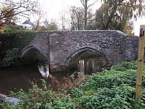
Bradford Bridge
- Location: Bradford on Tone
- Type: Bridge
- When it was built: 14th century.
- What it is: This is a stone bridge from the 15th century with two arches. It carries a road over the River Tone.
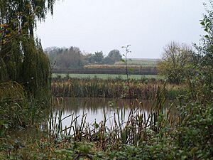
Buckland Priory Fishponds
- Location: Durston
- Type: Fish pond
- When it was built: 12th century.
- What it is: This area, about 150 meters by 61 meters, has the remains of three fishponds. They were likely dug in the 13th century and were filled in by 1725.
Burrow Mump Castle
- Location: Burrowbridge
- Type: Motte-and-bailey castle
- When it was built: Norman period.
- What it is: This site is on a hill where the River Tone and the old River Cary meet the River Parrett. It's high above the flat Somerset Levels. Experts think it was a Norman motte castle, possibly built between 1135 and 1153. A medieval church was also built here. The hill and its ruined church were given to the National Trust in 1946 as a memorial for soldiers from Somerset who died in the World Wars.
Castle Neroche
- Location: Curland
- Type: Hill fort
- When it was built: Iron Age, reused in the Norman period.
- What it is: This is a Norman motte-and-bailey castle built on top of an even older Iron Age hill fort. It was probably built by Robert, Count of Mortain in the 11th century.
King's Castle Hillfort
- Location: Wiveliscombe
- Type: Hill fort
- When it was built: Neolithic (New Stone Age).
- What it is: King's Castle is a Neolithic hillfort. It has two banks with a ditch in between them. The inner wall is up to 2.5 meters high, and the outer wall is up to 1.5 meters high. Tools like arrowheads and scrapers have been found here.
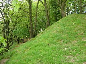
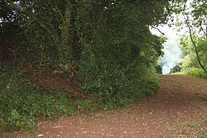
Norton Camp Hillfort
- Location: Norton Fitzwarren
- Type: Hill fort
- When it was built: Bronze Age.
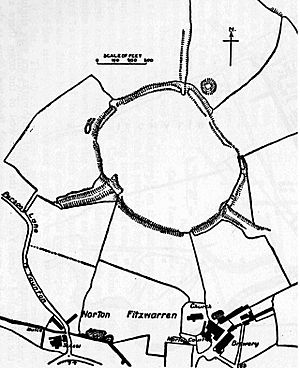
- What it is: This earthwork is a single circular rampart (wall) up to 3 meters high. It has three entrances. The fort is about 250 meters across and covers 5 hectares (about 12 acres). It's on a low hill about 1 kilometer north of the River Tone. This site is currently on the Heritage at Risk Register, meaning it needs special care.
Poundisford Park Pale
- Location: Pitminster
- Type: Deer park
- When it was built: Middle Ages.
- What it is: This is the old boundary of a deer park around Poundisford Park. The park used to cover about 180 hectares (445 acres). The "park pale" was a barrier, like an earthen bank, built to keep deer inside. It was 4 to 7 meters wide and up to 2 meters high. This site is also on the Heritage at Risk Register.
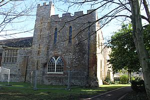
Taunton Castle
- Location: Taunton
- Type: Shell keep castle
- When it was built: 13th century (but has older parts).
- What it is: Taunton Castle started in the Anglo-Saxon period and was later a priory. The Normans then built a stone castle, which belonged to the Bishops of Winchester. The buildings you see today have been rebuilt a lot. The inner part now holds the Museum of Somerset and the Somerset Military Museum.
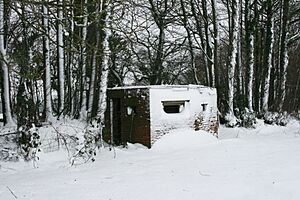
World War II Defences at RAF Culmhead
- Location: Churchstanton
- Type: Pillbox, Air traffic control tower, Blast pen
- When it was built: 1941.
- What it is: These are remains of the old RAF Culmhead airfield from World War II. They include:
- Two groups of pillboxes that protected the airfield.
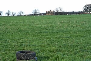
- Two air traffic control buildings, including the "Old Watch Office."
- A group of blast pens, which were shelters built to protect fighter aircraft during the war.
 | Charles R. Drew |
 | Benjamin Banneker |
 | Jane C. Wright |
 | Roger Arliner Young |


