Sgùrr nan Clach Geala facts for kids
Quick facts for kids Sgùrr nan Clach Geala |
|
|---|---|

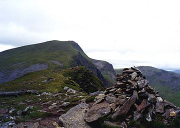
Sgùrr nan Clach Geala seen from the cairn on Sgùrr nan Each, two km to the south.
|
|
| Highest point | |
| Elevation | 1,093 m (3,586 ft) |
| Prominence | 228 m (748 ft) |
| Listing | Munro, Marilyn |
| Naming | |
| English translation | Peak of the White Stones |
| Language of name | Gaelic |
| Geography | |
| Location | Ross and Cromarty, Highland, Scotland |
| Parent range | Fannichs, Northwest Highlands |
| OS grid | NH184715 |
| Topo map | OS Landranger 20, OS Explorer 436 |
Sgùrr nan Clach Geala is a mountain in Scotland. It is located about 28 kilometres (17 miles) south-southeast of Ullapool. This mountain is in the Highland area, specifically in Ross and Cromarty. Sgùrr nan Clach Geala is one of ten Munros found in the Fannichs mountain range.
Contents
What is Sgùrr nan Clach Geala?
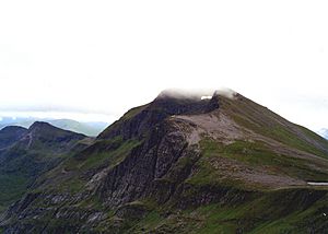
Sgùrr nan Clach Geala is 1093 metres (3586 feet) tall. It is the second highest peak in the Fannichs. Only Sgùrr Mòr is taller. Many people think it is the most impressive mountain in the group. It has a beautiful east-facing corrie (a bowl-shaped valley) and sharp, pointed ridges.
Where is the mountain located?
The mountain is not easy to see from main roads. It sits deep within the Fannichs. It is about eight kilometres (five miles) from the A832 road to the south. The best views are from other nearby mountains. You can see its eastern cliffs very well from Sgùrr Mòr. The name "Sgùrr nan Clach Geala" comes from Gaelic. It means "Peak of the White Stones." This name refers to some light-coloured quartzite rocks near the top.
Exploring the Mountain's Features
Sgùrr nan Clach Geala is part of a north-south ridge. This ridge also includes two other Munros: Meall a' Chrasgaidh and Sgùrr nan Each.
What are the ridges like?
The mountain's north ridge might look tricky from far away. It has rocky sections that can offer a bit of scrambling. However, there are no real dangers. Any difficult spots can be easily avoided. This northern ridge goes down to a col (a low point between two peaks). This col is 819 metres (2687 feet) high and is called Am Biachdaich. Its name means "The Feeding Place." This is because deer often feed on the rich grass there. From this col, you can climb Meall a' Chrasgaidh and Sgùrr Mòr. A small lochan (a small lake) is also found on the col. The southern ridge of Sgùrr nan Clach Geala connects to Sgùrr nan Each. This peak is less than two kilometres away. It is reached by crossing another col, which is 815 metres (2674 feet) high.
What about the cliffs and water?
The western slopes of the mountain are mostly grassy. They have a few rocky areas as they drop down to the Allt Breabaig valley. The most striking feature is its eastern cliffs. These are the highest cliffs in the Fannichs. They drop 400 metres (1312 feet) into Coire Mòr. These Schist cliffs are popular for winter ice climbing. There are about 20 known climbing routes there. Some famous ones include Skyscraper Buttress and Gamma Gully.
Water from the mountain flows to both sides of Scotland. Rain from the west and north slopes goes into the River Broom. It then flows into Loch Broom and reaches the west coast at Ullapool. Water from the south and east slopes flows south to Loch Fannich. This water eventually reaches the east coast at the Cromarty Firth.
How to Climb Sgùrr nan Clach Geala
The most common way to climb Sgùrr nan Clach Geala starts from the north. You can park on the A832 road at grid reference NH162760. From there, climbers usually first go up the nearby Munro, Meall a' Chrasgaidh. After that, they continue to Sgùrr nan Clach Geala.
What is at the summit?
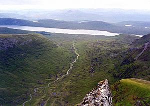
Most hikers will then go south from the summit to climb Sgùrr nan Each. They then return to their starting point by following the Allt Breabaig. At the very top of Sgùrr nan Clach Geala, you can find what is left of a trig point. A trig point is a marker used for surveying. This one has been damaged, with only about a quarter of it remaining. The eastern cliffs drop sharply into Coire Mòr right from the summit. From the top, you can see almost all the other Fannichs mountains. It is a great spot to understand the area's geography. There is also an amazing view of An Teallach, which is 18 kilometres (11 miles) to the north-west. The valley of the Allt a' Choire Mhoir looks impressive to the south as it flows down to Loch Fannich.
 | Kyle Baker |
 | Joseph Yoakum |
 | Laura Wheeler Waring |
 | Henry Ossawa Tanner |


