Silverhorn Mountain facts for kids
Quick facts for kids Silverhorn Mountain |
|
|---|---|

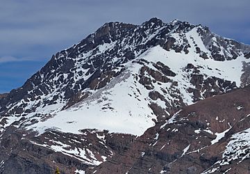
Silverhorn Mountain, south aspect
|
|
| Highest point | |
| Elevation | 2,911 m (9,551 ft) |
| Prominence | 168 m (551 ft) |
| Parent peak | Observation Peak (3174 m) |
| Listing | Mountains of Alberta |
| Geography | |
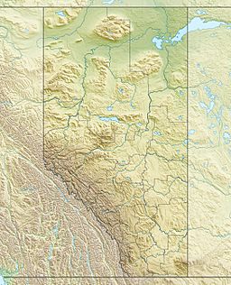
| Location | Banff National Park Alberta, Canada |
| Parent range | Murchison Group Canadian Rockies |
| Topo map | NTS 82N/16 |
| Geology | |
| Age of rock | Cambrian |
| Type of rock | Sedimentary |
| Climbing | |
| Easiest route | Scrambling |
Silverhorn Mountain is a tall peak in Banff National Park, Canada. It stands about 2,911 meters (9,551 feet) high. You can find it in the Mistaya River valley, which is part of the Canadian Rockies in Alberta.
It's located near other big mountains like Mount Weed and Observation Peak. From the Icefields Parkway, a famous road, you can see Silverhorn Mountain and Mount Patterson clearly across the valley.
Contents
Mountain's History
How Silverhorn Got Its Name
Silverhorn Mountain received its name in 1899. A person named Rev. Charles Lathrop Noyes gave it this descriptive name. He was a member of the Appalachian Mountain Club.
Noyes was a keen climber who explored the Canadian Rockies. He was the first to climb several mountains, including Mount Balfour and Mount Gordon. The name "Silverhorn" became official in 1924. This was decided by the Geographical Names Board of Canada.
Mountain's Geology
How Silverhorn Mountain Formed
Like other mountains in Banff National Park, Silverhorn Mountain is made of sedimentary rock. This type of rock forms from layers of sand, mud, and tiny bits of sea creatures. These layers were laid down over millions of years.
The rocks in Silverhorn Mountain formed during ancient times. This period stretches from the Precambrian to the Jurassic eras. These rocks were once at the bottom of shallow seas.
Later, a huge event called the Laramide orogeny happened. During this time, powerful forces pushed the Earth's crust. This caused the sedimentary rock layers to fold and lift up. They were pushed east and even over younger rock layers. This process created the tall mountains we see today.
Mountain's Climate
Weather at Silverhorn Mountain
Silverhorn Mountain has a subarctic climate. This means it has very cold, snowy winters. The summers are usually mild. Temperatures can drop below -20 °C (-4 °F). With wind, it can feel even colder, sometimes below -30 °C (-22 °F).
Water from melting snow and rain flows off the mountain. This water either goes west into the Mistaya River. Or it flows east into Dolomite Creek. Dolomite Creek then joins the Siffleur River.


