Sleaford Navigation facts for kids
Quick facts for kids Sleaford Navigation |
|
|---|---|

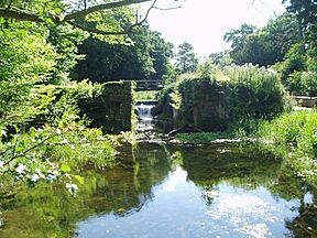
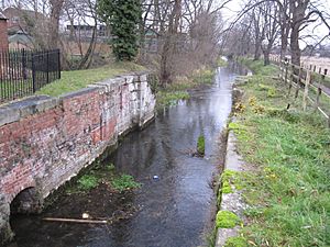
The derelict chamber at Haverholme Lock awaiting restoration
|
|
| Specifications | |
| Maximum boat length | 70 ft 0 in (21.34 m) |
| Maximum boat beam | 15 ft 0 in (4.57 m) |
| Locks | 7 (2 operational) |
| Status | Part operational |
| Navigation authority | none |
| History | |
| Original owner | Sleaford Navigation Co |
| Principal engineer | William Crawley |
| Date of act | 1792 |
| Date of first use | 1794 |
| Geography | |
| Start point | Sleaford |
| End point | Chapel Hill |
| Connects to | River Witham |
The Sleaford Navigation was a special waterway built along the River Slea in Lincolnshire, England. It opened in 1794 and was about 12.5 miles (20.1 km) long. The navigation connected the town of Sleaford to the River Witham near Chapel Hill. Along its path, it had seven locks, which are like water elevators for boats.
The project faced money problems and didn't reach its planned end point. However, it eventually became very successful. But when railways arrived in 1857, the canal quickly lost business. It was officially closed in 1878, though boats could still use parts of it until the 1940s.
People started wanting to bring the canal back to life in 1972. By 1986, about 8 miles (13 km) of the waterway were open again. The Sleaford Navigation Trust is now working to restore the entire canal. In 2004, they even bought the riverbed near Sleaford. A small section in Sleaford reopened in 2010 after a new lift bridge was installed.
Close by, a building called Navigation House used to be the canal's office. It has been restored and is now a visitor center where you can learn about the canal. The old seed warehouse next door is now The National Centre for Craft & Design.
Contents
The River Slea starts west of Sleaford and flows east through the town. It then becomes the Kyme Eau before joining the River Witham. The Kyme Eau part of the river had been used by boats for a very long time, even since the 1300s. But it often got blocked with mud, and its banks were in bad shape.
Important local landowners wanted to make it easier to travel and move goods. In 1783, they planned to make the Slea and Kyme Eau fully navigable. A group was formed to make this happen. They also talked with the people who managed the River Witham to get lower fees for boats using both waterways.
At that time, the River Slea wasn't easy to use past Kyme. There were obstacles like fish weirs and water mills. It took three tries to get a special law, called an Act of Parliament, passed to allow improvements. In 1791, two engineers, William Jessop and John Hudson, surveyed the river. They estimated the work would cost about £9,979. Their plan got support from Sir Joseph Banks, a very influential scientist. Thanks to his help, the fourth attempt to pass the Act was successful.
Starting the Canal Company
The Act was passed on June 11, 1792. It created The Company of Proprietors of the Sleaford Navigation. This company was allowed to build and maintain a waterway from Sleaford Castle Causeway to the River Witham. They could raise £13,000 to pay for the project, with an extra £6,500 if needed. Most of the money came from people living in Lincolnshire, especially Sleaford.
William Cawley was hired as the engineer to oversee the building. Five locks were needed to get past the mills, plus two more locks at Lower Kyme and near Flax Dyke. These locks were built to be wide, about 60 feet (18 m) long and 15 feet (4.6 m) wide. The total drop in water level from Sleaford to the Witham was 42 feet (13 m).
The canal officially opened on May 6, 1794. It was supposed to end at Castle Causeway in Sleaford. However, due to money problems, it stopped a bit short. Instead, the company built a wharf (a loading area for boats) east of what is now Carre Street in Sleaford.
How the Canal Worked
The Sleaford Navigation was quite busy, but the company struggled at first because building costs went over budget. They started paying dividends (money to shareholders) in 1795, but it wasn't regular until 1826. Between 1836 and 1856, the company was doing very well, paying good profits to its owners.
Instead of the company collecting the fees (tolls) from boats, they would rent out this job to toll collectors. For example, in 1816, John Keyworth paid £1,010 to collect tolls. This practice stopped in 1851 when the amount of money coming in started to drop.
There were ideas to make the canal even longer. In 1827, someone suggested extending it west to Wilsford. Six years later, the idea of a 16-mile (26 km) link from Sleaford to Grantham was brought up again. However, none of these extensions were ever built.
The Canal's Decline
In 1857, a railway line opened from Grantham to Sleaford. This line was extended to Boston in 1859. The railway offered direct competition to the canal. The decline of the Sleaford Navigation was very fast. The money it earned fell sharply from £981 in 1858 to just £168 in 1868.
By 1871, the company was losing money. A law to officially abandon the canal was passed on June 17, 1878. However, the navigation didn't fully close until May 14, 1881. The law said the company had to fill in the three locks closest to Sleaford. The next three locks were given to Murray Finch Hatton, who owned nearby Haverholme Priory. He could keep or abandon them. The last lock was given to the River Witham commissioners.
Even though it was officially closed, parts of the canal remained usable. The lower 6.5 miles (10.5 km) of the navigation stayed open for boats until the 1940s. Then, Lower Kyme lock was replaced by a sluice (a gate to control water flow), which stopped boats from passing.
Bringing the Canal Back to Life
In 1972, a book called Lost Canals of England and Wales inspired many people to restore old waterways. This included the Sleaford Navigation. The Sleaford Civic Society first focused on the canal's end in Sleaford. Then, in 1977, the Sleaford Navigation Society was formed. Their bigger goal was to restore the entire canal.
The society got support from the Anglian Water Authority in 1980. This led to the restoration of the Kyme Eau lock, which reopened in November 1986. With a low footbridge raised and a turning point for boats built at South Kyme, the first 8 miles (13 km) of the waterway were open again. Work on Cobblers lock began in 1991 and finished by 1994, though it still needs gates.
In 1997, a new group called the Sleaford Navigation Trust was created to lead the restoration. The Trust has worked hard to save and restore the canal's old buildings. They successfully stopped the Navigation Warehouse from being torn down in 1998. The local council helped fund the restoration of the warehouse and the old canal offices in 2002. The old seed warehouse is now part of The Hub, which houses The National Centre for Craft and Design.
In 2004, the Navigation Trust bought the riverbed between Carre Street in Sleaford and Bone Mill. This included the lock at Cogglesford Mill. Lower Kyme lock was updated in 2008. New lock gates and an easier-to-use system were installed.
About 0.6 miles (1 km) of the waterway from Sleaford to Cogglesford Mill lock reopened after a new lifting bridge was built in the town center. This bridge was installed in late 2008 and started working in January 2010. A new slipway was also built on Eastgate Green. This allows boats on trailers to be launched onto the town section of the canal. The official opening of the new bridge and facilities happened on July 3, 2010.
Journey Along the Canal

The canal starts at Navigation Yard, near Sleaford town center. Navigation House, the old clerk's home, is now a Grade II listed building. It has been restored and is a visitor center where you can learn about the canal's history. The Sleaford Navigation Trust owns the River Slea between Navigation Yard and Bone Mill lock.
A short distance from the start, a new steel lift bridge crosses the canal. The first lock is about 0.6 miles (1 km) from Sleaford. This lock allowed boats to pass Coggesford Mill, an old watermill from the 1700s that still grinds flour today. The railway line from Lincoln to Spalding crosses next. Then you reach Dyers Mill or Bone Mill lock, about 1.5 miles (2.4 km) from Sleaford. It is overshadowed by the A17 Sleaford bypass bridge.
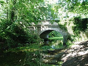
Corn Mill lock is about 2.4 miles (3.9 km) from Sleaford. The buildings of Holdingham Mill are also Grade II listed. They include a small, six-sided toll house where the lock keeper worked. Next is Paper Mill lock. After this, the canal turns more to the east and reaches Haverholme lock after about 3.5 miles (5.6 km). Nearby are the ruins of Haverholme Priory. The bridge over the canal here, built in 1893, is also a listed building.
At about 4.7 miles (7.6 km), you reach Cobblers lock. This has been the end of the navigable part of the canal since 1986. Just past it, the canal makes a sharp bend around Ewerby Waithe Common. Then there's another sharp bend by Ferry Farm, where Ferry Bridge crosses the canal. A short distance further, there's a bend called Heckington Tunnel. Here, a section of the Car Dyke, an old Roman waterway, goes off to the south.
Somewhere along this stretch, the river's name changes from the Slea to the Kyme Eau. The village of South Kyme follows, with its tall, fortified tower built in the 1300s. It is 77 feet (23 m) high and used to be surrounded by a moat. Two road bridges and a footbridge cross the canal in the village.
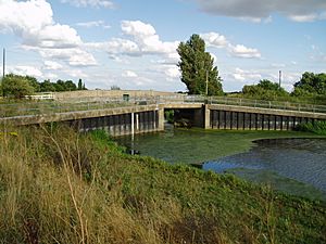
After passing Terry Booth Farm, Lower Kyme lock is reached, about 10.6 miles (17.1 km) from Sleaford. The Twenty Foot Drain joins the river here. The river then makes another sharp turn to the east to reach flood doors and Chapel Hill bridge. Beyond this is the River Witham, which flows southeast towards Boston.
Places of Interest Along the Canal
| Point | Coordinates (Links to map resources) |
OS Grid Ref | Notes |
|---|---|---|---|
| Chapel Hill flood doors | 53°04′13″N 0°11′57″W / 53.0702°N 0.1991°W | TF207540 | Where the canal meets the River Witham |
| Lower Kyme lock | 53°03′18″N 0°12′58″W / 53.0550°N 0.2160°W | TF196523 | |
| South Kyme | 53°01′50″N 0°15′06″W / 53.0306°N 0.2517°W | TF173495 | A village along the canal |
| Cobblers lock | 53°01′59″N 0°19′11″W / 53.0330°N 0.3198°W | TF127497 | |
| Haverholme lock | 53°01′53″N 0°21′15″W / 53.0315°N 0.3541°W | TF104495 | |
| Paper Mill lock | 53°01′20″N 0°22′46″W / 53.0223°N 0.3794°W | TF087484 | |
| Corn Mill lock | 53°01′04″N 0°22′43″W / 53.0179°N 0.3785°W | TF088479 | |
| Bone Mill lock | 53°00′37″N 0°23′07″W / 53.0104°N 0.3852°W | TF084471 | |
| Coggeshall Mill lock | 53°00′06″N 0°23′58″W / 53.0018°N 0.3994°W | TF075461 | |
| Canal Head | 52°59′54″N 0°24′24″W / 52.9983°N 0.4067°W | TF070457 | The current end of the canal |
| Castle Causeway | 52°59′50″N 0°25′00″W / 52.9971°N 0.4166°W | TF063455 | The original planned end of the canal |
 | James Van Der Zee |
 | Alma Thomas |
 | Ellis Wilson |
 | Margaret Taylor-Burroughs |


