Slight Side facts for kids
Quick facts for kids Slight Side |
|
|---|---|

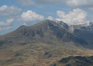
Slight Side (left of picture) seen from the south-east.
|
|
| Highest point | |
| Elevation | 762 m (2,500 ft) |
| Prominence | 14 m (46 ft) |
| Parent peak | Sca Fell |
| Listing | Wainwright |
| Geography | |
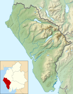
| Location | Cumbria, England |
| Parent range | Lake District, Southern Fells |
| OS grid | NY209050 |
| Topo map | OS Landranger 89 OS Explorer OL6 |
Slight Side is a mountain, also called a fell, in the amazing Lake District in England. It stands about 25 kilometers (15 miles) southeast of the town of Whitehaven. This mountain reaches a height of 762 meters (2,499 feet).
Slight Side is located on the southwestern edge of the Scafell Massif. This "massif" is a group of high mountains that stretches for about four kilometers. It includes the highest land in all of England! The name "Slight Side" comes from the Old Norse language. It means "The mountain pasture with flat fields." A "shieling" was a small hut or a summer pasture used by shepherds.
What Slight Side Looks Like
When you look at Slight Side from the Eskdale valley, it seems like its own mountain. But it's actually the end point of Scafell's southern ridge. From there, the land drops steeply down to Eskdale.
Slight Side is only 14 meters (46 feet) lower than Scafell. This small difference means it doesn't quite count as a separate "Nuttall" or "Hewitt" mountain. These are special lists of mountains based on their height and how much they stand out. However, Alfred Wainwright, a famous fell walker, did list Slight Side as a separate fell in his guidebooks.
The sides of Slight Side are steep and rocky. The only exception is to the north, where the ridge connects to Scafell. The eastern side slopes down to the young River Esk. The western slopes go across Eskdale Fell towards Burnmoor Tarn. Horn Crag is a rocky point south of the summit, looking over Eskdale.
Just under a kilometer (half a mile) north of the summit is Long Green. This area is the top of Cam Spout Crags. Sometimes, from a distance, Long Green can look like the actual summit of Slight Side. Cam Spout Crag is a place where people go rock climbing. It has 12 different climbs, including Cam Spout Buttress.
How to Climb Slight Side
One way to climb Slight Side is from Eskdale. Many people combine this climb with a trip to Scafell, and sometimes even Scafell Pike. You can start your climb from the small village of Boot.
The path goes past Eel Tarn and Stony Tarn. Then, you cross some rocky ground to climb the wide ridge up to the summit. Scafell is two kilometers (1.2 miles) north of Slight Side. To reach Scafell, you need to climb another 230 meters (755 feet) higher. If you are already coming down from Scafell, you can easily visit Slight Side on your way to Eskdale. This is called "bagging" a peak.
The Summit View
The top of Slight Side is a beautiful rocky peak. Alfred Wainwright even called it one of the six best summits in the Lake District. He described it as "rocky, shapely and well defined." He also said you can only reach it with "a rough final scramble." The best part of the view from the summit is looking west towards the sea.
 | Selma Burke |
 | Pauline Powell Burns |
 | Frederick J. Brown |
 | Robert Blackburn |


