South Crocker Mountain facts for kids
Quick facts for kids South Crocker Mountain |
|
|---|---|

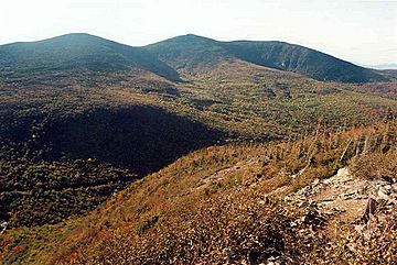
South Crocker (left) seen from the AT
|
|
| Highest point | |
| Elevation | 4,052 ft (1,235 m) |
| Prominence | 361 ft (110 m) |
| Listing | New England 4000 footers |
| Geography | |
| Topo map | USGS Black Nubble |
South Crocker Mountain is a cool mountain found in Franklin County, Maine. It stands tall at about 4,052 feet (1,235 meters) high! This makes it one of the "New England 4000 footers," which are mountains over 4,000 feet in New England.
South Crocker Mountain has other mountains nearby. To its north, you'll find Crocker Mountain. To its southwest, there's Mount Redington. It's like they're all part of a mountain family!
Contents
Exploring South Crocker Mountain
South Crocker Mountain is a popular spot for hikers. It's especially famous because a very long trail goes right over its top.
Where is South Crocker Mountain?
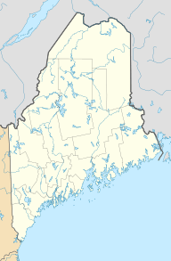
This mountain is located in the state of Maine, in the northeastern part of the U.S.. Maine is known for its beautiful forests and mountains. Franklin County is a rural area with lots of nature to explore.
Water Around the Mountain
Imagine rain falling on South Crocker Mountain. Where does that water go?
- Water from the northeast and southeast sides flows into the Carrabassett River.
- The Carrabassett River then joins the bigger Kennebec River.
- Finally, the Kennebec River carries the water all the way to the Gulf of Maine. This is a part of the huge Atlantic Ocean.
Water from the west side of the mountain takes a different path.
- It flows into a stream called Nash Stream.
- Nash Stream then leads to the South Branch of the Dead River.
- This water eventually reaches Flagstaff Lake, a large lake in Maine.
- From Flagstaff Lake, the water continues into the main Dead River, which also joins the Kennebec River.
So, all the water from South Crocker Mountain eventually makes its way to the Kennebec River and then to the ocean!
The Appalachian Trail
One of the most exciting things about South Crocker Mountain is the Appalachian Trail.
- This trail is super long, about 2,170 miles (3,500 kilometers)!
- It stretches all the way from Georgia in the south to Maine in the north.
- Hikers can walk for months to complete the entire trail.
The Appalachian Trail goes right over the top of South Crocker Mountain.
- If you hike north from the summit, the trail continues along the ridge to Crocker Mountain.
- If you head east, the trail crosses a place called Caribou Valley.
- It then leads towards another famous mountain, Sugarloaf Mountain.
Many people enjoy hiking parts of the Appalachian Trail. It's a great way to see amazing nature and challenge yourself.
 | Shirley Ann Jackson |
 | Garett Morgan |
 | J. Ernest Wilkins Jr. |
 | Elijah McCoy |


