Souther Fell facts for kids
Quick facts for kids Souther Fell |
|
|---|---|

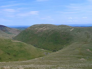
Seen across Mousethwaite Col from Scales Fell on Blencathra.
|
|
| Highest point | |
| Elevation | 522 m (1,713 ft) |
| Prominence | c. 87 m |
| Parent peak | Blencathra |
| Listing | Wainwright |
| Geography | |
| Location | Cumbria, England |
| Parent range | Lake District, Northern Fells |
| OS grid | NY355292 |
| Topo map | OS Landranger 89, 90 OS Explorer OL5 |

Souther Fell is a special kind of mountain, called a fell, located in the beautiful Lake District in England. It sits just south of the village of Mungrisdale in the northern part of the Lake District. Souther Fell is most famous for a strange event. People reported seeing a "spectral army" marching along its top on Midsummer's Day in 1745. No real army was in the area at that time.
Contents
What is Souther Fell Like?
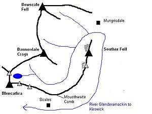
Souther Fell is the eastern end of a larger mountain called Blencathra. It's like a long arm stretching out from Blencathra's main peak. A gentle slope goes down from Scales Fell to a low point called Mousthwaite Comb. This spot is about 1,425 feet (434 meters) high. From there, the ridge turns northeast for two miles, leading to the top of Souther Fell.
How Water Flows Around Souther Fell
Mousthwaite Comb is a very interesting place. The River Glenderamackin flows east from the north side of this low point. But on the south side, the same river flows west! This means the Glenderamackin river actually goes all the way around Souther Fell. It acts like a moat, surrounding the fell on three sides. Mousthwaite Comb is the only dry path connecting Souther Fell to other land. Even this path is almost cut off by a small stream called Comb Beck.
The Sides of the Fell
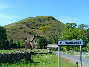
The very northern end of Souther Fell slopes steeply down to the Glenderamackin river. The village of Mungrisdale is just across the river. The eastern sides of the fell are smooth. Farmers use the lower parts for grazing animals. You can find farms like Southernfell and Hazelhurst here. At the southern end, there's a rockier slope called Knotts. This slope goes down towards the main road that connects Keswick and Penrith.
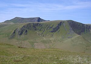
The western side of Souther Fell looks over the valley of the upper Glenderamackin river. From here, you can see Bannerdale Crags. Souther Fell has two main high points. Each one has a patch of loose rocks and stones below it. A small bridge crosses the river just north of Mousthwaite Comb. This is the only easy way to cross the river between Mousthwaite Comb and Mungrisdale village.
The "Spectral Army" Mystery
On the evening of Midsummer's Day in 1745, something truly strange happened on Souther Fell. People saw a long line of soldiers marching, horses, and even carriages moving along the very top of the mountain. The ground there is known to be too steep for such things to move easily. Yet, the procession kept going for several hours. It would appear at one end of the ridge and then disappear at the other.
Witnesses and Explanations
Twenty-six serious and respected people gathered to watch this amazing sight. They later swore under oath that they had seen it. The next day, people climbed Souther Fell. They looked for signs of the army, but not a single footprint was found on the soft ground of the ridge.
Scientists have tried to explain this mystery. One idea is that it was a type of mirage. This is when light bends and makes distant objects appear in a different place. Perhaps it was a reflection of Bonnie Prince Charlie's army. His army was exercising on the Scottish coast that very day. Another idea suggests that the sighting was actually smoke from German bonfire rituals. Over time, this smoke might have been mistaken for an army. The story then grew as it was told and retold in newspapers.
Reaching the Top of Souther Fell
Souther Fell has two main high points, but the one to the northeast is the true summit. It's about 30 feet (9 meters) higher than the southern top. A small pile of stones, called a cairn, marks the very top.
Views from the Summit
Because Souther Fell is the last of the Northern Fells in this direction, you get an amazing view. You can see all the way across to the Pennines mountains without anything blocking your sight. If you look towards the Lakeland area, you can see parts of Great Gable, the Scafells, and the nearby Helvellyn range. You can also spot some of the Far Eastern Fells.
How to Climb Souther Fell
There are a few ways to climb Souther Fell. From Scales, a village on the A66 road, you can walk up a path called Comb Gill to Mousthwaite Comb.
Wainwright, a famous fell walker, suggested a direct path from Mungrisdale village. This path goes across the fields behind the Mill Inn. However, Birkett, another expert, points out that this is not a public path. He suggests taking a different route that goes a bit further south.
 | Selma Burke |
 | Pauline Powell Burns |
 | Frederick J. Brown |
 | Robert Blackburn |


