Spotswood, New Jersey facts for kids
Quick facts for kids
Spotswood, New Jersey
|
||
|---|---|---|
|
Borough
|
||
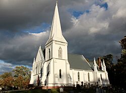
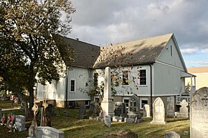
St. Peter's Church
|
||
|
||
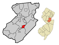
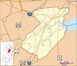
Location of Spotswood in Middlesex County highlighted in red (left). Inset map: Location of Middlesex County in New Jersey highlighted in orange (right).
|
||
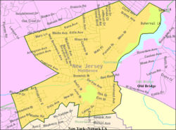
Census Bureau map of Spotswood, New Jersey
|
||
| Country | ||
| State | ||
| County | Middlesex | |
| Incorporated | May 12, 1908 | |
| Government | ||
| • Type | Faulkner Act (mayor–council) | |
| • Body | Borough Council | |
| Area | ||
| • Total | 2.42 sq mi (6.27 km2) | |
| • Land | 2.31 sq mi (5.99 km2) | |
| • Water | 0.11 sq mi (0.28 km2) 4.46% | |
| Area rank | 380th of 565 in state 20th of 25 in county |
|
| Elevation | 36 ft (11 m) | |
| Population
(2020)
|
||
| • Total | 8,163 | |
| • Estimate
(2023)
|
8,078 | |
| • Rank | 288th of 565 in state 20th of 25 in county |
|
| • Density | 3,538.4/sq mi (1,366.2/km2) | |
| • Density rank | 191st of 565 in state 15th of 25 in county |
|
| Time zone | UTC−05:00 (Eastern (EST)) | |
| • Summer (DST) | UTC−04:00 (Eastern (EDT)) | |
| ZIP Code |
08884
|
|
| Area code(s) | 732 | |
| FIPS code | 3402369810 | |
| GNIS feature ID | 0885405 | |
| Website | ||
Spotswood is a small town, called a borough, located in Middlesex County, New Jersey. It sits in the middle of the Raritan Valley region. Two brooks, the Manalapan Brook and Matchaponix Brook, meet here to form the South River. This river then flows into the Raritan River.
In 2020, about 8,163 people lived in Spotswood.
Contents
Spotswood's Story: A Look Back in Time
Spotswood was first settled in 1685 by James Johnston. He named it "Spottiswoode" after his home in Scotland. Sometimes, people spelled it "Spottswood."
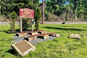
In 1816, a stagecoach route called the Bordentown and South Amboy Turnpike was built. It passed right through Spotswood. Later, in 1832, the Camden and Amboy Railroad followed this same route. The famous John Bull train once ran on this railroad. You can find a memorial to the railroad near East Spotswood Park.
Spotswood officially became a borough on April 15, 1908. This happened after people voted for it on May 12, 1908. It was formed from parts of East Brunswick Township.
Where is Spotswood? Geography Basics
Spotswood covers a total area of about 2.42 square miles (6.27 square kilometers). Most of this is land, about 2.31 square miles (5.99 square kilometers). A smaller part, about 0.11 square miles (0.28 square kilometers), is water.
Spotswood shares its borders with several other towns in Middlesex County. These include East Brunswick, Helmetta, Monroe Township, and Old Bridge Township.
Who Lives in Spotswood? Population Facts
| Historical population | |||
|---|---|---|---|
| Census | Pop. | %± | |
| 1910 | 623 | — | |
| 1920 | 704 | 13.0% | |
| 1930 | 921 | 30.8% | |
| 1940 | 1,201 | 30.4% | |
| 1950 | 2,325 | 93.6% | |
| 1960 | 5,788 | 148.9% | |
| 1970 | 7,891 | 36.3% | |
| 1980 | 7,840 | −0.6% | |
| 1990 | 7,983 | 1.8% | |
| 2000 | 7,880 | −1.3% | |
| 2010 | 8,257 | 4.8% | |
| 2020 | 8,163 | −1.1% | |
| 2023 (est.) | 8,078 | −2.2% | |
| Population sources: 1910–1920 1910 1910–1930 1940–2000 2000 2010 2020 |
|||
The population of Spotswood was 8,257 people in 2010. By 2020, it had slightly decreased to 8,163 people.
In 2010, most residents were White. There were also Black, Asian, and Hispanic or Latino people living in the borough. About 21% of the population was under 18 years old. The average age was about 43.5 years.
Fun and Games: Parks and Recreation
Spotswood has several places for fun and exercise. You can find tennis courts on Summerhill Road. There are also parks located on Rieder Road, Mundy Avenue, Michael Road, and East Spotswood.
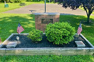
At East Spotswood Park, there is a special memorial. It honors those who served in World War Two.
Learning in Spotswood: Schools and Education
The Spotswood Public Schools educate students from pre-kindergarten all the way through twelfth grade. In the 2020–21 school year, about 1,610 students attended the four schools in the district.
The schools are:
- G. Austin Schoenly Elementary School (PreK–1)
- E. Raymond Appleby Elementary School (grades 2–5)
- Spotswood Memorial Middle School (grades 6–8)
- Spotswood High School (grades 9–12)
Students from the nearby town of Helmetta also attend schools in Spotswood. Students from Milltown go to Spotswood High School.
There is also a private school, Immaculate Conception School. It serves students from kindergarten to 8th grade. It is part of the Roman Catholic Diocese of Metuchen.
Getting Around: Transportation in Spotswood
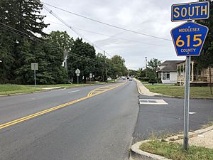
Spotswood has about 29.51 miles of roads. Most of these roads are maintained by the borough itself.
The main roads passing through Spotswood are:
- Middlesex County Route 613 (Devoe Avenue / Main Street / Summerhill Road)
- Middlesex County Route 615 (Manalapan Road / Main Street)
These roads connect Spotswood to neighboring towns like Monroe Township, East Brunswick Township, and Helmetta.
Major highways like Route 18 and County Route 527 are very close by. The New Jersey Turnpike (Interstate 95) is also easily reached from Spotswood.
For public transportation, NJ Transit offers bus service. You can take the 138 bus route from Spotswood to the Port Authority Bus Terminal in Midtown Manhattan, New York City.
See also
 In Spanish: Spotswood (Nueva Jersey) para niños
 | Audre Lorde |
 | John Berry Meachum |
 | Ferdinand Lee Barnett |


