
Springdale (Stamford) facts for kids
Quick facts for kids
Springdale
|
|
|---|---|

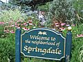
Welcome sign at entrance to railroad station, Hope Street
|
|
| Country | |
| State | |
| County | Fairfield |
| City | Stamford |
| Time zone | UTC-5:00 (Eastern) |
| • Summer (DST) | UTC-4:00 (Eastern) |
| Area code(s) | 203 |
Springdale is a friendly neighborhood located in Stamford, Connecticut. It's in the eastern part of Stamford, near the towns of Darien and New Canaan. Many people love Springdale for its "small town feel," even though it's part of a bigger city.
The main street in Springdale is Hope Street. Here you'll find lots of shops, restaurants, and apartments. A big part of the neighborhood is also next to the New Canaan Branch train line. The area even has its own train stop called Springdale station.
Contents
What's in a Name?
Springdale has been known by its current name since 1868. This name was chosen because of the many local springs and rivers, like the Noroton River, where early European settlers built their homes.
Before "Springdale," the area had some interesting older names. These included "Shittim Plains," "Greedy Ridge," "Black Swamp," and "Broad Brook." There was also a name called "Shino," but no one knows where it came from.
The area also had a name given by Native American tribes. It was recorded in different ways, like "Hequetch" or "Hecwitts." This Native American name was used in official town records until 1870. Local newspapers even used it into the early 1900s. The exact meaning and origin of this name are still a mystery.
Springdale's Past
Early Settlements
According to local history, Europeans first bought the land that includes Springdale in 1640. This land deal covered all of what is now Stamford and some nearby areas. The Springdale area itself was settled by Europeans in 1641.
There were some disagreements about land borders between the European settlers and Native Americans. So, they updated their land agreement in 1655. However, this new agreement didn't have clear details. On January 7, 1667, they signed another treaty. This time, it included specific place names. The treaty officially gave "Hequetch," the Native American name for Springdale, to the European settlers.
After the land rights were clear, many Europeans moved to the area in the early 1700s. Hequetch was mostly a farming area. It had many orchards and cider mills. Farmers grew crops like wheat, oats, and corn. They also harvested oak and walnut trees for wood.
During the Revolutionary War, most people living in Springdale were loyalists. This meant they supported the British King, not the American rebels.
Growing into a Town
The first shop in Springdale opened in 1792. It was a blacksmith shop located on Woodway Road and Hope Street. By 1811, there was also a store in the area known as Shittim Plains.
The mid-1800s brought many important new buildings to Springdale. This happened around the same time the New Canaan Railroad opened. A school was built in 1854 where Springdale Elementary School is today. At that time, this area was called "Shino."
The Methodist Church was built in 1876, and the Episcopal Church in 1868. The train made its first trip from Stamford to New Canaan on July 4, 1868. Around this time, a local post office was set up. This is when the name "Springdale" became the official name for the area.

The city of Stamford wanted to combine many smaller towns in the early 1900s. Springdale, however, resisted this idea until 1949.
The early and mid-1900s saw a big increase in new homes being built. Many of these were Cape Cod style houses.
Starting in the 1980s, many small condominium buildings were constructed along Hope Street. This street is a major business area.
In the early 2000s, parts of Hope Street were changed to encourage different types of buildings. This helped create mixed-use buildings, which have both shops and homes. It also helped reduce too much parking.
Where is Springdale?

Springdale is a neighborhood, so it doesn't have exact borders like a city or town. It's located in the eastern part of Stamford. The heart of Springdale is along Hope Street, where you'll find most of its shops, restaurants, and apartments. Much of the neighborhood also runs alongside the New Canaan Branch of the Metro-North New Haven Line.
The City of Stamford has a "Neighborhood Statistical Area" for Springdale. This area places it north of Glenbrook and Belltown. It's south and east of Turn of River and Newfield, and east of Ridgeway and Bulls' Head. To its east is northern Darien.
Some people also think of Springdale as being just east of Belltown. The area of Springdale is mostly hilly.
People of Springdale
It can be tricky to get exact numbers for Springdale's population because its borders aren't fixed. In 2013, The New York Times suggested about 12,000 people lived there. However, the City of Stamford's "Neighborhood Statistical Area" estimated a population of 8,021 between 2015 and 2019.
The city's report also shares information about the people living in Springdale:
- About 62.3% are non-Hispanic White.
- About 8.9% are non-Hispanic Asian.
- About 6.9% are non-Hispanic Black.
- About 2.8% are non-Hispanic people of another race.
- About 19.1% are Hispanic.
Springdale's Economy
Most of Springdale's businesses and industries are located along its eastern border. This includes Hope Street and the area near the New Canaan Branch train line.
In 2019, the city's report for Springdale showed an average income per person of $47,223. This was lower than the average for all of Stamford, but still higher than the average for Connecticut. The report also noted an unemployment rate of 9.2%. This was the second highest in Stamford and higher than the city and state averages.
The report also found that 48.4% of Springdale residents aged 25 and older have a bachelor's degree or higher. This is similar to the city average and a bit higher than the state average.
Some universities, like Sacred Heart University and the University of Bridgeport, have held classes in rented spaces near Springdale station. The Riverbend Office Park and Omega Engineering Inc. are also located near the train station.
Fun and Games
Springdale has a great park with a playground. It also has a Little League field with lights for night games. This field has become one of the best Little League fields in all of Connecticut. It often hosts special "All-Star" Little League games for teams from all over the region.
Cool Places to See

- Scofield-Hoyt farmhouse: This historic house on Eden Road was built in 1868. It was part of a large farm. Some original parts of the house still remain, like the old wooden frame, windows, and stone walls.
- State Cinema: A local movie theater where you can catch the latest films.
- Twin Rinks ice rinks: This place has two large ice rinks, perfect for ice skating or hockey. You can find it at 1063 Hope Street.
Getting Around
The neighborhood is served by the Springdale station. This train station is on the New Canaan Branch of the Metro-North New Haven Line. It makes it easy for people to travel to and from Springdale.
Images for kids
-
Welcome sign at entrance to railroad station, Hope Street
-
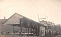
Springdale station, sometime between 1907 and 1915
-
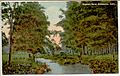
Noroton River, about 1911
-
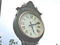
Pedestal clock at entrance to railroad station, Hope Street ("EST. 1868" when station opened)
