St. Joseph, Missouri facts for kids
Quick facts for kids
St. Joseph, Missouri
|
|||||
|---|---|---|---|---|---|
|
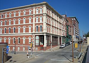
Downtown St. Joseph, the Missouri River, and the Pony Express Bridge viewed from King Hill
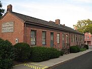
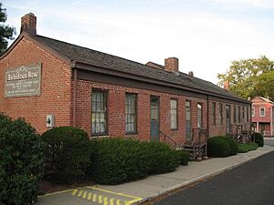
Robidoux Row
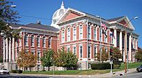
Buchanan County Courthouse
Missouri Western State University
|
|||||
|
|||||
| Nickname(s):
St. Joe; The City Worthwhile
|
|||||
| Motto(s):
"Where the Pony Express started and Jesse James ended."
|
|||||
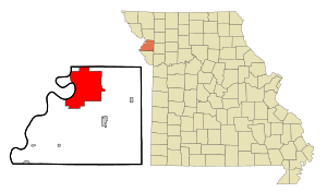
Location of St. Joseph in Missouri
|
|||||
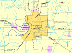
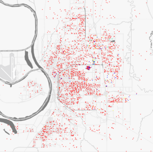
US Census map
|
|||||
| Country | United States | ||||
| State | Missouri | ||||
| County | Buchanan, Andrew | ||||
| Incorporated | 1843 | ||||
| Named for | Joseph Robidoux IV and Saint Joseph | ||||
| Area | |||||
| • Total | 44.82 sq mi (116.09 km2) | ||||
| • Land | 44.04 sq mi (114.05 km2) | ||||
| • Water | 0.79 sq mi (2.04 km2) | ||||
| Elevation | 889 ft (271 m) | ||||
| Population
(2020)
|
|||||
| • Total | 72,473 | ||||
| • Density | 1,645.77/sq mi (635.43/km2) | ||||
| Demonym(s) | St. Josephian | ||||
| Time zone | UTC−6 (CST) | ||||
| • Summer (DST) | UTC−5 (CDT) | ||||
| ZIP Code |
64501-64508
|
||||
| Area codes | 816, 975 | ||||
| FIPS code | 29-64550 | ||||
| GNIS feature ID | 2396498 | ||||
St. Joseph is a city in Missouri, United States. It is located on the Missouri River. The city is found in both Andrew and Buchanan counties. It is also the main city of the St. Joseph area, which includes counties in Missouri and Kansas.
In 2020, St. Joseph had about 72,473 people. This makes it the 8th largest city in Missouri. It is about 30 miles north of Kansas City, Missouri. The city was named after its founder, Joseph Robidoux IV, and the biblical Saint Joseph. St. Joseph is home to Missouri Western State University. It is famous for being the starting point of the Pony Express. It is also where the famous outlaw Jesse James died.
Contents
History of St. Joseph
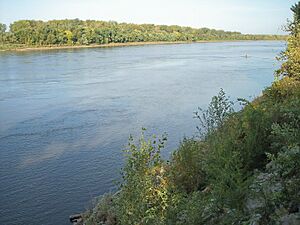
St. Joseph was started by Joseph Robidoux IV. He was a fur trader from French Canadian background. The city officially became a town in 1843. In its early days, it was a busy place on the edge of the frontier. It was the last stop for supplies for people traveling west.
St. Joseph was the westernmost point in the United States that you could reach by train. This was true until after the American Civil War. The main streets downtown were named after Robidoux's eight children.
Many people called the city "St. Joe." It was a "jumping-off point" for pioneers. These were people moving to the Oregon Territory in the mid-1800s. Pioneers would stop in cities like St. Joseph to buy supplies. Then, they would travel in wagon trains across the Great Plains. The town was a very lively place back then.
The Pony Express and Jesse James
From April 1860 to October 1861, St. Joseph was a key location for the Pony Express. This service delivered mail quickly across areas where there were no train tracks yet. Today, the Pony Express Museum is in the old stables of the company. St. Joseph is known by its slogan: "Where the Pony Express started and Jesse James ended."
The main hotel in town was Patee House. After the Civil War, it was used as a college for women.
The famous outlaw Jesse James lived here using the name "Mr. Howard." On April 3, 1882, he was killed in his home. His home has been moved next to the Patee House. You can still see the bullet hole from the shot that killed him. It is now the Jesse James Home Museum.
The Heaton-Bowman-Smith Funeral Home has a small museum about Jesse James. Their earlier company handled his funeral.
Early City Life
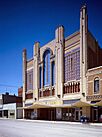
St. Joseph was the second city in the U.S. to have electric streetcars. They started running on July 4, 1888. Many historic buildings are still here. These include Robidoux Row, which belonged to the city's founder. The Patee House is now a museum about St. Joseph's history. The Missouri Theatre is a beautiful old movie theater.
The city's population grew a lot by 1900. Some people think the count was too high. At that time, St. Joseph had big companies. These included the Nave & McCord Mercantile Company and the Hannibal and St. Joseph Railroad.
Before 1954, when schools were separated by race, Bartlett High School was for African American students. After desegregation, it became Horace Mann Elementary.
The Glore Psychiatric Museum
In 1874, a hospital for mental health was opened east of St. Joseph. It was called State Lunatic Asylum #2. It was built for 250 patients but opened with over 300. The hospital was mostly self-sufficient. Patients worked on farms, in shops, and at a power plant. By the 1940s, it had almost 3,000 patients.
In 1968, a therapist named George Glore created exhibits with his patients. These showed old ways of treating mental health. This was the start of the Glore Psychiatric Museum. It is now the largest museum of its kind. It shows the history of mental health treatment. You can visit the museum, which is in the hospital's old surgical center.
Geography and Climate
St. Joseph is in northwestern Missouri. It is near the borders of Kansas and Nebraska. Iowa is about 70 miles north. The closest big city area is Kansas City, about 30 miles south. The nearest major airport is Kansas City International Airport, about 35 miles south.
The city covers about 44.77 square miles. Most of this is land, with a small amount of water. St. Joseph has a climate with warm, humid summers and cold winters. Snowfall usually ranges from 12 to 20 inches each year.
| Climate data for St Joseph, Missouri (Rosecrans Memorial Airport), 1991–2020 normals, extremes 1908–present | |||||||||||||
|---|---|---|---|---|---|---|---|---|---|---|---|---|---|
| Month | Jan | Feb | Mar | Apr | May | Jun | Jul | Aug | Sep | Oct | Nov | Dec | Year |
| Record high °F (°C) | 73 (23) |
83 (28) |
98 (37) |
96 (36) |
103 (39) |
105 (41) |
108 (42) |
110 (43) |
107 (42) |
97 (36) |
82 (28) |
73 (23) |
110 (43) |
| Mean maximum °F (°C) | 61.7 (16.5) |
65.1 (18.4) |
79.7 (26.5) |
86.9 (30.5) |
91.9 (33.3) |
95.0 (35.0) |
97.4 (36.3) |
96.9 (36.1) |
92.7 (33.7) |
87.5 (30.8) |
74.0 (23.3) |
63.8 (17.7) |
99.0 (37.2) |
| Mean daily maximum °F (°C) | 37.4 (3.0) |
42.8 (6.0) |
55.1 (12.8) |
65.9 (18.8) |
75.8 (24.3) |
84.7 (29.3) |
88.1 (31.2) |
86.2 (30.1) |
79.7 (26.5) |
67.8 (19.9) |
53.4 (11.9) |
41.1 (5.1) |
64.8 (18.2) |
| Daily mean °F (°C) | 27.3 (−2.6) |
32.0 (0.0) |
43.3 (6.3) |
53.8 (12.1) |
64.8 (18.2) |
74.2 (23.4) |
77.7 (25.4) |
75.3 (24.1) |
67.0 (19.4) |
55.3 (12.9) |
42.0 (5.6) |
31.1 (−0.5) |
53.6 (12.0) |
| Mean daily minimum °F (°C) | 17.1 (−8.3) |
21.2 (−6.0) |
31.5 (−0.3) |
41.8 (5.4) |
53.7 (12.1) |
63.8 (17.7) |
67.3 (19.6) |
64.5 (18.1) |
54.4 (12.4) |
42.8 (6.0) |
30.6 (−0.8) |
21.1 (−6.1) |
42.5 (5.8) |
| Mean minimum °F (°C) | −4.3 (−20.2) |
2.5 (−16.4) |
12.4 (−10.9) |
25.0 (−3.9) |
38.0 (3.3) |
51.0 (10.6) |
55.8 (13.2) |
52.3 (11.3) |
39.1 (3.9) |
25.2 (−3.8) |
14.4 (−9.8) |
1.1 (−17.2) |
−8.7 (−22.6) |
| Record low °F (°C) | −25 (−32) |
−23 (−31) |
−13 (−25) |
2 (−17) |
29 (−2) |
41 (5) |
41 (5) |
41 (5) |
30 (−1) |
11 (−12) |
−5 (−21) |
−24 (−31) |
−25 (−32) |
| Average precipitation inches (mm) | 0.71 (18) |
0.95 (24) |
2.06 (52) |
3.71 (94) |
4.87 (124) |
4.75 (121) |
4.73 (120) |
3.84 (98) |
3.18 (81) |
2.84 (72) |
1.87 (47) |
1.25 (32) |
34.76 (883) |
| Average precipitation days (≥ 0.01 in) | 4.7 | 5.6 | 7.7 | 10.6 | 12.3 | 11.8 | 9.3 | 9.4 | 8.4 | 8.3 | 5.6 | 5.6 | 99.3 |
| Source: NOAA | |||||||||||||
People of St. Joseph
| Historical population | |||
|---|---|---|---|
| Census | Pop. | %± | |
| 1860 | 8,932 | — | |
| 1870 | 19,565 | 119.0% | |
| 1880 | 32,431 | 65.8% | |
| 1890 | 52,324 | 61.3% | |
| 1900 | 102,979 | 96.8% | |
| 1910 | 77,403 | −24.8% | |
| 1920 | 77,939 | 0.7% | |
| 1930 | 80,935 | 3.8% | |
| 1940 | 75,711 | −6.5% | |
| 1950 | 78,588 | 3.8% | |
| 1960 | 79,035 | 0.6% | |
| 1970 | 72,748 | −8.0% | |
| 1980 | 76,691 | 5.4% | |
| 1990 | 71,852 | −6.3% | |
| 2000 | 73,990 | 3.0% | |
| 2010 | 76,780 | 3.8% | |
| 2020 | 72,473 | −5.6% | |
| 2023 (est.) | 70,634 | −8.0% | |
| US decennial census | |||
In 2020, St. Joseph had 72,473 people. There were 29,008 households and 16,841 families. About 80.76% of the people were white. About 6.03% were Black or African-American. People of Hispanic or Latino background made up 7.1% of the population.
About 23.1% of the people were under 18 years old. The average age was 37.6 years. The city had slightly more males than females. The average household had 2.5 people.
Business and Economy
St. Joseph has a strong and varied economy. A big part of it is the food processing industry. Many well-known foods are made here. This includes bio-fuels, meat, grains, and candies. Companies that make packaging and food processing equipment also employ many people.
St. Joseph is in the center of the Kansas City Animal Health Corridor. This area is known for animal health businesses. Several companies here make animal medicines and nutrition products. Other farm-related products, like herbicides, are also made in St. Joseph.
TransitAmerica Services helps run transit rail systems. Its parent company, Herzog Contracting, is based in St. Joseph. They provide construction, rail equipment, and signaling services. St. Joseph has the third-largest manufacturing economy in Missouri. Only St. Louis and Kansas City are larger. In June 2019, over 65,000 people worked in the St. Joseph area.
Major Employers
| Employer | Product or service | Number employed |
|---|---|---|
| Mosaic Life Care | Health care | 3,067 |
| Triumph Foods | Food processing | 2,400 |
| St. Joseph School District | Education | 1,744 |
| 139th Airlift Wing, MO Air National Guard | Government | 1,113 |
| Boehringer Ingelheim Vetmedica, Inc. | Animal pharmaceuticals | 1,070 |
| Walmart | Retail | 740 |
| City of St. Joseph | Government | 673 |
| Tyson Foods | Food processing | 670 |
| American Family Insurance | Insurance | 664 |
| Western Reception, Diagnostic & Correctional Center | Government | 583 |
Shopping Areas
St. Joseph has several places to shop. Many are along Belt Highway on the east side of the city. East Hills Mall opened in 1965 and has been updated several times. The Shoppes at North Village opened in 2005. It is a big shopping area for the region. Other shopping centers include Belt Center and Hy-Vee Shopping Center. People from parts of Kansas, Missouri, Nebraska, and Iowa come to St. Joseph to shop.
Education in St. Joseph
Public Schools
The St. Joseph School District runs many schools. There are three public high schools, four public middle schools, and 16 public elementary schools. Two new elementary schools, Oak Grove and Carden Park, opened in 2014–15. Many families also choose to educate their children at home.
|
|
Private Schools
- Bishop LeBlond High School (Grades 9–12)
- Cathedral Grade School (Preschool–8)
- St. Francis Xavier Grade School (Preschool–8)
- St. James Grade School (Preschool–8)
- St. Joseph Christian School (Preschool–12)
- St. Paul Lutheran School (Preschool–8)
- Prescott Seventh-Day Adventist School (Grades K–8)
Colleges and Universities
- Missouri Western State University
- American Business and Technology University
- Hillyard Technical Center
- Webster Learning Center
Public Library System
St. Joseph has a public library system with four branches. The main office is at the Downtown Library. The Carnegie Library and Washington Park Library serve different parts of the city. East Hills Library is the largest branch. The Downtown Library and Carnegie Library are listed on the National Register of Historic Places.
The Rolling Hills Consolidated Library also has a branch in St. Joseph. It was founded in 1961. This library has a large space for books, offices, and a used book store.
Transportation
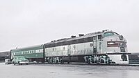
The St. Joseph Transit system provides public bus service. Rosecrans Memorial Airport is a local airport used for general flying. It is home to the 139th Airlift Wing of the Missouri Air National Guard. It does not have commercial flights. The closest airport for commercial flights is Kansas City International Airport, about 35 miles south. You can also take intercity buses with Jefferson Lines.
The city is served by several major highways:
 I-29 runs south to Kansas City and north to Iowa.
 I-229 is a bypass around the west side of St. Joseph.
 I-72 might come to St. Joseph in the future.
 US 36, the Pony Express Highway, runs east and west.
 US 59 runs south to Kansas and north into Iowa.
 US 71 runs south with I-29 to Kansas City and north to Maryville.
 US 169 runs south to Kansas City and north to Iowa.
There are also four state routes that serve the city:
 Route 6
 Route 371
 Route 752
 Route 759
City Parks and Attractions
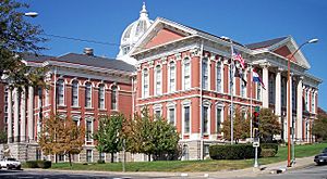
St. Joseph has many parks, golf courses, and sports areas. There are also skate parks, a water park, and a riverwalk along the Missouri River. The city is known for its 26-mile parkway system. This system has trails for walking and biking. Two of the biggest parks are Krug Park and Hyde Park. A dog park has also been added near Corby Pond. Many old buildings are still standing, like the Missouri Theater.
Media and News
St. Joseph is part of a media market that covers six counties in Missouri and one in Kansas. The city has several television and radio stations. News-Press & Gazette, a media company, is based in St. Joseph. They own many TV, radio, and newspaper businesses.
Television Stations
For a long time, KQTV (ABC) was the only major TV station in St. Joseph. But in recent years, other stations have started. KNPN-LD became a Fox affiliate. KNPG-LD became an NBC affiliate and also carries CW+. KCJO-LD became a CBS affiliate. This means people in St. Joseph can now watch all the main TV networks locally.
Local Broadcast Stations
| Channel | Callsign | Network | Subchannels | Owner | Website | |
|---|---|---|---|---|---|---|
| (Virtual/RF) | Channel | Programming | ||||
| 2.1 (7) | KQTV | ABC | N/A | N/A | Heartland Media | [1] |
| 16.1 (21) | KTAJ-TV | TBN | 16.2 16.3 16.4 16.5 |
The Church Channel JCTV TBN Enlace USA Smile of a Child Network |
Trinity Broadcasting Network | [2] |
| 21.1 (9) | KNPG-LD | NBC | 21.2 21.3 21.4 21.5 |
CW+ Telemundo Bounce TV Grit |
News-Press & Gazette Company | [3] [4] [5] [6] [7] |
| 26.1 (15) | KNPN-LD | Fox | 26.2 26.3 26.4 26.5 |
CBS News-Press 3 NOW Escape Laff |
News-Press & Gazette Company | [8] [9] [10] |
| 30.1 (28) | KCJO-LD | CBS | N/A | N/A | News-Press & Gazette Company | [11] |
Local Cable Channels
- News-Press 3 NOW, Suddenlink channel 3/KNPN-LD virtual channel 26.3 (local news)
Radio Stations
| Band | Frequency | Callsign | Nickname | Format | Owner | Website |
|---|---|---|---|---|---|---|
| AM stations | 680 | KFEQ | 680 KFEQ | News/talk/sports | Eagle Communications | [12] |
| 1270 | KYSJ | KY 102 | Classic rock | Eagle Communications, Inc. | [13] | |
| 1550 | KESJ | Joe Town 107.5 | Classic hits | Eagle Communications | [14] | |
| FM stations | 89.7 | KJCV | Bott Radio Network | Religious | Community Broadcasting, Inc. | [15] |
| 91.1 | KSJI | Life 88.5 (KJNW) | Contemporary Christian | Northwestern Media | [16] | |
| 91.9 | KSRD | Air1 | Contemporary Christian | Educational Media Foundation | [17] | |
| 92.7 | KSJQ | Q-Country 92.7 | Country music | Eagle Communications | [18] | |
| 95.3 | K237HF | 680 KFEQ (KFEQ) | News/talk/sports | Eagle Communications | [19] | |
| 98.5 | K253BG | K-Love (KLRX) | Contemporary Christian | Educational Media Foundation | [20] | |
| 99.3 | KFOH-LP | SJMF Radio | All genres | St. Joseph Music Foundation | ||
| 102.5 | K273BF | KY 102 (KYSJ) | Classic rock | Eagle Communications | [21] | |
| 105.5 | KKJO | K-JO 105-5 | Hot adult contemporary | Eagle Communications | [22] | |
| 106.7 | K294BE | Catholic Radio Network (KEXS) | Catholic religious | Catholic Radio Network | [23] | |
| 107.5 | K298DA | Joe Town 107.5 (KESJ) | Classic hits | Eagle Communications | [24] |
Newspapers
- St. Joseph News-Press
- The Saint Joseph Telegraph
- The Regular Joe
Notable People from St. Joseph
See also
 In Spanish: St. Joseph (Misuri) para niños
 | Madam C. J. Walker |
 | Janet Emerson Bashen |
 | Annie Turnbo Malone |
 | Maggie L. Walker |


