St. Joseph County, Indiana facts for kids
Quick facts for kids
Saint Joseph County
|
|||
|---|---|---|---|

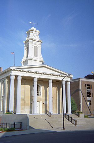
Old St. Joseph County courthouse in South Bend, Indiana
|
|||
|
|||

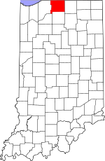
Location within the U.S. state of Indiana
|
|||
 Indiana's location within the U.S. |
|||
| Country | |||
| State | |||
| Founded | 1830 | ||
| Named for | St. Joseph River | ||
| Seat | South Bend | ||
| Largest city | South Bend | ||
| Area | |||
| • Total | 461.38 sq mi (1,195.0 km2) | ||
| • Land | 457.85 sq mi (1,185.8 km2) | ||
| • Water | 3.54 sq mi (9.2 km2) 0.77%% | ||
| Population
(2020)
|
|||
| • Total | 272,912 | ||
| • Estimate
(2023)
|
272,848 |
||
| • Density | 591.512/sq mi (228.3842/km2) | ||
| Time zone | UTC−5 (Eastern) | ||
| • Summer (DST) | UTC−4 (EDT) | ||
| Congressional district | 2nd | ||
|
|||
St. Joseph County is a county located in the state of Indiana, USA. People who live there often call it St. Joe County. In 2020, about 272,912 people lived here. This makes it the fifth-biggest county in Indiana by population.
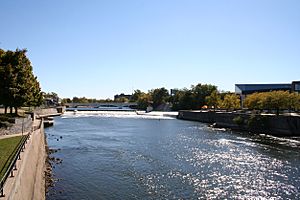
The county was created in 1830. It was named after the St. Joseph River, which flows through the area and eventually reaches Lake Michigan. The main city and government center of the county is South Bend. St. Joseph County is part of a larger area called "Michiana", which includes South Bend, Mishawaka, and parts of Michigan.
Contents
Geography
St. Joseph County covers about 461 square miles. Most of this area, about 458 square miles, is land. The rest, about 3.5 square miles, is water.
Cities and Towns
Here are the main cities and towns in St. Joseph County:
Census-Designated Places
These are areas that are like towns but are not officially incorporated as cities or towns:
County Divisions
The county is divided into smaller areas called townships:
- Centre
- Clay
- German
- Greene
- Harris
- Liberty
- Lincoln
- Madison
- Olive
- Penn
- Portage
- Union
- Warren
Neighboring Counties
St. Joseph County shares borders with these other counties:
- Berrien County, Michigan (to the north)
- Cass County, Michigan (to the northeast)
- Elkhart County (to the east)
- Marshall County (to the south)
- Starke County (to the southwest)
- LaPorte County (to the west)
Main Roads
Important highways that run through St. Joseph County include:


 I-80 / I-90 / Indiana Toll Road (a major toll road)
 US 20
US 20 US 31
US 31
Climate and Weather
| Weather chart for South Bend, Indiana | |||||||||||||||||||||||||||||||||||||||||||||||
|---|---|---|---|---|---|---|---|---|---|---|---|---|---|---|---|---|---|---|---|---|---|---|---|---|---|---|---|---|---|---|---|---|---|---|---|---|---|---|---|---|---|---|---|---|---|---|---|
| J | F | M | A | M | J | J | A | S | O | N | D | ||||||||||||||||||||||||||||||||||||
|
2.3
31
16
|
2
36
19
|
2.9
47
28
|
3.6
59
38
|
3.5
71
48
|
4.2
80
58
|
3.7
83
63
|
4
81
61
|
3.8
74
53
|
3.3
62
42
|
3.4
48
33
|
3.1
36
22
|
||||||||||||||||||||||||||||||||||||
| temperatures in °F precipitation totals in inches source: The Weather Channel |
|||||||||||||||||||||||||||||||||||||||||||||||
|
Metric conversion
|
|||||||||||||||||||||||||||||||||||||||||||||||
The weather in South Bend changes a lot throughout the year. In January, the average low temperature is about 16°F (about -9°C). In July, the average high temperature is about 83°F (about 28°C).
The coldest temperature ever recorded was -22°F (-30°C) in January 1943. The hottest was 109°F (43°C) in July 1934. The county gets the most rain in June, with about 4.19 inches (106 mm). February is usually the driest month.
Population Information
| Historical population | |||
|---|---|---|---|
| Census | Pop. | %± | |
| 1830 | 287 | — | |
| 1840 | 6,425 | 2,138.7% | |
| 1850 | 10,954 | 70.5% | |
| 1860 | 18,455 | 68.5% | |
| 1870 | 25,322 | 37.2% | |
| 1880 | 33,178 | 31.0% | |
| 1890 | 42,457 | 28.0% | |
| 1900 | 58,881 | 38.7% | |
| 1910 | 84,312 | 43.2% | |
| 1920 | 103,304 | 22.5% | |
| 1930 | 160,033 | 54.9% | |
| 1940 | 161,823 | 1.1% | |
| 1950 | 205,058 | 26.7% | |
| 1960 | 238,614 | 16.4% | |
| 1970 | 245,045 | 2.7% | |
| 1980 | 241,617 | −1.4% | |
| 1990 | 247,052 | 2.2% | |
| 2000 | 265,559 | 7.5% | |
| 2010 | 266,931 | 0.5% | |
| 2020 | 272,912 | 2.2% | |
| 2023 (est.) | 272,848 | 2.2% | |
| U.S. Decennial Census 1790-1960 1900-1990 1990-2000 2010 |
|||
In 2010, there were 266,931 people living in St. Joseph County. Most people (78.7%) were white. About 12.7% were black or African American, and 7.3% were of Hispanic or Latino background.
The average age of people in the county was 36.2 years old. The average income for a family was about $57,510 per year. About 14.6% of the population lived below the poverty line. This included 21.7% of people under 18 years old.
Education
Schools for Kids
St. Joseph County has several school districts. These districts manage public schools from kindergarten to 12th grade.
- John Glenn School Corporation
- Mishawaka School City
- New Prairie United School Corporation
- Penn-Harris-Madison School Corporation
- South Bend Community School Corporation
- Union-North United School Corporation
Some of the public high schools in the county are:
- John Adams High School
- Clay High School
- James Whitcomb Riley High School
- Washington High School
- Mishawaka High School
- Penn High School
There are also many private schools in the county, including several Catholic schools.
Colleges and Universities
St. Joseph County is home to several colleges and universities:
- Bethel College
- Holy Cross College
- Indiana University South Bend
- Ivy Tech North Central
- St. Mary's College
- University of Notre Dame
St. Joseph County Public Library
The St. Joseph County Public Library helps people learn and read.
Library History
The library started in 1889 as the South Bend Public Library. Its first main building, opened in 1896, was called "The Castle" because of its unique look. In 1918, the first branch library opened in Washington High School. This branch was a community hub for many immigrant families.
A new main library building opened in 1959. In 1992, during a renovation, there was a fire. The community helped the library reopen just seven days later! In 2018, the library decided to expand the main building to add a community learning center. In 2019, many people protested when the county considered cutting the library's funding. Even with the protests, the library lost some funding two years later.
Library Locations
The library has a main building and several branches:
- Main Library
- Centre Township Branch
- Francis Branch
- German Township Branch
- Lakeville Branch
- LaSalle Branch
- North Liberty Branch
- River Park Branch
- Tutt Branch
- Western Branch
Library Services
The library offers many cool services:
- Studio 304: This is a technology area where you can try 3-D printing, make posters, use iPads, play games, and even record music or videos.
- Local and Family History: You can look at old newspapers, yearbooks, and books about the local area. You can also use online tools to research your family tree.
- Databases: The library has access to over 50 online databases. These can help with school projects, research, and even starting a business.
- Homebound Delivery: If you can't get to the library, staff members can bring books and other materials right to your home.
Notable People
- Thadeus Jay Miller, an artist.
See also
 In Spanish: Condado de Saint Joseph (Indiana) para niños
 | Victor J. Glover |
 | Yvonne Cagle |
 | Jeanette Epps |
 | Bernard A. Harris Jr. |


