St. Julien Mountain facts for kids
Quick facts for kids St. Julien Mountain |
|
|---|---|

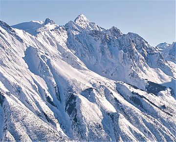
West-northwest aspect in winter
|
|
| Highest point | |
| Elevation | 3,090 m (10,140 ft) |
| Prominence | 400 ft (120 m) |
| Isolation | 0.77 mi (1.24 km) |
| Parent peak | Messines Mountain |
| Listing | Mountains of British Columbia |
| Geography | |
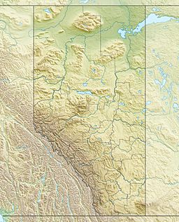
| Location | Banff National Park Alberta / British Columbia Canada |
| Parent range | Canadian Rockies |
| Topo map | NTS 82N/14 |
| Geology | |
| Age of rock | Cambrian |
| Type of rock | sedimentary rock |
| Climbing | |
| First ascent | 1930 |
| Easiest route | Mountaineering |
St. Julien Mountain is a tall mountain in the Canadian Rockies in British Columbia, Canada. It stands at 3,090 meters (about 10,140 feet) high. This mountain is special because it sits right on the border between British Columbia and Alberta. It's also part of the Continental Divide, which is like a big line that separates where water flows either to the Pacific Ocean or the Atlantic Ocean. St. Julien Mountain is also on the western edge of Banff National Park.
Mountain's Name and Past
The name "St. Julien Mountain" was suggested in 1919 by Arthur Oliver Wheeler. He wanted to remember a small village called St. Julien in Belgium. This village was where Canadian soldiers bravely fought in a big battle during World War I in 1915. This fight was called the Battle of St. Julien.
During this battle, it was the first time that Germany used a type of poison gas on the Western Front. It was also a very important moment because it was the first time that soldiers from a former colony (the 1st Canadian Division from Canada) defeated a European power (the German Empire) in Europe.
The name "St. Julien Mountain" was officially approved in 1920. The first time someone successfully climbed to the top of the mountain was in 1930. This climb was done by D. Duncan and A. F. Megrew.
How the Mountain Formed
St. Julien Mountain is made of sedimentary rock. This type of rock forms from layers of sand, mud, and tiny bits of sea creatures that settle at the bottom of ancient shallow seas over millions of years. These layers were laid down during periods from the Precambrian to the Jurassic times.
Later, during a time called the Laramide orogeny, huge forces pushed these rock layers. They were pushed east and even moved on top of younger rocks. Water from rain and melting snow flows off the mountain. From the south side, water goes into Mons Creek, which eventually reaches the Columbia River. From the north side, water flows into Forbes Creek, which is a part of the Howse River.
Mountain Climate
St. Julien Mountain has a subarctic climate. This means it has very cold winters with lots of snow. The summers are usually mild. Temperatures can drop below −20 degrees Celsius (which is about −4 degrees Fahrenheit). With the wind, it can feel even colder, sometimes below −30 degrees Celsius. This cold climate helps to keep the Mons Icefield, which is just north of the mountain, frozen.
 | Janet Taylor Pickett |
 | Synthia Saint James |
 | Howardena Pindell |
 | Faith Ringgold |


