Suruga Province facts for kids
Suruga Province (called Suruga no kuni in Japanese) was an old region in Japan. Today, this area is the central part of Shizuoka Prefecture. People sometimes called it Sunshū.
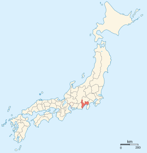
Suruga was located near the Pacific Ocean, with a large bay called Suruga Bay. It shared borders with several other old provinces: Izu, Kai, Sagami, Shinano, and Tōtōmi.
Contents
History of Suruga Province

Suruga was one of Japan's first provinces. It was created during the Nara period (around 710-794 AD). This happened as part of big changes called the Taihō Code reforms.
Control by Clans
During the Kamakura period (1185-1333 AD), the powerful Hōjō clan controlled Suruga. They were a very important family in Japan at that time.
The Edo Period and the Tōkaidō Road
In the Edo period (1603-1868 AD), a major road called the Tōkaidō passed through Suruga. This road was like a highway connecting Japan's old capital, Kyoto, with the main city of the Tokugawa government.
The famous leader Tokugawa Ieyasu lived in Sumpu Castle in Suruga. He moved there after he stopped being the Shogun (Japan's military ruler). Ieyasu later died in Sunpu.
During this time, a special official called the Sunpu jōdai was in charge of the city of Sunpu for the shogun.
After the Meiji Restoration
After the Meiji Restoration in 1868, Japan changed a lot. The last Tokugawa Shogun, Tokugawa Yoshinobu, moved to Suruga after he retired.
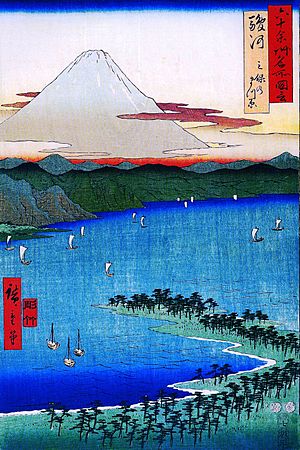
In the Meiji period (1868-1912 AD), Japan's old provinces were changed into new areas called prefectures. The maps of Japan were updated in the 1870s. Because Suruga was close to Mount Fuji, it was a popular place for mapmakers.
Important Shrines and Temples
The most important Shinto shrine in Suruga was called Sengen jinja. It was known as the ichinomiya, which means it was the chief shrine of the province.
Related pages
See also
 In Spanish: Provincia de Suruga para niños
 | Lonnie Johnson |
 | Granville Woods |
 | Lewis Howard Latimer |
 | James West |


