Swansea Canal facts for kids
Quick facts for kids Swansea Canal |
|
|---|---|

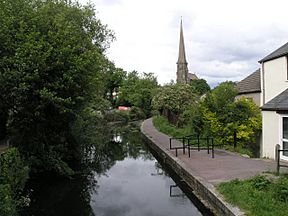
The canal at Pontardawe
|
|
| Specifications | |
| Maximum boat length | 65 ft 0 in (19.81 m) |
| Maximum boat beam | 7 ft 6 in (2.29 m) |
| Locks | 6 (originally 36) |
| Original number of locks | 36 |
| Status | Restoration proposed |
| Navigation authority | Canal and River Trust |
| History | |
| Original owner | Swansea Canal Company |
| Principal engineer | Charles Roberts |
| Other engineer(s) | Thomas Sheasby |
| Date of act | 1794 |
| Date completed | 1798 |
| Date closed | 1931 |
| Geography | |
| Start point | Abercraf |
| End point | Swansea Docks |
| Branch(es) | 4 short branches |
The Swansea Canal (Welsh: Camlas Abertawe) was a canal built between 1794 and 1798. It stretched for about 16.5 miles (26.6 km) from Swansea to Abercraf in South Wales. The canal was quite steep, needing 36 locks to lift boats 373 feet (114 m) along its path.
The main goods carried were coal, iron, and steel. The canal was very successful for many years. In 1873, it was sold to the Great Western Railway. It continued to make money until 1895. After that, it slowly declined, with the last commercial boats using it in 1931.
Over time, parts of the canal were closed and filled in. But about 5 miles (8.0 km) of it still have water. The Swansea Canal Society, started in 1981, is working hard to restore the canal.
Contents
Why the Canal Was Built
The canal was built to move coal from the upper Swansea Valley to Swansea docks. From there, the coal could be sent to other places or used by local metal factories. Between 1830 and 1840, many towns grew up along the canal. These included Abercraf, Clydach, Pontardawe, and Ystradgynlais. This happened as industries developed in these areas.
In 1817, a large area called Fforest Fawr (meaning Great Forest of Brecon) was divided into fields. This land was owned by the Crown. In 1812, the Crown decided to sell it to help pay for the Napoleonic Wars. A businessman named John Christie bought a lot of this land. He already had a limestone quarry at Penwyllt and wanted to build lime kilns there.
Christie also developed the Brecon Forest Tramroad in 1820. This was a network of tracks, over 100 miles (160 km) long. It connected farms, coal mines, lime kilns, and ironworks to the Swansea Canal. This helped move goods around the area.
Building the Canal
As Swansea harbour grew from the 1760s, people started thinking about how to move rich minerals from the Tawe valley to the coast. In 1790, William Padley looked at the valley for a possible canal route.
In 1793, a meeting was held, and Thomas Sheasby was asked to survey the area. Some people, like the Duke of Beaufort, did not want the canal to end in Swansea. They wanted it to stop further up the river. But Swansea Corporation wanted the canal to reach the town. They even offered to help pay for it. This made others want to invest, and £52,000 was quickly raised.
Eventually, a deal was made. The canal would end in Swansea. But the Duke of Beaufort would build a small section of the canal, about 1.4 miles (2.3 km) long. He could charge tolls on his section. This part was called the Trewyddfa Canal.
An Act of Parliament was passed on May 23, 1794. This allowed the Swansea Canal Company to raise money to build the canal. They could also build tramways and small canal branches near the main canal. The company decided to build the canal themselves, rather than hiring other companies. Charles Roberts was the main engineer, helped by Thomas Sheasby.
The first part of the canal opened in 1796, from Swansea to Godre'r-Graig. The whole 16.5 miles (26.6 km) length was finished by October 1798. The canal had 36 locks and five aqueducts. Aqueducts are like bridges that carry the canal over rivers. The locks on the main part were 69 by 7.5 feet (21.0 by 2.3 m). But the locks on the Duke's section were only 65 feet (20 m) long. This meant boats could not be longer than 65 feet (20 m).
The canal rose 373 feet (114 m) from near sea level in Swansea to Abercraf. Wharfs (docks) were built in Swansea to transfer goods to larger ships. The project cost £51,602, which was less than expected.
How the Canal Worked
The boats used on the canal were 65 feet (20 m) long and 7 feet 6 inches (2.29 m) wide. They could carry 22 tons of cargo when full. The last narrowboat built on this canal was named 'Grace Darling' in 1918.
The canal's opening led to more factories and businesses along the valley. Four short branch canals were built, and many tramways connected mines and quarries to the canal. In 1804, over 54,000 tons of coal were carried. The canal made enough money to pay a 3 percent profit to its owners. Profits and payments to owners steadily increased. By 1860, they reached £13,800 and 18 percent.
In 1852, the harbour in Swansea was improved. The river Tawe was moved into a new channel. The old channel became a floating harbour. A lock was built to give canal boats direct access to the new harbour.
The Canal's Decline
In 1830, people first suggested building a railway along the Tawe Valley. This railway would compete with the canal. More serious railway plans came in 1845. The Canal Company even agreed to lease the canal to a railway company, but the plan failed. Another plan to lease the canal in 1864 also failed.
The 1860s were tough for the canal. The steel industry started to replace the iron industry. Many ironworks either got smaller or closed down. In 1871, the Canal Company talked to the Great Western Railway. They agreed to sell the main Swansea Canal for £107,666. The Duke of Beaufort's Trewyddfa Canal was sold for £40,000. The sale happened on January 31, 1873.
The Great Western Railway managed the canal well. It remained profitable until 1895, when it started losing money. However, it did recover a little between 1898 and 1902. A lot of coal was still carried on the canal. In 1888 alone, 385,000 tons of coal went down the canal to Swansea.
The last time commercial cargo was carried on the Swansea Canal was in 1931. Coal was moved from Clydach to Swansea. After that, boats were only used for maintenance work. Horse-drawn boats were last seen at Clydach in 1958.
The canal was slowly closed down over the years. This happened under different laws, starting in 1928. In 1947, the canal became part of the British Transport Commission. More sections were closed in 1949 and 1957. The rest of the canal was closed in 1962. Control then passed to British Waterways, and later to the Canal and River Trust in 2012.
The Canal Today
Much of the canal has been filled in over the last 50 years. The northern part was affected by the building of the A4067 road. The southern part below Clydach was filled in by 1982.
Only about 5 miles (8.0 km) of the canal still has water. This section runs from Clydach to Pontardawe. It is now a popular trail and part of National Cycle Network route 43.
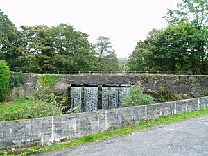
The canal empties from an aqueduct into the Lower Clydach River. A project is underway to clean out the canal and remove Japanese knotweed. The canal is an important home for water birds and eels. Young people from Clydach often fish for eels there.
In 1981, the Swansea Canal Society was formed. They are working to restore the remaining parts of the canal. They have done a lot to improve the canal's environment. They hope to create a 35-mile (56 km) boating route by connecting it with a restored Neath and Tennant Canal.
On October 23, 1998, heavy rain caused the canal's water levels to rise. At Pontardawe, the water spilled over the path and down an embankment. This caused the bank to break, leading to a lot of flooding. Thirty houses, some businesses, and shops in the town centre were flooded. The water was up to 4 feet (1.2 m) deep in some places.
Canal's Path
Northern Part
The Swansea Canal started at a large basin (a wide part of the canal) near Aber-craf. There was an iron works nearby. Tramways connected the basin to limestone quarries on Cribarth hill. These quarries had many inclined planes to move materials up and down. The Rheola Arms pub was next to the basin. The canal went south-west, through two locks at Ynys-bydafau. There was also a brickworks and a dry dock built by Christie in 1825.
The canal continued west of the river, through more locks. It crossed the Afon Giedd on an aqueduct. The town of Ystradgynlais grew up later, east of the river. There were more locks at Gorof, and a waterwheel. By 1904, a tramway from Pant-mawr Colliery ran along the canal.
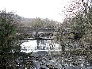
Further south-west, the canal turned south. A short part of the canal still exists today. It crosses the Afon Twrch on an aqueduct. This aqueduct was restored in 1995. There were two locks at Gurnos. The A4067 road now follows much of the canal's path.
The canal passed by the Ystalyfera Iron and Tinplate Works, which was once the largest in South Wales. From Ystalyfera to Godre'r-graig, the canal is mostly straight. Six of the seven locks are still visible. The canal here is 6 to 8 feet (1.8 to 2.4 m) wide and acts as a feeder from the Afon Tawe. About 1 mile (1.6 km) of the canal near Ynysmeudwy is now a nature reserve.
Middle Part
Most of the next 5.5 miles (8.9 km) of the canal still has water. After the Cilmaengwyn lock, the canal crosses the Cwmdu Aqueduct. There was once a pottery nearby that made many items. Later, a tinplate works was on the site.
The Ynysmeudwy Upper and Lower Locks are below the bridge. There was also a branch canal that went to a dock by the river. The canal is currently navigable from Ynysmeudwy Lower Lock to Pontardawe. Further on, a lowered bridge blocks the way. The canal then goes into a culvert (an underground tunnel).
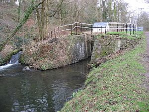
This culverted section once had a dock and two locks. The Pontardawe Tin Plate Works was located here. Near Trebanos, the canal comes out of its culvert. There are more locks here, like Trebanos Lock and Green Lock. The Pheasant Bush Tin Works used to be by Trebanos Lock.
The canal then goes under the B4603 road bridge. There is another short culverted section under a council depot. There are ideas that one of the old locks might still be under this depot. The Mond Lock was next. Below it is the Mond Nickel Works, built in 1900. This factory made pure nickel. The canal crosses the Lower Clydach River on an aqueduct, which lets water flow into the river. The watered section ends about 50 yards (46 m) further on.
Southern Part
The next lock was at Ynystawe. In 1879, this area was full of factories, like a gas works, a brick works, and a tinplate works. The canal then ran next to the river and the Swansea Vale Railway. The A4067 road now follows their paths.
The M4 motorway crosses over the canal's route. Further south, the canal was surrounded by many different factories around 1900. These included chemical works, potteries, coal pits, and steel works. A tramway crossed the canal to reach the Hafod copper works. There were also more locks and dry docks.
The final part of the canal is near Morfa Road, next to the railway tracks leading to Swansea's High Street railway station. To the east was the North Dock. There were many wharfs and two more locks, one leading into the dock. The North Dock closed in 1930.
Restoring the original route to Clydach would be difficult. But since a barrage was built across Swansea Bay, river levels are now stable. This means the river could be used to reach Llansamlet. From there, the Fendrod River could be made into a canal to reach a large lake. Then, about 3 miles (4.8 km) of new canal and an aqueduct over the Tawe would be needed to connect to the old canal.
Points of Interest
| Point | Coordinates (Links to map resources) |
OS Grid Ref | Notes |
|---|---|---|---|
| Abercraf basin | 51°47′54″N 3°43′48″W / 51.7983°N 3.7300°W | SN808124 | |
| Afon Giedd aqueduct | 51°47′06″N 3°45′25″W / 51.7851°N 3.7570°W | SN789110 | |
| Afon Twrch aqueduct | 51°46′06″N 3°46′48″W / 51.7683°N 3.7800°W | SN772092 | |
| Start of watered section | 51°44′36″N 3°48′33″W / 51.7432°N 3.8092°W | SN751064 | |
| Cwmdu aqueduct | 51°44′11″N 3°49′28″W / 51.7365°N 3.8245°W | SN741057 | |
| Upper Clydach aqueduct | 51°43′11″N 3°51′10″W / 51.7196°N 3.8528°W | SN721039 | End of watered section |
| Start of lower watered section | 51°42′41″N 3°51′45″W / 51.7113°N 3.8624°W | SN714030 | |
| Lower Clydach aqueduct | 51°41′38″N 3°53′53″W / 51.6939°N 3.8981°W | SN689011 | End of lower watered section |
| Swansea Docks wharfs | 51°37′30″N 3°56′21″W / 51.6251°N 3.9392°W | SS658935 |
 | Shirley Ann Jackson |
 | Garett Morgan |
 | J. Ernest Wilkins Jr. |
 | Elijah McCoy |


