Telford and Wrekin facts for kids
Quick facts for kids
Telford and Wrekin
Telford
|
|
|---|---|
|
Unitary authority area and borough
|
|
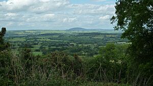
The Wrekin
|
|
| Nickname(s):
Wrekin
|
|
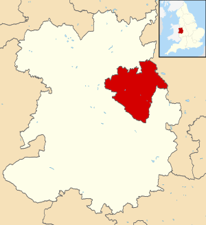
Shown within Shropshire
|
|
| Country | United Kingdom |
| Region | West Midlands |
| County | Shropshire |
| Admin HQ | Telford |
| Area | |
| • Total | 112.09 sq mi (290.31 km2) |
| Population | |
| • Total | 185,600 |
| • Density | 1,655.8/sq mi (639.32/km2) |
| Ethnicity (2021) | |
| • Ethnic groups |
List
|
| Religion (2021) | |
| • Religion |
List
47.6% Christianity
40.9% no religion 2.7% Islam 0.7% Hinduism 0.1% Judaism 1.5% Sikhism 0.3% Buddhism 0.5% other 5.6% not stated |
| Time zone | GMT |
| ISO 3166 code | GB-TFW |
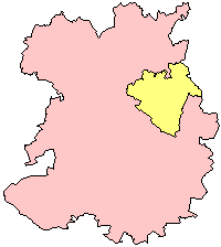
Telford and Wrekin is a special area in Shropshire, England. It's known as a borough and a unitary authority. This means it has its own local government that makes decisions for the area.
The name "Telford and Wrekin" comes from two important things. One is Telford, the main town. The other is The Wrekin, a famous hill nearby. The area became a unitary authority in 1998. Even though it has its own government, it's still part of the larger Shropshire county. It shares services like the Fire and Rescue Service with the rest of Shropshire.
Telford was planned as a new town in the 1960s. It brought together smaller towns like Dawley, Madeley, Oakengates, and Wellington. After Telford, the next biggest town is Newport, which is in the northeast. It's not part of the original Telford new town area.
The borough is surrounded by the main Shropshire district. It also borders Staffordshire.
Contents
History of Telford and Wrekin
How the Area Was Formed
The Telford and Wrekin area was officially created on April 1, 1974. This happened under a law called the Local Government Act 1972. It combined several smaller districts into one. These included:
- Dawley Urban District
- Newport Urban District
- Oakengates Urban District
- Wellington Rural District
- Wellington Urban District
- A small part of Shifnal Rural District
At first, the new district was just called "Wrekin." But later in 1974, the local council changed its name to "The Wrekin."
The Growth of Telford New Town
A big part of this new district was chosen to become the new town of Telford. It was first planned in 1963 as Dawley New Town. Then, in 1968, it was made bigger and renamed Telford.
For a while, the Telford Development Corporation helped manage the new town. They handled things like town planning. This was until 1991, when the elected local councils took over all these duties.
Becoming a Unitary Authority
On April 1, 1998, a big change happened. The district became a unitary authority. This meant it could make more of its own decisions. It no longer reported to the Shropshire County Council. On the same day, its name changed again to "Telford and Wrekin."
In 1999, the council houses in the area were moved to a new group. This group is called the Wrekin Housing Trust. They now own most of the social housing in Telford.
Telford and Wrekin tried to become a city in 2000, but it didn't happen. However, in 2002, it was given borough status.
Towns and Villages in Telford and Wrekin
Telford and Wrekin is home to many towns and villages. Here are some of them:
- Coalbrookdale
- Crudgington
- Edgmond
- Great Bolas
- High Ercall
- Ironbridge
- Jackfield
- Lilleshall
- Little Wenlock
- Newport (a town)
- Church Aston
- Longford
- Roden
- Telford (the main new town)
- Dawley (a town within Telford)
- Donnington
- Donnington Wood
- Hadley
- Ketley
- Lawley
- Madeley (a town within Telford)
- Muxton
- Oakengates (a town within Telford)
- Shawbirch
- Priorslee
- Stirchley
- St George's
- Trench
- Wellington (a town within Telford)
- Sambrook, Shropshire
- Tibberton
- Waters Upton
- Wrockwardine
How Telford and Wrekin is Divided
Local Parishes
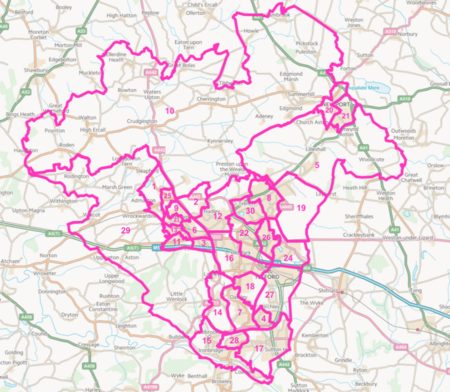
The borough is split into 29 smaller areas called civil parishes. Each parish has its own local council.
- See a list of parishes here
Council Wards
For the main borough council, the area is divided into 30 wards. People living in each ward vote for their local councillors.
- Find a list of wards on the Telford and Wrekin website
- See who the current councillors are
Council Elections
Elections for the borough council happen every four years.
- See past election results
How the Council is Run
The Telford and Wrekin Council uses a "cabinet-style" system. This means there are 54 elected councillors. These councillors choose seven cabinet members, including the leader. The cabinet members meet often to make important decisions for the area.
Currently, the Labour party controls the Telford and Wrekin Council.
Policing in the Area
Telford and Wrekin is part of the West Mercia Police area. This police force helps keep the area safe. Their main office is in Worcester. The Telford and Wrekin area is one of their local policing units.
Population and Diversity
Telford and Wrekin is home to many different people. The population was about 185,600 in 2021.
Most people in the area are White (about 88.2%). There are also many people from Asian backgrounds (5.4%), Black backgrounds (2.9%), and mixed ethnic backgrounds (2.6%). About 0.9% of the population belongs to other ethnic groups.
When it comes to religion, about 47.6% of people are Christian. A large number, 40.9%, say they have no religion. Other religions like Islam (2.7%), Hinduism (0.7%), and Sikhism (1.5%) are also present.
Economy and Jobs
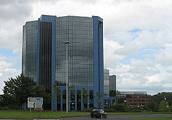
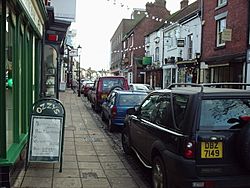
The economy of Telford and Wrekin has grown over the years. The total value of goods and services produced in the area has increased.
- In 1995, this value was about £1,763 million.
- By 2003, it had grown to about £2,370 million.
Most of the jobs in the area are in the services sector. This includes things like shops, healthcare, and education. There are also many jobs in industry, such as factories and manufacturing. A smaller number of jobs are in agriculture, like farming.
Freedom of the Borough Award
The "Freedom of the Borough" is a special honour given to people, military groups, or organisations that have done great things for Telford and Wrekin. It's a way to thank them for their contributions.
People Who Have Received the Award
- Iris Butler: 2002
- Richie Woodhall: 2002
- Lee Carter: 2005
- Elizabeth Holt: 2008
- Peter Gibbons: 2009
- George Whyle: 2011
- Corporal Ricky Fergusson: 2012
- Mickey Bushell: 2014
- Alan Olver: 2015
- John Alfred David Gill: 2017
- Liam Davies: 2023
Military Units Honoured
- The Rifles: May 29, 2010
Organisations Honoured
- Telford Crisis Support: June 11, 2022
- The Wrekin Housing Group
See also
 In Spanish: Telford and Wrekin para niños
 | Lonnie Johnson |
 | Granville Woods |
 | Lewis Howard Latimer |
 | James West |


