Thatcher Peninsula facts for kids

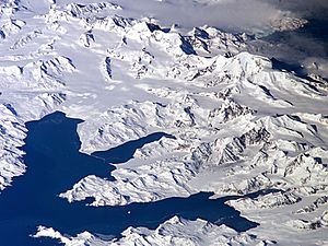
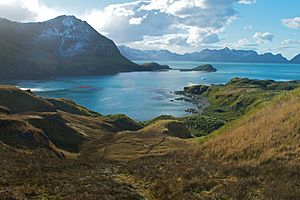
Thatcher Peninsula is a mountainous area in the middle of northern South Georgia. It covers about 56.4 square kilometers (21.8 square miles). Around 16.2 square kilometers (6.2 square miles) of this land is covered in plants.
The peninsula ends at Mai Point in the north. It lies between Cumberland West Bay to the west and Cumberland East Bay and Moraine Fjord to the east. To its southwest and south are the Lyell Glacier and Hamberg Glacier. King Edward Cove, on the east side, is home to the British Antarctic Survey (BAS) station at Grytviken. This area also has an old whaling station.
The United Kingdom Antarctic Place-Names Committee (UK-APC) named Thatcher Peninsula in 1991. Members of the Royal Geographical Society suggested the name. It honors Margaret Thatcher, who was the British prime minister from 1979 to 1990. Sir Vivian Fuchs, who led the Antarctic Place Names Committee, called her "a major figure in the history of South Georgia." This was because of her important role during the Falklands War. Friends of Margaret Thatcher said she was "flattered and amused" by this honor.
Contents
Exploring Thatcher Peninsula's Geography
Many parts of the peninsula's coast have been mapped and named. Features on the west coast are part of the Cumberland West Bay area. Those on the east coast are part of the Cumberland East Bay area.
Northern Coastal Features
One of the most important places on the northern coast is Maiviken. This is a small cove. The Swedish Antarctic Expedition (SAE) first mapped Maiviken and its nearby areas between 1901 and 1904. This expedition was led by Otto Nordenskjold. Maiviken was first entered on May Day in 1902. Because of this, it was named "Majviken," which means "May Cove." Over time, the Norwegian spelling, Maiviken, became the official name.
Poa Cove is a smaller cove located in the southeast part of Maiviken. Burnet Cove is found on the northeastern coast of Maiviken, southwest of Mai Point. Tortula Cove is very close to the south of Mai Point. These three smaller coves were re-mapped by the Discovery Investigations (DI) in 1929. They were also surveyed by the Falkland Islands Dependencies Survey (FIDS) in 1951. The UK-APC named all three coves after types of plants found nearby. Poa is named for the grass type Poa. Burnet is named for the common plant Acaena. Tortula is named for the moss type Tortula.
Mai Point marks the eastern side of Maiviken. It is also the northernmost tip of the entire peninsula. The SAE team gave it this name because of its link to Maiviken.
East of Mai Point is Sappho Point. This point marks the west side of the entrance to Cumberland East Bay. It is on the north coast of South Georgia. Captain James Cook's British expedition in 1775 likely saw it first. This expedition explored the north coast of South Georgia. Sappho Point is named after HMS Sappho. This was a British ship that helped map parts of Cumberland Bay in 1906.
Inland Peaks and Lakes
In the northern part of the peninsula, Camp Peak rises about 330 meters (1,083 feet) high. It is on the west side of Maiviken. The DI mapped it in 1929. It was named "Camp Peak" because a camp was set up on the shore below it.
Spencer Peak is 444 meters (1,457 feet) tall. It is southwest of Sappho Point. The name "Spencer Peak" first appeared on a British Admiralty map in 1906. It is probably named after Lieutenant P. Spencer. He helped survey Cumberland Bay from HMS Sappho in 1906. Northwest of Spencer Peak, the valley Maidalen runs north to south down to Lewis Pass.
Mount Duse stands 505 meters (1,657 feet) high. It is about 1.6 kilometers (1 mile) south of Spencer Peak, overlooking King Edward Point. Lieutenant S.A. Duse mapped it in 1902. He was the mapmaker for the SAE, and the mountain is named after him. Mount Hodges is 605 meters (1,985 feet) high. It is about 1.9 kilometers (1.2 miles) west of Mount Duse. It was first called "Moldaenke Berg" on a 1907 map. However, the name "Mount Hodges" became more common later. It is likely named after Captain M.H. Hodges of the Royal Navy. He was from the ship Sappho and visited and mapped parts of Cumberland Bay in 1906.
Several freshwater lakes and ponds are found along the east and southeast shores of Maiviken. The UK-APC named all of them. Løken Pond is the northernmost one, located east of Burnet Cove. It is named after Reverend Kristen Løken. He was a Norwegian Lutheran minister and the first pastor appointed to South Georgia. Arch Pond is a bit further south, between Burnet and Poa coves. It is named for a natural arch nearby. East of Arch Pond is the shallow Humic Lake. Its water is dark because of humic acid. This acid comes from decaying peat on the nearby slopes. The southernmost lake in this group is Evans Lake. It is a deep lake with an unusual shape. It is named after John C. Ellis-Evans, a biologist from BAS.
South of Maiviken's head is the lake Maivatn. It is the largest lake in the Maiviken area. At 39 meters (128 feet) deep, it is also the deepest. The lake was named Maivatn (May lake) because it is near Maiviken. Tiny Lancetes Lake is found southwest of Maivatn.
Wildlife of Thatcher Peninsula

Lancetes Lake has many plants and mosses at its bottom. These plants support a large number of Lancetes clausii. This is the only water beetle found in the sub-Antarctic region. The lake is named after this beetle.
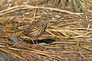
Brown rats are a problem on Thatcher Peninsula. They are an invasive species, meaning they are not native and harm local wildlife. These rats threaten native animals like the South Georgia pipit. From about 2011 to 2014, the government of South Georgia and the South Sandwich Islands worked to get rid of the rats. They dropped special pellets containing brodifacoum from the air. A year after the project, monitoring showed that the rats were gone. This means the effort was successful.
See also
 In Spanish: Península Thatcher para niños
 | Lonnie Johnson |
 | Granville Woods |
 | Lewis Howard Latimer |
 | James West |


