Trinidad Head facts for kids
Quick facts for kids Trinidad Head |
|
|---|---|
 |
|
| Location | Trinidad, California |
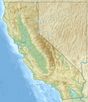
| Coordinates | 41°03′16″N 124°09′03″W / 41.054308°N 124.150914°W |
| Offshore water bodies | Pacific Ocean |
| Geology | Promontory |
| Operator | City of Trinidad, Bureau of Land Management |
| Reference no. | 146 |
| Designated | January 12, 2017 |
| Unit of the California Coastal National Monument | By President Barack Obama |
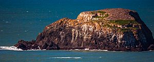
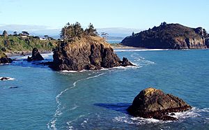
'Trinidad Head is a tall, rocky piece of land that sticks out into the Pacific Ocean in Humboldt County, California. It's near the small town of Trinidad. This special place is surrounded by cool rock formations called sea stacks. It also helps protect Trinidad Harbor from big waves. Trinidad Head is so important that it's been named a California Historical Landmark. In the Yurok language, it's called Chuerewa.
Contents
History of Trinidad Head
Early Explorers and Claims
In November 1595, a Portuguese captain named Sebastião Rodrigues Soromenho discovered Trinidad Bay. He was sailing the San Augustin, a ship from Manila. He saw the bay but did not stop, fearing hidden rocks.
Later, on June 9, 1775, two Spanish explorers arrived. They were Bruno de Heceta and Juan Francisco de la Bodega y Quadra. Their ships anchored in Trinidad Bay. Two days later, on June 11, 1775, which was Trinity Sunday, Heceta and his crew landed. Two Franciscan priests were with them. They put up a cross on top of Trinidad Head. They claimed the land for Spain in the name of King Charles III.
For the next 75 years, many ships visited Trinidad Head. Spanish, Russian, and English ships came here. They hunted sea otters and got fresh water. It was also a safe place to hide from storms.
Mapping the Coast
In 1850, the United States Coast and Geodetic Survey mapped Trinidad Harbor and Trinidad Head. This important work was led by United States Navy Lieutenant Commander William P. McArthur.
The Giant Wave of 1914
On December 31, 1914, something amazing happened. The biggest ocean wave ever recorded on the U.S. West Coast hit Trinidad Head. At 4:40 p.m., Captain Fred L. Harrington saw it. He was the lighthouse keeper at Trinidad Head Light. He had worked there for many years.
Captain Harrington saw a huge wave about 200 yards (183 meters) offshore. It was coming towards the tall cliff where the lighthouse stood. He said the wave seemed to rise as high as the lighthouse lens. That lens was 196 feet (60 meters) above sea level. The wave washed completely over Pilot Rock, which is 93 feet (28 meters) tall. Then, it broke over the top of the 175-foot (53-meter) cliff. Water covered the area between the lighthouse and the cliff. It even reached the lighthouse's balcony.
This means the wave might have been 200 feet (61 meters) tall! The wave's impact shook the lighthouse. It even put out its light. But Captain Harrington quickly fixed it, and the light was back on in four hours.
Protecting the Land
In 1983, much of Trinidad Head was given to the city of Trinidad. It used to belong to the United States Coast Guard. The city received 46 acres (19 hectares) of land. The deal was that the city had to keep the land open for people to enjoy. So, the city made it an "open space" area. In 1984, they opened a hiking trail around Trinidad Head for everyone.
The southern 13 acres (5.3 hectares) of the headland, where the lighthouse is, stayed with the Coast Guard. But in 2014, the Coast Guard gave it to the United States Department of the Interior's Bureau of Land Management.
In January 2017, the United States Congress added this part of Trinidad Head to the California Coastal National Monument. President Barack Obama used his special power to do this. He used the 1906 Antiquities Act to make it a unit of the National Monument.
Geology of Trinidad Head
Trinidad Head is made of a special type of rock called gabbro. This gabbro has been changed by heat and pressure, a process called metamorphosis. It's found within a larger mix of rocks called Franciscan melange. On top of these rocks, you can find sands and gravels from the Pleistocene Ice Age.
Managing Trinidad Head
Today, many groups work together to manage Trinidad Head. The Bureau of Land Management works with the City of Trinidad. They also partner with the Trinidad Rancheria, the Trinidad Museum Society, and the Yurok Tribe. This teamwork helps protect this special place for everyone.
See also
 In Spanish: Cabo Trinidad para niños


