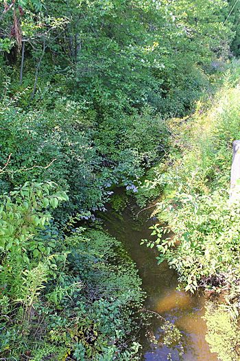
Trout Brook (Toby Creek tributary) facts for kids
Quick facts for kids Trout Brook |
|
|---|---|

Trout Brook
|
|
| Physical characteristics | |
| Main source | pond near Lower Demunds Road in Dallas Township, Luzerne County, Pennsylvania 1,200 ft (370 m) |
| River mouth | Toby Creek in Dallas Township, Luzerne County, Pennsylvania 1,020 ft (310 m) 41°19′50″N 75°56′36″W / 41.33045°N 75.94325°W |
| Length | 3.4 mi (5.5 km) |
| Basin features | |
| Progression | Toby Creek → Susquehanna River → Chesapeake Bay |
| Basin size | 4.20 sq mi (10.9 km2) |
Trout Brook is a small stream, also called a tributary, in Luzerne County, Pennsylvania. It flows into Toby Creek. This stream is about 3.4 miles (5.5 km) long and runs through Dallas Township.
The area of land that drains into Trout Brook, known as its watershed, is about 4.20 square miles (10.9 km2). Trout Brook is a special place for fish, designated as a Coldwater Fishery and a Migratory Fishery. Sometimes, the stream gets filled with dirt and fallen trees. Around the stream, you can find different types of ground, like glacial soil, river deposits, wet areas, and rocks such as shale and sandstone.
Contents
Where Does Trout Brook Flow?
Trout Brook starts in a pond near Lower Demunds Road in Dallas Township. It flows south-southeast next to the road for almost a mile. Then, it turns south.
For the next mile or so, the stream continues alongside Lower Demunds Road, crossing it a few times. After that, it turns south-southwest and enters a valley, still flowing next to the road. A short distance later, it turns south and goes through an area called Maplewood Heights.
Finally, after a bit more flowing, Trout Brook meets Toby Creek. This meeting point is just north of Shavertown. Trout Brook joins Toby Creek about 7.60 miles (12.23 km) upstream from where Toby Creek ends.
What Is the Land Like Around Trout Brook?
The land near where Trout Brook flows into Toby Creek is about 1,020 feet (310 m) above sea level. Where the stream begins, its source, the land is a bit higher, just over 1,200 feet (370 m) above sea level.
Logs and other natural materials often wash into Trout Brook. The stream has also been affected by sediment (dirt and sand) building up in it. This has made the streambed shallower in some places. In the past, during the 1900s, these spots were much deeper.
Most of the ground near Trout Brook is made of a type of glacial soil called Wisconsinan Till. There are also areas with bedrock made of sandstone and shale. Near the stream's mouth, you can find alluvium, which is soil deposited by flowing water.
The Trout Brook Watershed
The watershed of Trout Brook covers an area of about 4.20 square miles (10.9 km2). This entire area is located within the Kingston map section of the United States Geological Survey.
The land around Trout Brook is not as developed as the land near the main part of Toby Creek. However, more buildings and towns are starting to appear in the watershed. This growth could cause the stream to have higher water flows, especially after heavy rains.
Sometimes, water from a nearby development overflows its detention pond and flows into Trout Brook. As of 2005, another planned development might also send water into the stream. Because the streambed is shallow, this extra water could increase the risk of flooding. There is also a patch of wetlands along the lower parts of the stream.
History of Trout Brook
Trout Brook was officially added to the Geographic Names Information System on October 1, 1992. This system helps keep track of names for places like streams and mountains.
Trout Brook was impacted by big storms, including Tropical Storm Lee in 2011 and Tropical Storm Irene. These storms caused a lot of debris, like fallen trees, to clog the stream. Money from the state and federal governments was used to help clear away this debris.
Fish and Wildlife in Trout Brook
Trout Brook is a special place for fish. It is called a Coldwater Fishery, meaning its water stays cool enough for certain fish species to live there. It's also a Migratory Fishery, which means fish travel through it as part of their life cycle.
 | Georgia Louise Harris Brown |
 | Julian Abele |
 | Norma Merrick Sklarek |
 | William Sidney Pittman |

