Tsunami warning system facts for kids
A tsunami warning system helps detect tsunamis early. It sends warnings to protect people and property. These systems have two main parts. First, a network of sensors finds tsunamis. Second, a communication system sends quick alerts. This allows people in coastal areas to evacuate safely. There are two types: international and regional systems. They use seismic wave alerts from earthquakes. Then, they check sea level data from tide gauges or special buoys. This confirms if a tsunami is really coming.
Contents
How Tsunami Warnings Began
The first basic system to warn about tsunamis started in Hawaii in the 1920s. More advanced systems were created after two big tsunamis. One happened in 1946 and another in 1960. Both caused huge damage in Hilo, Hawaii. Tsunamis travel very fast in open water, about 500 to 1,000 kilometers per hour. But earthquake waves travel even faster, around 14,400 kilometers per hour. This speed difference gives scientists time to predict a possible tsunami. They can then issue warnings to areas that might be in danger. Sometimes, these systems give false alarms. This happens when an earthquake doesn't create a big tsunami. Scientists are always working to make predictions more accurate.
Global Tsunami Watch: International Systems
International systems cover large ocean areas. They share information between many countries.
Pacific Ocean: Watching for Waves
The Pacific Tsunami Warning Center (PTWC) issues tsunami warnings for most of the Pacific Ocean. The United States NOAA (National Oceanic and Atmospheric Administration) runs it from Ewa Beach, Hawaii. Another center, the National Tsunami Warning Center (NTWC) in Palmer, Alaska, warns North American areas. This includes Alaska, British Columbia, Oregon, California, the Gulf of Mexico, and the East Coast. The PTWC began in 1949 after a 1946 tsunami caused many deaths. The NTWC started in 1967. Countries work together through a group set up by UNESCO (United Nations Educational, Scientific and Cultural Organization).
Chile's Advanced Monitoring
In 2005, Chile started a special monitoring network called IPOC. It has 14 stations along a 600-kilometer stretch of coast. Each station has tools like seismometers, accelerometers, and GPS antennas. Some stations also have tiltmeters. Some stations are deep underground. This network works with Chile's naval service to check sea levels. In 2010, these tools detected unique signals before a tsunami arrived. This showed they could be very useful for warning systems.
Indian Ocean: Learning from the Past
After the terrible 2004 Indian Ocean earthquake and tsunami, countries decided to act. This tsunami killed almost 250,000 people. In 2005, the United Nations helped create the Indian Ocean Tsunami Warning System. This system helps Indonesia and other affected regions. Indonesia's system had problems in 2012 when its detection buoys stopped working. This meant warnings relied only on earthquake detection. In 2018, Indonesia was hit by tsunamis caused by a volcano. After this, the government installed new sea level sensors. These sensors help predict tsunamis from volcanic eruptions.
Europe and the Mediterranean Sea
A warning system for the North Eastern Atlantic, the Mediterranean, and connected seas was also created. This system, called ICG/NEAMTWS, started in 2005. It was set up by UNESCO's ocean commission. Many countries and organizations attended the first meeting in Rome. They worked together to plan how to protect these coastal areas.
Caribbean Sea: Preparing for Safety
Caribbean nations planned a region-wide tsunami warning system. This plan was made in 2008. The goal was to have it ready by 2010. Panama had a major tsunami in 1882 that killed many people. Barbados tested its tsunami plan in 2010 as a pilot for the region.
Local Protectors: Regional Warning Systems
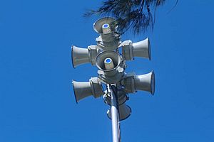
Regional warning systems focus on smaller areas. They use data from nearby earthquakes. These systems can issue warnings very quickly, sometimes in less than 15 minutes. They use public address systems and sirens to alert people. It's hard to know if an underwater earthquake will cause a tsunami. So, these systems might sometimes give false alarms. But because they cover small areas, the disruption from a false alarm is usually minor.
Japan's Quick Response System
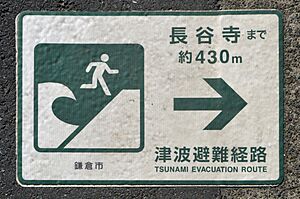
Japan has a nationwide tsunami warning system. It often issues warnings just minutes after an earthquake alert. This happens if large waves are expected. During the 2011 Tōhoku earthquake and tsunami, a "major tsunami" warning was issued quickly. This meant waves were expected to be at least 3 meters (9.8 feet) high. Japan improved its system in 2013 after the 2011 disaster. This helps them better assess incoming tsunamis.
India's High-Tech Ocean Watch
India has one of the world's most advanced tsunami warning systems. After the 2004 tsunami, India set up the INCOIS. This center is in Hyderabad, India. It provides ocean information and advice. This includes tsunami warnings, ocean forecasts, and fishing area information.
INCOIS gathers data from over 35 sea level gauges every five minutes. It also uses wave rider buoys and special bottom pressure readers. A network of seismographs across the Indian Ocean Region also sends data. India's tsunami buoy system has a surface buoy and a bottom pressure reader. They communicate underwater using sound devices. Then, they send readings to shore using satellites. The warning station combines information from many seismic stations, both national and international.
INDOFOS is a service that forecasts ocean conditions. It can predict surface and underwater features of the Indian Ocean. These forecasts are shared through various channels. This includes radio, digital signs, websites, and TV. The Oceansat 2 satellite system also helps. It monitors sea life and ocean features like currents and water movements. In 2013, Oceansat-2 helped predict Cyclone Phailin's path. This helped reduce its impact.
Spreading the Word: How Warnings Reach You
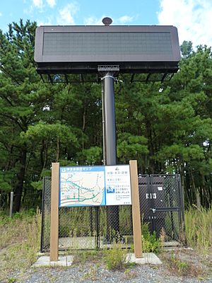
Detecting a tsunami is only half the job. It's just as important to warn people in affected areas. Tsunami warning systems use many ways to communicate. These include Cell Broadcast, SMS messages, e-mail, fax, and radio. They often use strong, reliable systems. These send emergency messages to emergency services and the military. They also alert the public using sirens and systems like the Emergency Alert System.
The Challenges of Tsunami Warnings
No system can protect against a very sudden tsunami. This happens when the coast is too close to the earthquake's epicenter. For example, a devastating tsunami hit Hokkaidō, Japan, in 1993. It struck just three to five minutes after the earthquake. Many people died while trying to escape. This was also the case in Aceh, Indonesia, during the 2004 tsunami.
Even with these challenges, warning systems are very effective. For instance, a very large underwater earthquake (a subduction zone earthquake) off the west coast of the United States would cause a tsunami. People in Japan would have over 12 hours before it arrived. They would also get warnings from systems in Hawaii and other places. This gives them time to evacuate safely.
See also
 In Spanish: Alerta de tsunami para niños
- Deep-ocean Assessment and Reporting of Tsunamis (DART)
- Disaster risk reduction
- Pacific Disaster Center
- Sound Fixing and Ranging (SOFAR) channel
 | Claudette Colvin |
 | Myrlie Evers-Williams |
 | Alberta Odell Jones |


