Tuchekoi, Queensland facts for kids
Quick facts for kids TuchekoiQueensland |
|||||||||||||||
|---|---|---|---|---|---|---|---|---|---|---|---|---|---|---|---|

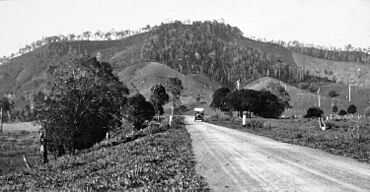
Looking toward Mount Tuchekoi, circa 1931
|
|||||||||||||||
| Population | 199 (2021 census) | ||||||||||||||
| • Density | 6.656/km2 (17.24/sq mi) | ||||||||||||||
| Postcode(s) | 4570 | ||||||||||||||
| Area | 29.9 km2 (11.5 sq mi) | ||||||||||||||
| Time zone | AEST (UTC+10:00) | ||||||||||||||
| Location | |||||||||||||||
| LGA(s) | Gympie Region | ||||||||||||||
| State electorate(s) | Gympie | ||||||||||||||
| Federal Division(s) | Wide Bay | ||||||||||||||
|
|||||||||||||||
Tuchekoi is a small rural area in the Gympie Region of Queensland, Australia. It's a quiet place where people live surrounded by nature. In 2021, about 199 people called Tuchekoi home.
Contents
Exploring Tuchekoi's Landscape
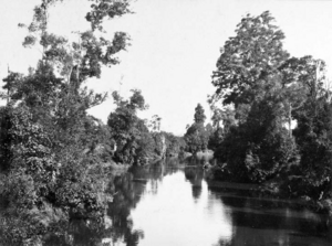
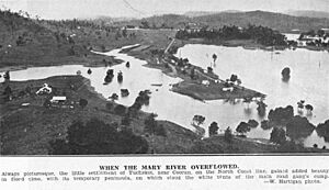
Tuchekoi is bordered by two important waterways. The Mary River forms its western edge, while Skyring Creek runs along its northern side. Skyring Creek eventually flows into the Mary River in the northwest part of Tuchekoi.
The land in Tuchekoi changes quite a bit. It's lowest near the Mary River and Skyring Creek, about 60 meters (200 feet) above sea level. As you move south and east, the land rises. The highest point is Mount Tuchekoi, which is right in the middle of the area. This mountain reaches about 295 meters (968 feet) high.
An old road, called the Old Bruce Highway, used to pass through Tuchekoi. It came from the east (near Federal) and left towards the north (near Coles Creek). However, the main Bruce Highway today goes further away and doesn't pass through Tuchekoi anymore.
Most of the land in Tuchekoi is used for grazing, which means animals like cows eat the natural plants. Some areas also have plantation forestry, where trees are grown for wood.
It's interesting to know that even though it's called Tuchekoi National Park, this park isn't actually in Tuchekoi! It's located in Pomona, which is to the east.
A Glimpse into Tuchekoi's Past
The name "Tuchekoi" comes from Mount Tuchekoi. People believe the mountain's name is a changed version of the Kabi language words dha/chu/koi. These words mean "place of fig trees," suggesting that fig trees were common in the area long ago.
Who Lives in Tuchekoi?
The number of people living in Tuchekoi has stayed quite steady. In 2016, there were 197 people. By 2021, the population had slightly increased to 199 people.
Learning in Tuchekoi
There are no schools directly in Tuchekoi. Kids who live here usually go to schools in nearby towns.
- For primary school, the closest option is Federal State School in Federal, which is to the west.
- For high school, students have a couple of choices:
There's also an outdoor education center in Tuchekoi called the NUDGEE COLLEGE OUTDOOR EDUCATION CENTRE. It's a place where students can go for outdoor learning experiences.
 | Percy Lavon Julian |
 | Katherine Johnson |
 | George Washington Carver |
 | Annie Easley |


