
Twomile Run facts for kids
Quick facts for kids Twomile Run |
|
|---|---|

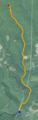
Satellite map of Twomile Run. The red dot is the source and the blue dot is the mouth.
|
|
| Physical characteristics | |
| Main source | Sproul State Forest in Leidy Township, Clinton County, Pennsylvania 1,700 ft (520 m) |
| River mouth | Kettle Creek in Noyes Township, Clinton County, Pennsylvania 705 ft (215 m) 41°18′53″N 77°51′31″W / 41.3147°N 77.8586°W |
| Length | 4.5 mi (7.2 km) |
| Basin features | |
| Progression | Twomile Run Kettle Creek West Branch Susquehanna River Susquehanna River Chesapeake Bay |
| Basin size | 9.15 sq mi (23.7 km2) |
| Tributaries |
|
Twomile Run is a small stream, or "tributary," that flows into Kettle Creek in Clinton County, Pennsylvania. It is about 4.5 miles (7.2 km) long. This stream is important because it carries water from a large area called a "watershed."
The Twomile Run watershed covers about 9 square miles. It includes smaller streams like Huling Branch and Middle Branch Twomile Run. The stream flows through two areas: Leidy Township and Noyes Township.
For many years, coal was dug up from mines in this area. This mining caused a problem called "acid mine drainage." This is polluted water from old mines that flows into the stream. Twomile Run is the main source of this polluted water for Kettle Creek.
Contents
Where Does Twomile Run Flow?
Twomile Run starts in the Sproul State Forest in Leidy Township. It flows generally south and a little to the east. The stream leaves the forest and Leidy Township, then enters Noyes Township.
Soon after, it meets its tributary, Middle Branch Twomile Run. The valley around Twomile Run gets deeper here. The stream then makes several turns before joining another tributary, Huling Branch. After this, Twomile Run flows into Kettle Creek.
Smaller Streams Joining Twomile Run
Several smaller streams, called tributaries, flow into Twomile Run. The main ones are Middle Branch Twomile Run and Huling Branch. Another stream, Robbins Hollow, joins Twomile Run a short distance after Middle Branch.
Huling Branch is quite long, almost as long as Twomile Run itself. It even has its own small unnamed tributary. Other small streams in the area include Pecking Patch Hollow and MackIntosh Hollow.
What's in the Water?
The water in Twomile Run has a big problem with "acid mine drainage." This means that about 2.3 miles (3.7 km) of the stream is affected by polluted water from old coal mines. This polluted water is very acidic, like lemon juice or vinegar.
The mine water has a low pH (between 2.5 and 3.5), which means it's very acidic. It also contains high levels of metals like iron and aluminum. This makes the water unhealthy for many living things. Twomile Run is the only major source of this acidic water flowing into Kettle Creek from its eastern side.
The amount of water flowing in Twomile Run changes. At its mouth, where it meets Kettle Creek, the flow can be anywhere from 200 to 10,000 gallons per minute. This is a small part of Kettle Creek's total flow.
Over time, the water quality has shown some small improvements. For example, the pH of the stream has slightly increased in some areas, meaning it's become a little less acidic. This is a good sign for the stream's health.
Land and Rocks Around the Stream
The area around Twomile Run, its watershed, has many old coal mines. Some of these are "surface mines," where coal was dug from the ground's surface. Others are "deep mines," which are tunnels underground.
The land here has several types of rock formations. These include the Huntley Mountain Formation, the Burgoon Sandstone, the Pottsville Group, and the Allegheny Group. These rocks formed millions of years ago. Some of these rock groups, like the Allegheny and Pottsville Groups, contain layers of coal.
The highest point in the watershed is about 2,204 feet (672 m) high. The stream itself starts at 1,700 feet (520 m) and ends at 705 feet (215 m) where it meets Kettle Creek.
When the acidic water of Twomile Run mixes with the less acidic water of Kettle Creek, you can sometimes see white and orange material forming on the banks. This happens because the metals in the acidic water react when they meet the different water.
The Twomile Run Watershed
The Twomile Run watershed is the entire area of land where water drains into Twomile Run. It covers about 9.15 square miles. Most of this land is covered by forests. However, there are also some grassy areas, roads, and parking lots.
Much of the land in the watershed is owned by the state of Pennsylvania or the U.S. Forest Service. There are also some farms, especially near Huling Branch. Roads like Two Mile Run Road cross the watershed. There are many places where roads cross over the streams.
The upper parts of Twomile Run and its tributaries, Huling Branch and Middle Branch Twomile Run, have flat areas next to them called "floodplains." These areas can get covered with water when the stream overflows.
History and What People Do Here
The first coal mines in the Twomile Run watershed were deep underground mines. Later, after World War II, people started "surface mining" for coal. This type of mining ended by the 1970s. A lot of the coal dug up in the Kettle Creek area came from the Twomile Run watershed.
In the 1930s and early 1940s, a group called the Civilian Conservation Corps worked in the Twomile Run watershed. They helped with conservation projects during the Great Depression.
Efforts have been made to clean up the acid mine drainage. Special systems have been put in place to treat the polluted water in Robbins Hollow and in Twomile Run itself.
Today, people still use the land in the Twomile Run watershed for producing timber (wood). There is still some coal left underground, but it is not being mined.
Animals and Plants in the Stream
Even with the pollution, some fish and insects live in Twomile Run and its tributaries.
- Fish:
* Brook trout are found in the upper parts of Middle Branch Twomile Run, where the water is not affected by acid mine drainage. They are also found in parts of Twomile Run above the polluted areas. The population of brook trout is actually growing! * In 1967, no fish were found where Twomile Run meets Kettle Creek. But by 1997, two types of fish, white sucker and smallmouth bass, were seen there. * Twomile Run has the potential to support many different kinds of fish, more than other streams in the Kettle Creek area.
- Insects:
* Different types of insects, like stoneflies, caddisflies, and beetles, have been found in Huling Branch. * The numbers of stoneflies and caddisflies in Middle Branch Twomile Run are increasing.
Even though some areas are still considered "poor" or "marginal" habitats for fish, the presence of these animals shows that the stream is slowly recovering in some parts.
Fun Things to Do
Most of the land in the Twomile Run watershed is used for outdoor activities.
- Hunting: People often go deer hunting and bear hunting in the area.
- ATV Trails: There are also trails for ATVs (four-wheelers) called the Whiskey Springs ATV trail complex. These trails are located in the areas around Huling Branch and Middle Branch Twomile Run.
Images for kids
-
Satellite map of Twomile Run. The red dot is the source and the blue dot is the mouth.
