Upper Macungie Township, Pennsylvania facts for kids
Quick facts for kids
Upper Macungie Township
|
||
|---|---|---|
|
Township
|
||

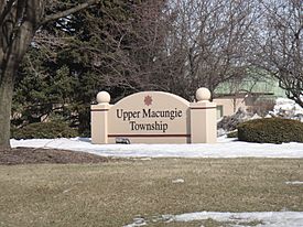
Township sign in Breinigsville in March 2014
|
||
|
||

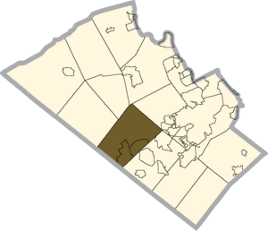
Location of Upper Macungie Township in Lehigh County, Pennsylvania
|
||
| Country | ||
| State | ||
| County | Lehigh | |
| Area | ||
| • Township | 26.26 sq mi (68.02 km2) | |
| • Land | 26.07 sq mi (67.53 km2) | |
| • Water | 0.19 sq mi (0.49 km2) | |
| Elevation | 463 ft (141 m) | |
| Population
(2020)
|
||
| • Township | 26,377 | |
| • Estimate
(July 2022)
|
27,875 | |
| • Density | 1,011.0/sq mi (353.70/km2) | |
| • Metro | 865,310 (US: 68th) | |
| Time zone | UTC-5 (EST) | |
| • Summer (DST) | UTC-4 (EDT) | |
| ZIP Codes |
18031, 18051, 18087, 18104, and 18106
|
|
| Area code(s) | 610 and 484 | |
| FIPS code | 42-077-79104 | |
| Primary airport | Lehigh Valley International Airport | |
| Major hospital | Lehigh Valley Hospital–Cedar Crest | |
| School district | Parkland | |
Upper Macungie Township is a special kind of local government area called a township in Lehigh County, Pennsylvania, United States. In 2020, about 26,377 people lived here. This made it one of the fastest-growing places in Pennsylvania between 2010 and 2020.
The township was created in 1832. Before that, it was part of a larger area called Macungie Township. That area was split into two: Upper Macungie and Lower Macungie townships.
Upper Macungie Township is part of the Lehigh Valley metropolitan area. A metropolitan area is a large region that includes a big city and the smaller towns and cities around it. The Lehigh Valley area had over 860,000 people in 2020.
The township is located about 18.5 kilometers (11.5 miles) southwest of Allentown. It's also about 98 kilometers (60.8 miles) northwest of Philadelphia and 160 kilometers (99.2 miles) west of New York City.
Contents
Exploring Upper Macungie Township's Geography
Upper Macungie Township covers about 68 square kilometers (26.26 square miles). Most of this area, about 67.6 square kilometers (26.07 square miles), is land. The rest, about 0.4 square kilometers (0.19 square miles), is water.
Water from the township flows into the Little Lehigh Creek and Jordan Creek. These creeks then join the Lehigh River, which eventually flows into the Delaware River in Easton.
Villages and Communities in the Township
Upper Macungie Township is home to several smaller communities, often called villages. These include Breinigsville, Fogelsville, Krocksville, Kuhnsville, Newtown, Ruppsville, and Trexlertown.
Understanding the Climate in Upper Macungie
The township has a climate known as a hot-summer humid continental climate. This means it has warm, humid summers and cold winters. The average temperature in Fogelsville changes a lot throughout the year. In January, it's about -2 degrees Celsius (28.5 degrees Fahrenheit). In July, it warms up to about 23 degrees Celsius (73.3 degrees Fahrenheit).
Neighboring Towns and Townships
Upper Macungie Township shares its borders with several other towns and townships. These include:
- Lower Macungie Township (to the southeast)
- South Whitehall Township (to the northeast)
- North Whitehall Township (just touching the north)
- Lowhill Township (to the north)
- Weisenberg Township (to the northwest)
- Maxatawny Township in Berks County (to the west)
- Longswamp Township in Berks County (to the southwest)
Population and People of Upper Macungie
|
||||||||||||||||||||
In 2020, the township had a population of 26,377 people. This means there were about 390 people living in every square kilometer (1,011 people per square mile).
The people living in the township come from many different backgrounds. Based on the 2020 census, the population was made up of:
- 71.3% White
- 8.9% African American
- 0.1% Native American
- 12.7% Asian
- 5.9% from two or more races.
About 9.5% of the population identified as Hispanic or Latino.
There were 9,313 households in the township. About 35.8% of these households had children under 18 living with them. Most households, 66.0%, were married couples living together.
The average household had about 2.65 people. The average family had about 3.08 people.
The median age of people in the township was 39 years old. This means half the people were younger than 39, and half were older. About 26.0% of the population was under 18 years old.
The median income for a household in the township was $85,600. For families, the median income was $97,180. Upper Macungie has one of the highest family incomes in Pennsylvania.
Education in Upper Macungie Township
Students in Upper Macungie Township attend schools in the Parkland School District.
High School Education
Students in grades 9 through 12 go to Parkland High School. This school is located within the district.
Middle School Education
Most middle school students attend Springhouse Middle School. However, students living in the far northern part of the township might go to a different middle school.
Elementary School Education
The district has six elementary schools for students from kindergarten to fifth grade. Three of these schools are in Upper Macungie: Fogelsville, Fred J. Jaindl, and Veterans Memorial Elementary Schools. The other three, Cetronia, Kernsville, and Parkway Manor Elementary Schools, are located in other parts of the district.
Getting Around Upper Macungie: Transportation
As of 2022, Upper Macungie Township had about 294 kilometers (182.81 miles) of public roads. These roads are managed by different groups:
- About 1.4 kilometers (0.90 miles) are maintained by the Pennsylvania Turnpike Commission (PTC).
- About 74 kilometers (45.97 miles) are maintained by the Pennsylvania Department of Transportation (PennDOT).
- The township itself maintains about 218.8 kilometers (135.94 miles) of roads.
Major Roads and Highways
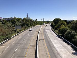
Interstate 78 and U.S. Route 22 both pass through Fogelsville. They meet at exit 49, where they also connect with Pennsylvania Route 100. These are the main roads for traveling east and west.
U.S. Route 222 runs from the southwest to the northeast. Pennsylvania Route 100, Interstate 476, and Pennsylvania Route 863 are the main roads for traveling north and south.
Another important east-to-west road is Schantz Road. This road serves many business and industrial areas and goes almost all the way across the township.
Public Bus Services
The township is also served by public bus routes. LANta bus routes 213, 218, and 322 help people get around the township without a car.
See also
 In Spanish: Municipio de Upper Macungie para niños
 | Shirley Ann Jackson |
 | Garett Morgan |
 | J. Ernest Wilkins Jr. |
 | Elijah McCoy |


